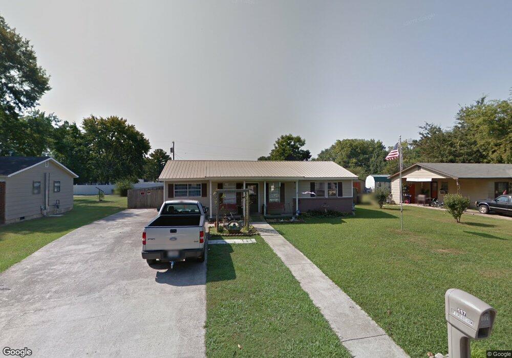
117 Beard St SW Decatur, AL 35601
Estimated Value: $79,157 - $156,000
--
Bed
--
Bath
1,222
Sq Ft
$108/Sq Ft
Est. Value
About This Home
This home is located at 117 Beard St SW, Decatur, AL 35601 and is currently estimated at $132,539, approximately $108 per square foot. 117 Beard St SW is a home located in Morgan County with nearby schools including Banks-Caddell Elementary School, Brookhaven Middle School, and Austin High School.
Ownership History
Date
Name
Owned For
Owner Type
Purchase Details
Closed on
Mar 16, 2022
Sold by
Decker Green Donna
Bought by
Barradas-Ramos Cirenio
Current Estimated Value
Home Financials for this Owner
Home Financials are based on the most recent Mortgage that was taken out on this home.
Original Mortgage
$100,000
Outstanding Balance
$68,951
Interest Rate
3.55%
Estimated Equity
$63,588
Purchase Details
Closed on
Jul 25, 2018
Sold by
Ferguson Marvin L and Ferguson Linda K
Bought by
Green Donna
Purchase Details
Closed on
Jun 17, 2016
Sold by
Ferguson Marvin L and Ferguson Linda K
Bought by
Ferguson Marvin L and Ferguson Linda A
Create a Home Valuation Report for This Property
The Home Valuation Report is an in-depth analysis detailing your home's value as well as a comparison with similar homes in the area
Home Values in the Area
Average Home Value in this Area
Purchase History
| Date | Buyer | Sale Price | Title Company |
|---|---|---|---|
| Barradas-Ramos Cirenio | $100,000 | None Listed On Document | |
| Green Donna | $27,201 | None Available | |
| Ferguson Marvin L | -- | None Available |
Source: Public Records
Mortgage History
| Date | Status | Borrower | Loan Amount |
|---|---|---|---|
| Open | Barradas-Ramos Cirenio | $100,000 |
Source: Public Records
Tax History Compared to Growth
Tax History
| Year | Tax Paid | Tax Assessment Tax Assessment Total Assessment is a certain percentage of the fair market value that is determined by local assessors to be the total taxable value of land and additions on the property. | Land | Improvement |
|---|---|---|---|---|
| 2024 | $316 | $3,490 | $890 | $2,600 |
| 2023 | $316 | $6,480 | $1,780 | $4,700 |
| 2022 | $294 | $6,480 | $1,780 | $4,700 |
| 2021 | $275 | $6,080 | $1,780 | $4,300 |
| 2020 | $275 | $6,080 | $1,780 | $4,300 |
| 2019 | $275 | $6,080 | $0 | $0 |
| 2015 | -- | $4,840 | $0 | $0 |
| 2014 | -- | $4,840 | $0 | $0 |
| 2013 | -- | $4,560 | $0 | $0 |
Source: Public Records
Map
Nearby Homes
- 120 Beard St SW
- 116 Daniel St SW
- 1519 Phillips Ave SW
- 1606 3rd Ave SW
- 405 Beard St SW
- 1403 7th Ave SE
- 504 Betty St SW
- 216 Austinville Rd SW
- 1007 Honeysuckle Ln SW
- 420 Autumnwood Dr SW
- 430 Autumnwood Dr SW
- 1210 9th Ave SE
- 456 Autumnwood Dr SW
- 819 3rd Ave SE
- 1703 10th Ave SE
- 428 Carridale St SW
- 1019 9th Ave SE
- 434 Carridale St SW
- 1910 Ewell St SW
- 1003 8th Ave SW
- 115 Beard St SW
- 119 Beard St SW
- 113 Beard St SW
- 1407 Newman Ave SW
- 118 Beard St SW
- 1405 Newman Ave SW
- 116 Beard St SW
- 1402 1st Ave SW
- 1404 1st Ave SW
- 114 Beard St SW
- 1406 1st Ave SW
- 1316 1st Ave SW
- 1409 Newman Ave SW
- 1408 1st Ave SW
- 1314 1st Ave SW
- 117 Cecil St SW
- 119 Cecil St SW
- 1316 Newman Ave SW
- 115 Cecil St SW
- 1410 1st Ave SW