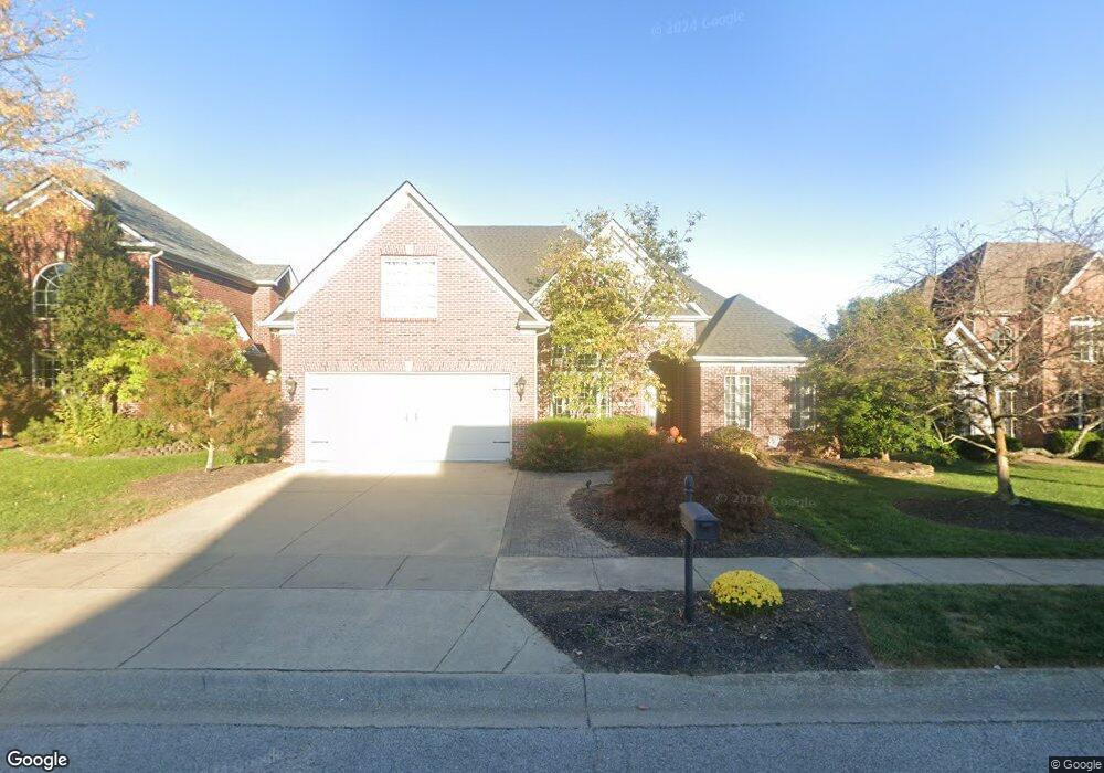
117 Birkdale Dr Georgetown, KY 40324
Southeast Scott County NeighborhoodEstimated Value: $513,389 - $636,000
3
Beds
4
Baths
2,696
Sq Ft
$208/Sq Ft
Est. Value
About This Home
This home is located at 117 Birkdale Dr, Georgetown, KY 40324 and is currently estimated at $559,597, approximately $207 per square foot. 117 Birkdale Dr is a home located in Scott County with nearby schools including Creekside Elementary School, Eastern Elementary School, and Scott County Middle School.
Ownership History
Date
Name
Owned For
Owner Type
Purchase Details
Closed on
Mar 26, 2012
Sold by
Cornish David S and Fannin Cornish Scarlett L
Bought by
Cornish David S and Cornish Scarlett L
Current Estimated Value
Home Financials for this Owner
Home Financials are based on the most recent Mortgage that was taken out on this home.
Original Mortgage
$398,249
Interest Rate
3.95%
Mortgage Type
New Conventional
Create a Home Valuation Report for This Property
The Home Valuation Report is an in-depth analysis detailing your home's value as well as a comparison with similar homes in the area
Home Values in the Area
Average Home Value in this Area
Purchase History
| Date | Buyer | Sale Price | Title Company |
|---|---|---|---|
| Cornish David S | -- | None Available |
Source: Public Records
Mortgage History
| Date | Status | Borrower | Loan Amount |
|---|---|---|---|
| Closed | Cornish David S | $398,249 |
Source: Public Records
Tax History Compared to Growth
Tax History
| Year | Tax Paid | Tax Assessment Tax Assessment Total Assessment is a certain percentage of the fair market value that is determined by local assessors to be the total taxable value of land and additions on the property. | Land | Improvement |
|---|---|---|---|---|
| 2024 | $4,211 | $468,200 | $0 | $0 |
| 2023 | $4,098 | $452,000 | $75,000 | $377,000 |
| 2022 | $3,476 | $408,800 | $75,000 | $333,800 |
| 2021 | $3,725 | $395,400 | $75,000 | $320,400 |
| 2020 | $3,331 | $387,700 | $75,000 | $312,700 |
| 2019 | $3,384 | $387,700 | $0 | $0 |
| 2018 | $3,280 | $377,942 | $0 | $0 |
| 2017 | $3,296 | $377,942 | $0 | $0 |
| 2016 | $3,043 | $377,942 | $0 | $0 |
| 2015 | $3,002 | $375,200 | $0 | $0 |
| 2014 | $3,111 | $375,246 | $0 | $0 |
| 2011 | $233 | $375,246 | $0 | $0 |
Source: Public Records
Map
Nearby Homes
- 100 Mossey Cup Ct
- 1 Cherry Blossom Way
- 112 Cherry Hill Dr
- 111 Spyglass Dr
- 189 Clubhouse Dr
- 150 Sunningdale Dr
- 114 Bethpage Path
- 185 Blossom Park Dr
- 154 Riviera Dr
- 103 Amick Way
- 107 Amick Way
- 103 Sunningdale Dr
- 113 Amick Way
- 127 Amick Way
- 129 Amick Way
- 124 Amick Way
- 126 Lanes Run Dr
- LOT 26 Lawson Dr
- 181 Oxford Landing Dr
- 177 Oxford Landing Dr
- 115 Birkdale Dr
- 119 Birkdale Dr
- 113 Birkdale Dr
- 121 Birkdale Dr
- 118 Birkdale Dr
- 116 Birkdale Dr
- 111 Birkdale Dr
- 123 Birkdale Dr
- 0 Saint Ann Ct
- 109 Clubhouse Dr
- 108 Birkdale Dr
- 115 Clubhouse Dr
- 107 Clubhouse Dr
- 109 Birkdale Dr
- 102 Saint Ann Ct
- 105 Clubhouse Dr
- 106 Birkdale Dr
- 107 Birkdale Dr
- 0 Birkdale Dr
- 120 Birkdale Dr