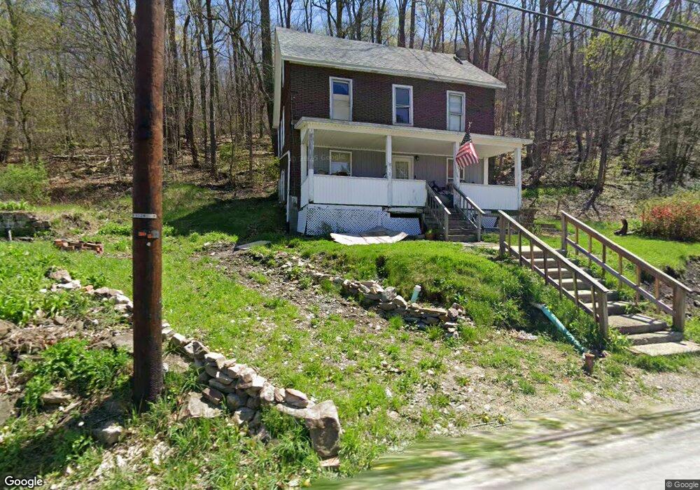
117 Border St Hollsopple, PA 15935
Estimated Value: $82,432 - $174,000
4
Beds
1
Bath
1,400
Sq Ft
$88/Sq Ft
Est. Value
About This Home
This home is located at 117 Border St, Hollsopple, PA 15935 and is currently estimated at $122,608, approximately $87 per square foot. 117 Border St is a home with nearby schools including Conemaugh Township Area Elementary School, Conemaugh Township Area Middle/High School, and Johnstown Christian School.
Ownership History
Date
Name
Owned For
Owner Type
Purchase Details
Closed on
Dec 16, 2011
Sold by
Nemeth Jason C and Nemeth Annie C
Bought by
Nemeth Terrence R and Nemeth Anna D
Current Estimated Value
Purchase Details
Closed on
May 1, 2006
Sold by
Marker Lawrence E and Marker Deborah
Bought by
Nemeth Jason C and Nemeth Tammy B
Home Financials for this Owner
Home Financials are based on the most recent Mortgage that was taken out on this home.
Original Mortgage
$8,000
Interest Rate
6.42%
Mortgage Type
New Conventional
Create a Home Valuation Report for This Property
The Home Valuation Report is an in-depth analysis detailing your home's value as well as a comparison with similar homes in the area
Home Values in the Area
Average Home Value in this Area
Purchase History
| Date | Buyer | Sale Price | Title Company |
|---|---|---|---|
| Nemeth Terrence R | -- | None Available | |
| Nemeth Jason C | $8,000 | None Available |
Source: Public Records
Mortgage History
| Date | Status | Borrower | Loan Amount |
|---|---|---|---|
| Closed | Nemeth Jason C | $8,000 |
Source: Public Records
Tax History Compared to Growth
Tax History
| Year | Tax Paid | Tax Assessment Tax Assessment Total Assessment is a certain percentage of the fair market value that is determined by local assessors to be the total taxable value of land and additions on the property. | Land | Improvement |
|---|---|---|---|---|
| 2025 | $423 | $7,490 | $0 | $0 |
| 2024 | $407 | $7,490 | $0 | $0 |
| 2023 | $394 | $7,490 | $0 | $0 |
| 2022 | $394 | $7,490 | $0 | $0 |
| 2021 | $394 | $7,490 | $0 | $0 |
| 2020 | $394 | $7,490 | $0 | $0 |
| 2019 | $394 | $7,490 | $0 | $0 |
| 2018 | $394 | $7,490 | $4,550 | $2,940 |
| 2017 | $394 | $7,490 | $4,550 | $2,940 |
| 2016 | -- | $7,490 | $4,550 | $2,940 |
| 2015 | -- | $7,490 | $4,550 | $2,940 |
| 2014 | -- | $7,490 | $4,550 | $2,940 |
Source: Public Records
Map
Nearby Homes
- 118 1st St
- 527 Sugar Maple Ave
- 0 Seanor Rd Lot Unit WP001
- 7 Crestview Dr
- 2 Crestview Dr
- 0 Fyock Dr
- 165 Back St
- 142 Hilltop Dr Unit 28
- 142 Hilltop Dr
- 0 Fyock Dr Lot Unit WP001
- 135 Rachele Ave
- 146 Back St
- 128 Ashbrook Rd
- 527 Maple Springs Rd
- 0 Ridge Rd Unit 96036692
- 0 Seanor Rd
- 2317 Seanor Rd
- 138 N White Dr
- 110 Coal Ave
- 149 5th St