Estimated Value: $407,000 - $481,000
4
Beds
3
Baths
2,725
Sq Ft
$159/Sq Ft
Est. Value
About This Home
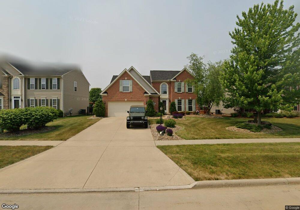
This home is located at 117 Boulder Dr, Berea, OH 44017 and is currently estimated at $433,301, approximately $159 per square foot. 117 Boulder Dr is a home located in Cuyahoga County with nearby schools including Falls-Lenox Primary Elementary School, Olmsted Falls Intermediate Building, and Olmsted Falls Middle School.
Ownership History
Date
Name
Owned For
Owner Type
Purchase Details
Closed on
Dec 20, 2006
Sold by
Nvr Inc
Bought by
Mucic Michael D and Mucic Carolyn M
Current Estimated Value
Home Financials for this Owner
Home Financials are based on the most recent Mortgage that was taken out on this home.
Original Mortgage
$266,000
Outstanding Balance
$158,418
Interest Rate
6.24%
Mortgage Type
Purchase Money Mortgage
Estimated Equity
$274,883
Purchase Details
Closed on
Sep 27, 2006
Sold by
Lopat Development Co Ii Llc
Bought by
Nvr Inc and Ryan Homes
Create a Home Valuation Report for This Property
The Home Valuation Report is an in-depth analysis detailing your home's value as well as a comparison with similar homes in the area
Home Values in the Area
Average Home Value in this Area
Purchase History
| Date | Buyer | Sale Price | Title Company |
|---|---|---|---|
| Mucic Michael D | $307,560 | Nvr Title Agency | |
| Nvr Inc | $47,355 | Nvr Title Agency |
Source: Public Records
Mortgage History
| Date | Status | Borrower | Loan Amount |
|---|---|---|---|
| Open | Mucic Michael D | $266,000 |
Source: Public Records
Tax History
| Year | Tax Paid | Tax Assessment Tax Assessment Total Assessment is a certain percentage of the fair market value that is determined by local assessors to be the total taxable value of land and additions on the property. | Land | Improvement |
|---|---|---|---|---|
| 2024 | $7,799 | $134,750 | $27,615 | $107,135 |
| 2023 | $7,179 | $103,950 | $24,920 | $79,030 |
| 2022 | $7,134 | $103,950 | $24,920 | $79,030 |
| 2021 | $7,083 | $103,950 | $24,920 | $79,030 |
| 2020 | $7,249 | $94,500 | $22,650 | $71,860 |
| 2019 | $7,056 | $270,000 | $64,700 | $205,300 |
| 2018 | $7,041 | $94,500 | $22,650 | $71,860 |
| 2017 | $8,155 | $101,930 | $19,710 | $82,220 |
| 2016 | $8,094 | $101,580 | $19,710 | $81,870 |
| 2015 | $7,473 | $101,580 | $19,710 | $81,870 |
| 2014 | $7,473 | $99,580 | $19,320 | $80,260 |
Source: Public Records
Map
Nearby Homes
- 100 River Rock Way
- 160 Stonepointe Dr
- 379 Laurel Dr
- 428 Park Place
- 628 Lindbergh Blvd
- 446 Redwood Dr
- 404 Crescent Dr
- 487 Karen Dr
- 8241 Lewis Rd
- 8757 Roberts Ct Unit 25C
- 146 Marian Ln
- 7461 River Rd
- 160 Marian Ln Unit 6A
- 287 Edgewood Dr
- 300 West St
- 24690 Thicket Ln Unit M32
- 550 Race St
- 8873 Ashlyn Ct Unit 13A
- 281-12-007 River Rd
- 281-12-024 River Rd
- 119 Boulder Dr
- 115 Boulder Dr
- 113 Boulder Dr
- 108 Stonewater Ct
- 149 Stone Ridge Way
- 153 Stone Ridge Way
- 111 Boulder Dr
- 116 Boulder Dr
- 114 Boulder Dr
- 151 Stone Ridge Way
- 112 Boulder Dr
- 110 Stonewater Ct
- 157 Stone Ridge Way
- 147 Stone Ridge Way
- 110 Boulder Dr
- 104 Stonewater Ct
- 109 Boulder Dr
- 145 Stone Ridge Way
- 159 Stone Ridge Way
- 106 Stonewater Ct
Your Personal Tour Guide
Ask me questions while you tour the home.