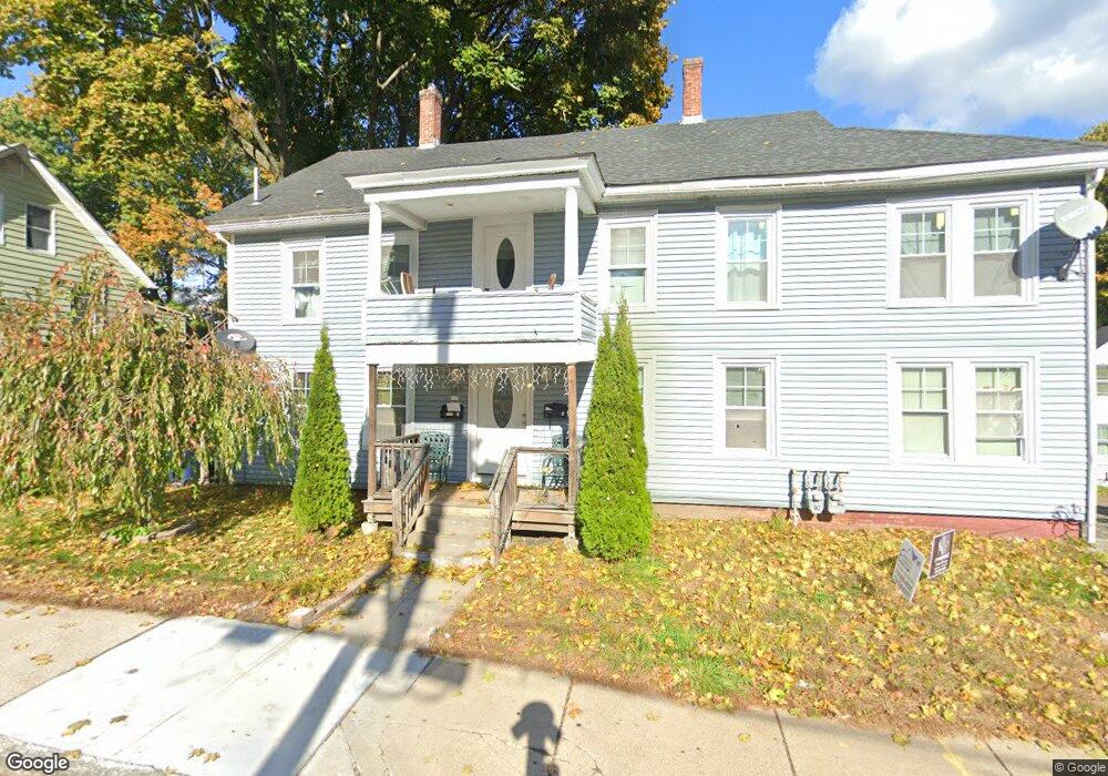
117 Broad St Marlborough, MA 01752
French Hill NeighborhoodEstimated Value: $646,782 - $733,000
8
Beds
2
Baths
2,359
Sq Ft
$286/Sq Ft
Est. Value
About This Home
This home is located at 117 Broad St, Marlborough, MA 01752 and is currently estimated at $675,696, approximately $286 per square foot. 117 Broad St is a home located in Middlesex County with nearby schools including Marlborough High School, Advanced Math & Science Academy, and New Covenant Christian School.
Ownership History
Date
Name
Owned For
Owner Type
Purchase Details
Closed on
Jan 14, 2009
Sold by
Marlborough City Of
Bought by
Salvatierra Walter
Current Estimated Value
Purchase Details
Closed on
Jan 25, 2005
Sold by
Richer Antoinette
Bought by
Marlborough Cmnty Dev and Bergeron Arthur P
Create a Home Valuation Report for This Property
The Home Valuation Report is an in-depth analysis detailing your home's value as well as a comparison with similar homes in the area
Home Values in the Area
Average Home Value in this Area
Purchase History
| Date | Buyer | Sale Price | Title Company |
|---|---|---|---|
| Salvatierra Walter | $50,000 | -- | |
| Marlborough Cmnty Dev | -- | -- |
Source: Public Records
Tax History Compared to Growth
Tax History
| Year | Tax Paid | Tax Assessment Tax Assessment Total Assessment is a certain percentage of the fair market value that is determined by local assessors to be the total taxable value of land and additions on the property. | Land | Improvement |
|---|---|---|---|---|
| 2025 | $5,852 | $593,500 | $148,300 | $445,200 |
| 2024 | $5,591 | $546,000 | $134,900 | $411,100 |
| 2023 | $5,862 | $508,000 | $101,000 | $407,000 |
| 2022 | $5,594 | $426,400 | $96,200 | $330,200 |
| 2021 | $5,060 | $366,700 | $76,400 | $290,300 |
| 2020 | $4,864 | $343,000 | $74,400 | $268,600 |
| 2019 | $4,614 | $327,900 | $73,000 | $254,900 |
| 2018 | $4,429 | $302,700 | $73,300 | $229,400 |
| 2017 | $3,936 | $256,900 | $73,300 | $183,600 |
| 2016 | $3,870 | $252,300 | $73,300 | $179,000 |
| 2015 | $3,239 | $205,500 | $76,900 | $128,600 |
Source: Public Records
Map
Nearby Homes
- 156 Chestnut St
- 76 Broad St
- 118 Elm St
- 30A Winter Ave
- 11 Paris St
- 30 Broad St Unit 104
- 8 Saint Mary's Way Unit 8
- 280 Elm St Unit A6
- 73 Howland St
- 52 Norwood St
- 29 Elm St
- 63 W Main St
- 91 Maplewood Ave
- 32 Water St
- 287 Elm St
- 53 Russell St
- 27 Jefferson St
- 27 Jefferson St Unit 204
- 71 Hudson St
- 272 Lincoln St Unit 102
- 10 Lacouture Ct
- 123 Broad St
- 9 Lacouture Ct
- 118 Broad St
- 120 Broad St
- 114 Broad St
- 107 Broad St Unit A
- 107 Broad St
- 107 Broad St Unit D
- 107 Broad St Unit B
- 122 Broad St
- 131 Broad St
- 194 Chestnut St
- 194 Chestnut St
- 194 Chestnut St Unit 3
- 11 Silver St
- 18 Cross St
- 130 Broad St
- 527 Lincoln St
- 190 Chestnut St Unit 2