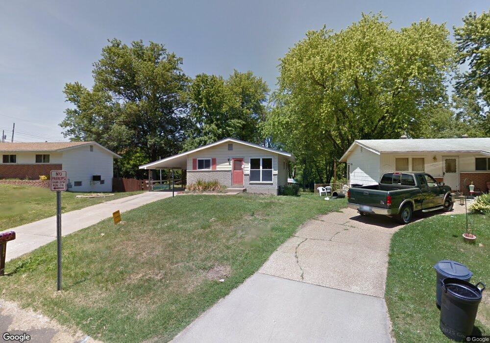
117 Burncoate Dr Saint Louis, MO 63129
Estimated Value: $209,323 - $222,000
3
Beds
1
Bath
864
Sq Ft
$250/Sq Ft
Est. Value
About This Home
This home is located at 117 Burncoate Dr, Saint Louis, MO 63129 and is currently estimated at $216,081, approximately $250 per square foot. 117 Burncoate Dr is a home located in St. Louis County with nearby schools including Wohlwend Elementary School, Bernard Middle School, and Oakville Senior High School.
Ownership History
Date
Name
Owned For
Owner Type
Purchase Details
Closed on
Nov 6, 2015
Sold by
Cook Daniel M and Cook Amber C
Bought by
Mattco Properties Llc
Current Estimated Value
Purchase Details
Closed on
Jul 17, 2012
Sold by
The Bank Of New York Mellon
Bought by
Cook Daniel M and Cook Amber C
Home Financials for this Owner
Home Financials are based on the most recent Mortgage that was taken out on this home.
Original Mortgage
$56,960
Interest Rate
3.57%
Mortgage Type
New Conventional
Purchase Details
Closed on
Oct 28, 2011
Sold by
Liable Richard H
Bought by
The Bank Of New York Mellon and The Bank Of New York
Purchase Details
Closed on
May 31, 2006
Sold by
Liable Elizabeth M
Bought by
Liable Richard H
Home Financials for this Owner
Home Financials are based on the most recent Mortgage that was taken out on this home.
Original Mortgage
$104,300
Interest Rate
9.5%
Mortgage Type
Fannie Mae Freddie Mac
Create a Home Valuation Report for This Property
The Home Valuation Report is an in-depth analysis detailing your home's value as well as a comparison with similar homes in the area
Home Values in the Area
Average Home Value in this Area
Purchase History
| Date | Buyer | Sale Price | Title Company |
|---|---|---|---|
| Mattco Properties Llc | -- | None Available | |
| Cook Daniel M | $71,200 | None Available | |
| The Bank Of New York Mellon | $106,200 | None Available | |
| Liable Richard H | $149,000 | None Available |
Source: Public Records
Mortgage History
| Date | Status | Borrower | Loan Amount |
|---|---|---|---|
| Previous Owner | Cook Daniel M | $56,960 | |
| Previous Owner | Liable Richard H | $104,300 |
Source: Public Records
Tax History Compared to Growth
Tax History
| Year | Tax Paid | Tax Assessment Tax Assessment Total Assessment is a certain percentage of the fair market value that is determined by local assessors to be the total taxable value of land and additions on the property. | Land | Improvement |
|---|---|---|---|---|
| 2025 | $2,126 | $38,580 | $24,800 | $13,780 |
| 2024 | $2,126 | $31,460 | $11,360 | $20,100 |
| 2023 | $2,099 | $31,460 | $11,360 | $20,100 |
| 2022 | $1,861 | $28,000 | $13,450 | $14,550 |
| 2021 | $1,801 | $28,000 | $13,450 | $14,550 |
| 2020 | $1,798 | $26,580 | $13,170 | $13,410 |
| 2019 | $1,793 | $26,580 | $13,170 | $13,410 |
| 2018 | $1,592 | $21,280 | $7,520 | $13,760 |
| 2017 | $1,590 | $21,280 | $7,520 | $13,760 |
| 2016 | $1,554 | $19,950 | $5,810 | $14,140 |
| 2015 | $1,428 | $19,950 | $5,810 | $14,140 |
| 2014 | $1,593 | $22,080 | $9,180 | $12,900 |
Source: Public Records
Map
Nearby Homes
- 4460 Telegraph Rd
- 141 Stallard Ln
- 2 Freeman Dr
- 4555 Burncoate Dr
- 4322 Martyridge Dr
- 5228 Kings Park Dr
- 236 Tapestry Dr
- 223 Freeman Dr
- 200 Rouen Dr
- 337 Saddle Back Dr
- 4130 Saddle Back Ct
- 5405 Edelweis Ln
- 5126 Firelight Ct
- 517 Aqua Ridge Dr
- 144 Martigney Dr
- 2675 Victron Dr
- 4301 Heinle Dr
- 525 Fairwick Dr
- 2408 Whitshire Dr
- 170 Bridgeview Ln
- 121 Burncoate Dr
- 111 Burncoate Dr
- 125 Burncoate Dr
- 114 Burncoate Dr
- 4501 Burncoate Dr
- 4448 Telegraph Rd
- 129 Burncoate Dr
- 110 Burncoate Dr
- 4511 Burncoate Dr
- 4500 Burncoate Dr
- 4456 Telegraph Rd
- 4515 Burncoate Dr
- 4504 Burncoate Dr
- 4519 Burncoate Dr
- 4508 Burncoate Dr
- 212 W Pottle Ave
- 216 W Pottle Ave
- 208 W Pottle Ave
- 220 W Pottle Ave
- 4512 Burncoate Dr