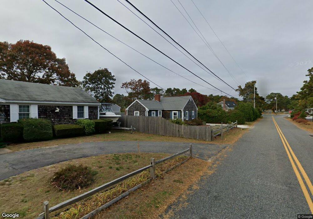
117 Captain Chase Rd Dennis Port, MA 02639
Dennis Port NeighborhoodEstimated Value: $457,000 - $563,394
2
Beds
1
Bath
616
Sq Ft
$835/Sq Ft
Est. Value
About This Home
This home is located at 117 Captain Chase Rd, Dennis Port, MA 02639 and is currently estimated at $514,349, approximately $834 per square foot. 117 Captain Chase Rd is a home located in Barnstable County with nearby schools including Dennis-Yarmouth Regional High School and St. Pius X. School.
Ownership History
Date
Name
Owned For
Owner Type
Purchase Details
Closed on
Jul 18, 2023
Sold by
Bugai Jennifer V
Bought by
Jennifer V Bugai Lt and Bugai
Current Estimated Value
Purchase Details
Closed on
Jan 30, 2008
Sold by
Shinnick Patrick
Bought by
Bugai Jennifer V and Bugai Robert P
Home Financials for this Owner
Home Financials are based on the most recent Mortgage that was taken out on this home.
Original Mortgage
$204,300
Interest Rate
6.18%
Mortgage Type
Purchase Money Mortgage
Purchase Details
Closed on
Jan 5, 2000
Sold by
Bedard Leo F and Bedard Linda F
Bought by
Shinnick Patrick
Home Financials for this Owner
Home Financials are based on the most recent Mortgage that was taken out on this home.
Original Mortgage
$92,000
Interest Rate
7.73%
Mortgage Type
Purchase Money Mortgage
Create a Home Valuation Report for This Property
The Home Valuation Report is an in-depth analysis detailing your home's value as well as a comparison with similar homes in the area
Home Values in the Area
Average Home Value in this Area
Purchase History
| Date | Buyer | Sale Price | Title Company |
|---|---|---|---|
| Jennifer V Bugai Lt | -- | None Available | |
| Bugai Jennifer V | $227,000 | -- | |
| Shinnick Patrick | $100,000 | -- |
Source: Public Records
Mortgage History
| Date | Status | Borrower | Loan Amount |
|---|---|---|---|
| Previous Owner | Bugai Jennifer V | $204,300 | |
| Previous Owner | Shinnick Patrick | $92,000 |
Source: Public Records
Tax History Compared to Growth
Tax History
| Year | Tax Paid | Tax Assessment Tax Assessment Total Assessment is a certain percentage of the fair market value that is determined by local assessors to be the total taxable value of land and additions on the property. | Land | Improvement |
|---|---|---|---|---|
| 2025 | $2,149 | $496,200 | $269,000 | $227,200 |
| 2024 | $1,988 | $452,900 | $258,700 | $194,200 |
| 2023 | $1,923 | $411,800 | $235,200 | $176,600 |
| 2022 | $1,761 | $314,500 | $185,400 | $129,100 |
| 2021 | $1,726 | $286,300 | $181,700 | $104,600 |
| 2020 | $1,687 | $276,600 | $181,700 | $94,900 |
| 2019 | $1,715 | $277,900 | $193,500 | $84,400 |
| 2018 | $1,660 | $261,900 | $184,200 | $77,700 |
| 2017 | $1,506 | $244,800 | $169,600 | $75,200 |
| 2016 | $1,464 | $224,200 | $160,000 | $64,200 |
| 2015 | $1,435 | $224,200 | $160,000 | $64,200 |
| 2014 | $1,362 | $214,500 | $150,300 | $64,200 |
Source: Public Records
Map
Nearby Homes
- 31 Easy St
- 64 Beaten Rd
- 37 Ocean Dr Unit 2
- 80 Michaels Ave
- 154 Old Wharf Rd Unit 26
- 154 Old Wharf Rd Unit 14
- 112 Old Wharf Rd Unit E4
- 112 Old Wharf Rd Unit E1
- 262 Old Wharf Rd Unit 67
- 262 Old Wharf Rd Unit 5
- 262 Old Wharf Rd Unit 5
- 262 Old Wharf Rd Unit 20
- 262 Old Wharf Rd Unit 87
- 217 Old Wharf Rd Unit 64
- 37 Beach Hills Rd
- 120 Old Wharf Rd Unit 11
- 241 Old Wharf Rd Unit 82
- 241 Old Wharf Rd Unit 127
- 241 Old Wharf Rd Unit 90
- 22 Wixon Rd
- 119 Captain Chase Rd
- 6 Uncle Rolf Rd
- 165 Lower County Rd
- 165 Lower County Rd Unit 1&2
- 165 Lower County Rd
- 124 Captain Chase Rd
- 123 Captain Chase Rd
- 10 Uncle Rolf Rd
- 1 Uncle Rolf Rd
- 0 Captain Chase Rd Unit 2008408
- 0 Captain Chase Rd Unit 2011643
- 0 Captain Chase Rd Unit 5011178
- 0 Captain Chase Rd Unit 23 5009259
- 0 Captain Chase Rd Unit 16 2016692
- 0 Captain Chase Rd Unit 7 7032693
- 0 Captain Chase Rd Unit 2 2029410
- 0 Captain Chase Rd Unit 11 2024241
- 0 Captain Chase Rd Unit 15 2033407
- 0 Captain Chase Rd Unit 5004506
- 0 Captain Chase Rd Unit 8 20018