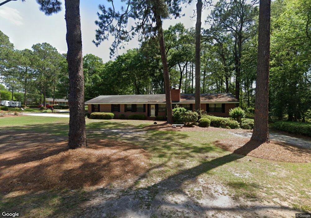
117 Carolina Dr Tifton, GA 31794
Estimated Value: $200,000 - $228,000
3
Beds
2
Baths
1,710
Sq Ft
$128/Sq Ft
Est. Value
About This Home
This home is located at 117 Carolina Dr, Tifton, GA 31794 and is currently estimated at $218,860, approximately $127 per square foot. 117 Carolina Dr is a home located in Tift County with nearby schools including Len Lastinger Primary School, Charles Spencer Elementary School, and J.T. Reddick School.
Ownership History
Date
Name
Owned For
Owner Type
Purchase Details
Closed on
Sep 27, 2021
Sold by
Batten Laverne T
Bought by
Batten Laverne T and Batten Keith A
Current Estimated Value
Purchase Details
Closed on
Apr 14, 1989
Sold by
Decatur Federal Savings And Loan Associa
Bought by
Batten Herman L and Batten Laverne T
Purchase Details
Closed on
Aug 2, 1988
Sold by
Coker Joseph C and Coker Regis F
Bought by
Decatur Federal Savings And Loan
Purchase Details
Closed on
Jan 11, 1985
Sold by
Coker Joseph C and Coker Regis F
Bought by
Hartnett Lawrence B and Hartnett Barbara
Create a Home Valuation Report for This Property
The Home Valuation Report is an in-depth analysis detailing your home's value as well as a comparison with similar homes in the area
Home Values in the Area
Average Home Value in this Area
Purchase History
| Date | Buyer | Sale Price | Title Company |
|---|---|---|---|
| Batten Laverne T | -- | -- | |
| Batten Herman L | $67,000 | -- | |
| Decatur Federal Savings And Loan | $67,900 | -- | |
| Hartnett Lawrence B | $7,300 | -- |
Source: Public Records
Tax History Compared to Growth
Tax History
| Year | Tax Paid | Tax Assessment Tax Assessment Total Assessment is a certain percentage of the fair market value that is determined by local assessors to be the total taxable value of land and additions on the property. | Land | Improvement |
|---|---|---|---|---|
| 2024 | $1,735 | $68,192 | $15,200 | $52,992 |
| 2023 | $1,847 | $54,915 | $7,200 | $47,715 |
| 2022 | $1,917 | $54,915 | $7,200 | $47,715 |
| 2021 | $1,929 | $54,915 | $7,200 | $47,715 |
| 2020 | $1,738 | $48,764 | $7,200 | $41,564 |
| 2019 | $1,738 | $48,764 | $7,200 | $41,564 |
| 2018 | $1,739 | $48,764 | $7,200 | $41,564 |
| 2017 | $1,786 | $48,764 | $7,200 | $41,564 |
| 2016 | $1,788 | $48,764 | $7,200 | $41,564 |
| 2015 | $1,790 | $48,764 | $7,200 | $41,564 |
| 2014 | $1,793 | $48,764 | $7,200 | $41,564 |
| 2013 | -- | $48,764 | $7,200 | $41,564 |
Source: Public Records
Map
Nearby Homes
- 0 Penn Place
- 225 Alabama Dr
- 0 Lee Ball Rd
- 711 10th St W
- 803 Forest Ave
- 803 Forrest Ave
- 307 Fulwood Blvd
- 821 Murray Ave
- 523 Alabama Dr Unit 15 & PT 16
- 523 Alabama Dr
- 416 6th St W
- 1601 Murray Ave
- 801 Ridge Ave N
- 1617 Wilson Ave N
- 15 acres Us Highway 41
- 33.7 ac Us Highway 41
- 48 acres Us Highway 41
- 2021 Emory Dr
- 2202 Emory Dr
- 401 Park Ave N
- 113 Carolina Dr
- 721 Vermont Ave
- 156 Alabama Dr
- 109 Carolina Dr
- 204 Alabama Dr
- 201 Carolina Dr
- 801 8th St W
- 803 8th St W
- 110 Carolina Dr
- 114 Fulwood Blvd
- 101 Carolina Dr
- 204 Carolina Dr
- 210 Alabama Dr
- 153 Alabama Dr
- 110 Fulwood Blvd
- 805 8th St W
- 210 Carolina Dr
- 211 Carolina Dr
- 120 Fulwood Blvd
- 214 Alabama Dr