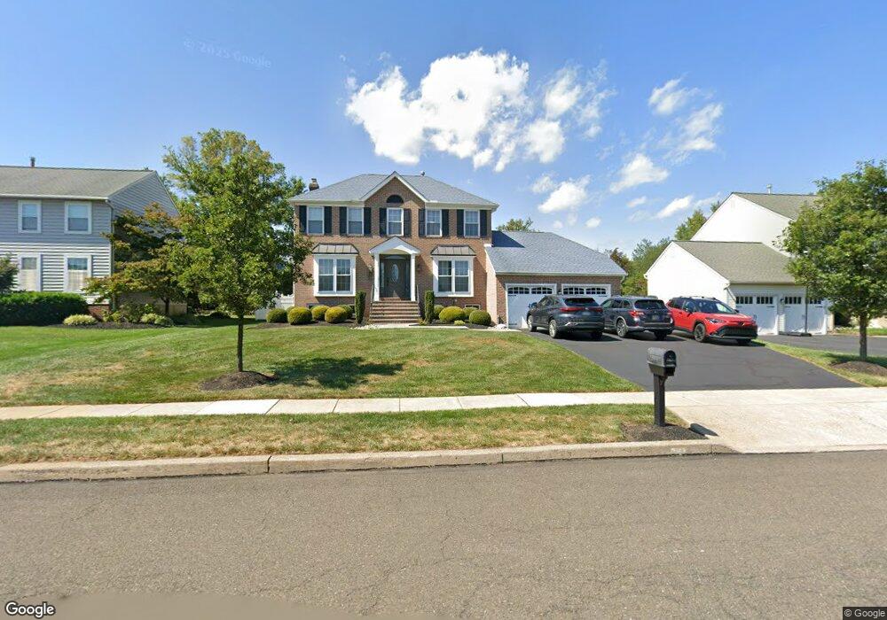
117 Colwyn Terrace Lansdale, PA 19446
Estimated Value: $685,000 - $748,000
5
Beds
4
Baths
2,314
Sq Ft
$313/Sq Ft
Est. Value
About This Home
This home is located at 117 Colwyn Terrace, Lansdale, PA 19446 and is currently estimated at $725,005, approximately $313 per square foot. 117 Colwyn Terrace is a home located in Montgomery County with nearby schools including Montgomery Elementary School, Pennbrook Middle School, and North Penn Senior High School.
Ownership History
Date
Name
Owned For
Owner Type
Purchase Details
Closed on
Jun 18, 2010
Sold by
Vanzanten Patricia A and Vanzanten Eric M
Bought by
Tapper Kathleen B
Current Estimated Value
Home Financials for this Owner
Home Financials are based on the most recent Mortgage that was taken out on this home.
Original Mortgage
$337,600
Outstanding Balance
$225,259
Interest Rate
4.88%
Estimated Equity
$499,746
Purchase Details
Closed on
Jul 15, 2004
Sold by
Herring Patricia A and Herring William Z
Bought by
Vanzanten Eric M and Vanzanten Patricia A
Purchase Details
Closed on
Jan 29, 1996
Sold by
Miles Patricia and Herring Patricia A
Bought by
Herring Patricia A and Miles Patricia
Create a Home Valuation Report for This Property
The Home Valuation Report is an in-depth analysis detailing your home's value as well as a comparison with similar homes in the area
Home Values in the Area
Average Home Value in this Area
Purchase History
| Date | Buyer | Sale Price | Title Company |
|---|---|---|---|
| Tapper Kathleen B | $422,000 | None Available | |
| Vanzanten Eric M | $411,000 | -- | |
| Herring Patricia A | -- | -- |
Source: Public Records
Mortgage History
| Date | Status | Borrower | Loan Amount |
|---|---|---|---|
| Open | Tapper Kathleen B | $337,600 | |
| Closed | Vanzanten Eric M | $0 |
Source: Public Records
Tax History Compared to Growth
Tax History
| Year | Tax Paid | Tax Assessment Tax Assessment Total Assessment is a certain percentage of the fair market value that is determined by local assessors to be the total taxable value of land and additions on the property. | Land | Improvement |
|---|---|---|---|---|
| 2025 | $8,460 | $226,790 | -- | -- |
| 2024 | $8,460 | $226,790 | -- | -- |
| 2023 | $8,071 | $226,790 | $0 | $0 |
| 2022 | $7,788 | $226,790 | $0 | $0 |
| 2021 | $7,322 | $226,790 | $0 | $0 |
| 2020 | $7,129 | $226,790 | $0 | $0 |
| 2019 | $6,996 | $226,790 | $0 | $0 |
| 2018 | $1,205 | $226,790 | $0 | $0 |
| 2017 | $6,697 | $226,790 | $0 | $0 |
| 2016 | $6,608 | $226,790 | $0 | $0 |
| 2015 | $6,310 | $226,790 | $0 | $0 |
| 2014 | $6,310 | $210,030 | $59,640 | $150,390 |
Source: Public Records
Map
Nearby Homes
- 105 Preston Dr
- 1308 Morris Ct
- 151 Canterbury Ln
- 137 Steeplechase Dr
- 206 Steeplechase Dr
- 302 Hancock Ct
- 981 Horsham Rd
- 708 Ascot Ct
- 102 Steeplechase Dr
- 307 Livingston Ct
- 182 Filly Dr
- 540 Springhouse Ct
- 101 Devon Ct
- 155 Hillside Ct
- 135 Creeks Edge Ct
- 103 Gordon Ln
- 501 Joshua Ct
- 53 Neshaminy Falls Cir
- 301 Essex Ct
- 304 Joshua Ct
- 115 Colwyn Terrace
- 119 Colwyn Terrace
- 428 S Stone Ridge Dr
- 113 Colwyn Terrace
- 426 S Stone Ridge Dr
- 105 Fairacres Dr
- 116 Colwyn Terrace
- 101 Fairacres Dr
- 114 Colwyn Terrace
- 102 Fairacres Dr
- 112 Colwyn Terrace
- 424 S Stone Ridge Dr
- 111 Colwyn Terrace
- 104 Fairacres Dr
- 100 Woodlea Terrace
- 110 Colwyn Terrace Unit 6
- 103 Woodlea Terrace
- 422 S Stone Ridge Dr
- 417 S Stone Ridge Dr
- 419 S Stone Ridge Dr