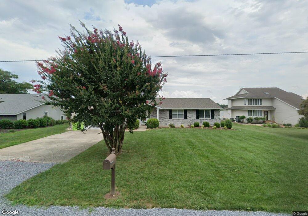
117 Congressional Dr Stevensville, MD 21666
Estimated Value: $929,000 - $1,352,000
--
Bed
3
Baths
2,528
Sq Ft
$462/Sq Ft
Est. Value
About This Home
This home is located at 117 Congressional Dr, Stevensville, MD 21666 and is currently estimated at $1,168,374, approximately $462 per square foot. 117 Congressional Dr is a home located in Queen Anne's County with nearby schools including Matapeake Elementary School, Matapeake Middle School, and Kent Island High School.
Ownership History
Date
Name
Owned For
Owner Type
Purchase Details
Closed on
May 22, 2017
Sold by
Woodside William H and Woodside Carlos
Bought by
Woodside William Harry and Woodside Carlos Carter
Current Estimated Value
Purchase Details
Closed on
Apr 22, 2014
Sold by
Woodside William H and Woodside Carlson
Bought by
Woodside William H and Woodside Carlson
Purchase Details
Closed on
Jan 12, 2007
Sold by
Woodside William H
Bought by
Woodside William H and Woodside Carlson
Purchase Details
Closed on
Dec 12, 2006
Sold by
Woodside William H
Bought by
Woodside William H and Woodside Carlson
Purchase Details
Closed on
Sep 1, 2004
Sold by
Gren S S and Gren Russell A
Bought by
Woodside William H and Woodside Carison
Purchase Details
Closed on
May 6, 2002
Sold by
Sandgren Russell and Sandgren Evelyn
Bought by
Sandgren Russell A and Evelyn W Trustees
Create a Home Valuation Report for This Property
The Home Valuation Report is an in-depth analysis detailing your home's value as well as a comparison with similar homes in the area
Home Values in the Area
Average Home Value in this Area
Purchase History
| Date | Buyer | Sale Price | Title Company |
|---|---|---|---|
| Woodside William Harry | -- | None Available | |
| Woodside William H | -- | None Available | |
| Woodside William H | -- | -- | |
| Woodside William H | -- | -- | |
| Woodside William H | $728,000 | -- | |
| Sandgren Russell A | -- | -- |
Source: Public Records
Mortgage History
| Date | Status | Borrower | Loan Amount |
|---|---|---|---|
| Closed | Woodside William H | -- |
Source: Public Records
Tax History Compared to Growth
Tax History
| Year | Tax Paid | Tax Assessment Tax Assessment Total Assessment is a certain percentage of the fair market value that is determined by local assessors to be the total taxable value of land and additions on the property. | Land | Improvement |
|---|---|---|---|---|
| 2025 | $6,948 | $810,267 | $0 | $0 |
| 2024 | $6,581 | $732,933 | $0 | $0 |
| 2023 | $6,236 | $655,600 | $398,500 | $257,100 |
| 2022 | $6,224 | $654,400 | $0 | $0 |
| 2021 | $6,313 | $653,200 | $0 | $0 |
| 2020 | $6,313 | $652,000 | $409,700 | $242,300 |
| 2019 | $6,234 | $643,700 | $0 | $0 |
| 2018 | $6,154 | $635,400 | $0 | $0 |
| 2017 | $6,075 | $627,100 | $0 | $0 |
| 2016 | -- | $627,100 | $0 | $0 |
| 2015 | $2,862 | $627,100 | $0 | $0 |
| 2014 | $2,862 | $754,200 | $0 | $0 |
Source: Public Records
Map
Nearby Homes
- 412 Five Farms Dr
- 312 Columbia Ln
- 410 5 Farms Dr
- 303 Queen Anne Club Dr
- 227 Queen Anne Club Dr
- 206 Columbia Ln
- 303 Queens Colony High Rd
- 312 Queens Colony High Rd
- 511 Chesapeake Ave
- 114 Queens Colony High Rd
- 116 Mallard Dr
- 122 Mallard Dr
- 0 Allen Ave
- 0 Reynolds Ave
- 321 Oregon Rd
- 101 Oak St
- 122 S Carolina Rd
- 116 Talbot Rd
- 306 N Lake Rd
- 224 Wicomico Rd
- 115 Congressional Dr
- 119 Congressional Dr
- 113 Congressional Dr
- 121 Congressional Dr
- 112 Congressional Dr
- 116 Congressional Dr
- 111 Congressional Dr
- 123 Congressional Dr
- 110 Congressional Dr
- 118 Congressional Dr
- 109 Congressional Dr
- 108 Congressional Dr
- 120 Congressional Dr
- 125 Congressional Dr
- 413 Five Farms Dr
- 415 Five Farms Dr
- 417 Five Farms Dr
- 107 Congressional Dr
- 411 Five Farms Dr
- 122 Congressional Dr