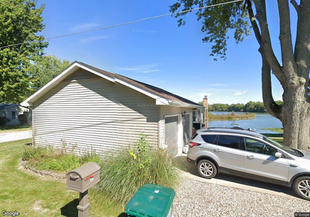
117 Craun's Beach Dr Quincy, MI 49082
Estimated Value: $501,000 - $611,933
5
Beds
2
Baths
1,300
Sq Ft
$428/Sq Ft
Est. Value
About This Home
This home is located at 117 Craun's Beach Dr, Quincy, MI 49082 and is currently estimated at $556,311, approximately $427 per square foot. 117 Craun's Beach Dr is a home located in Branch County with nearby schools including Jennings Elementary School, Quincy Middle School, and Quincy High School.
Ownership History
Date
Name
Owned For
Owner Type
Purchase Details
Closed on
May 5, 2023
Sold by
Mark A Kott And Leslie J Kott Living Tru
Bought by
Wintersteen Lynnette
Current Estimated Value
Home Financials for this Owner
Home Financials are based on the most recent Mortgage that was taken out on this home.
Original Mortgage
$100,000
Outstanding Balance
$89,355
Interest Rate
5.56%
Mortgage Type
New Conventional
Estimated Equity
$466,956
Purchase Details
Closed on
May 27, 2022
Sold by
Kott Mark A and Kott Leslie J
Bought by
Mark A Kott And Leslie J Kott Living Tru
Purchase Details
Closed on
Dec 22, 2020
Sold by
Walters Elaine K and Walters Clarence F
Bought by
Kott Mark A and Kott Leslie J
Home Financials for this Owner
Home Financials are based on the most recent Mortgage that was taken out on this home.
Original Mortgage
$309,320
Interest Rate
2.8%
Mortgage Type
New Conventional
Purchase Details
Closed on
Dec 3, 2013
Sold by
Walters Clarence F and Walters Elaine K
Bought by
Walters Clarence F and Walters Elaine K
Create a Home Valuation Report for This Property
The Home Valuation Report is an in-depth analysis detailing your home's value as well as a comparison with similar homes in the area
Home Values in the Area
Average Home Value in this Area
Purchase History
| Date | Buyer | Sale Price | Title Company |
|---|---|---|---|
| Wintersteen Lynnette | $542,675 | None Listed On Document | |
| Mark A Kott And Leslie J Kott Living Tru | -- | None Listed On Document | |
| Kott Mark A | $386,650 | Branch Cnty Abstract & Ttl I | |
| Walters Clarence F | -- | None Available |
Source: Public Records
Mortgage History
| Date | Status | Borrower | Loan Amount |
|---|---|---|---|
| Open | Wintersteen Lynnette | $100,000 | |
| Previous Owner | Kott Mark A | $309,320 |
Source: Public Records
Tax History Compared to Growth
Tax History
| Year | Tax Paid | Tax Assessment Tax Assessment Total Assessment is a certain percentage of the fair market value that is determined by local assessors to be the total taxable value of land and additions on the property. | Land | Improvement |
|---|---|---|---|---|
| 2025 | $6,109 | $215,050 | $0 | $0 |
| 2024 | $2,233 | $207,325 | $0 | $0 |
| 2023 | $1,573 | $185,042 | $0 | $0 |
| 2022 | $7,029 | $158,872 | $0 | $0 |
| 2021 | -- | $141,114 | $0 | $0 |
| 2020 | -- | $126,900 | $0 | $0 |
| 2019 | -- | $122,872 | $0 | $0 |
| 2018 | -- | $129,877 | $0 | $0 |
| 2017 | -- | $134,594 | $0 | $0 |
| 2016 | -- | $132,795 | $0 | $0 |
| 2015 | -- | $131,569 | $0 | $0 |
| 2014 | -- | $129,099 | $0 | $0 |
| 2013 | -- | $110,957 | $0 | $0 |
Source: Public Records
Map
Nearby Homes
- 117 Ridge Rd
- 804 Cornell Rd
- 181 Dons Dr
- 808 Rolling Meadows Dr
- 202 Dons Dr
- 180 Crockett Dr
- 905 Fisher Rd
- 204 Dons Dr
- 204 Crockett Dr
- 757 Lake Shore Point
- 216 Sandalwood Dr
- 211 S Ray Quincy Rd
- 727 Skipper Ln
- 283 S Fremont Rd
- 242 Bickford Dr
- 297 Winhoven Dr
- 0 Brocklebank Rd
- 988 Williams Dr
- 912 Beckwith Shore
- 0 Wildwood Rd
- 117 Crauns Beach Dr
- 117 Crauns Beach Dr
- 115 Craun's Beach Dr
- 115 Crauns Beach Dr
- 7616 Crauns Beach Dr
- 121 Crauns Beach Dr
- 7624 Crauns Beach Dr
- 113 Crauns Beach Dr
- 113 Crauns Beach Dr
- 111 Crauns Beach Dr
- 127 Crauns Beach Dr
- 7610 Craun's Beach Dr
- 109 Crauns Beach Dr
- 129 Crauns Beach Dr
- 132 Craun's Beach Dr
- 105 Crauns Beach Dr
- 105 Crauns Beach Dr
- 132 Crauns Beach Dr
- 133 Crauns Beach Dr
- 102 Crauns Beach Dr