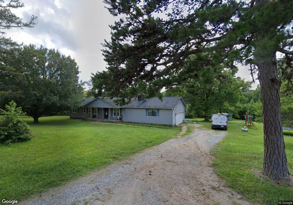
117 Detter Ln Kings Mountain, NC 28086
Estimated Value: $289,758 - $361,000
--
Bed
--
Bath
1,508
Sq Ft
$206/Sq Ft
Est. Value
About This Home
This home is located at 117 Detter Ln, Kings Mountain, NC 28086 and is currently estimated at $310,690, approximately $206 per square foot. 117 Detter Ln is a home located in Cleveland County with nearby schools including Grover Elementary School, Kings Mountain Middle, and Kings Mountain Intermediate School.
Ownership History
Date
Name
Owned For
Owner Type
Purchase Details
Closed on
May 8, 2015
Sold by
Detter Ronnie Edward and Detter Trudy B
Bought by
Scruggs Jonathan B and Scruggs Cynthia D
Current Estimated Value
Home Financials for this Owner
Home Financials are based on the most recent Mortgage that was taken out on this home.
Original Mortgage
$148,351
Outstanding Balance
$117,191
Interest Rate
4.4%
Mortgage Type
FHA
Estimated Equity
$193,499
Create a Home Valuation Report for This Property
The Home Valuation Report is an in-depth analysis detailing your home's value as well as a comparison with similar homes in the area
Home Values in the Area
Average Home Value in this Area
Purchase History
| Date | Buyer | Sale Price | Title Company |
|---|---|---|---|
| Scruggs Jonathan B | $151,500 | Chicago Title Insurance Co |
Source: Public Records
Mortgage History
| Date | Status | Borrower | Loan Amount |
|---|---|---|---|
| Open | Scruggs Jonathan B | $148,351 |
Source: Public Records
Tax History Compared to Growth
Tax History
| Year | Tax Paid | Tax Assessment Tax Assessment Total Assessment is a certain percentage of the fair market value that is determined by local assessors to be the total taxable value of land and additions on the property. | Land | Improvement |
|---|---|---|---|---|
| 2025 | $1,607 | $261,333 | $57,140 | $204,193 |
| 2024 | $1,426 | $173,667 | $37,419 | $136,248 |
| 2023 | $1,419 | $173,667 | $37,419 | $136,248 |
| 2022 | $1,419 | $173,667 | $37,419 | $136,248 |
| 2021 | $1,424 | $173,667 | $37,419 | $136,248 |
| 2020 | $1,198 | $139,287 | $34,966 | $104,321 |
| 2019 | $1,198 | $139,287 | $34,966 | $104,321 |
| 2018 | $1,194 | $139,287 | $34,966 | $104,321 |
| 2017 | $1,188 | $139,287 | $34,966 | $104,321 |
| 2016 | $1,135 | $139,287 | $34,966 | $104,321 |
| 2015 | $1,114 | $136,579 | $30,406 | $106,173 |
| 2014 | $1,114 | $136,579 | $30,406 | $106,173 |
Source: Public Records
Map
Nearby Homes
- 2058 Bethlehem Rd
- 1141 Mountain Brook Dr
- 100 W Highland Terrace
- 104 W Highland Terrace
- 226 Farris Rd
- 235 Stewart Rd Unit 2
- 253 Highway 161 None N
- 120 Wiggins Ln
- 164 Linderman Lake Ln
- 531 Highway 161 N
- 450 Dixon School Rd
- 5264 Battleground Rd
- 130 Benton Rd
- 116 Montview Dr
- 5147 Kings Pinnacle Dr
- 709 Unity Church Rd
- 107 Arrowood Dr
- 5143 Kings Pinnacle Dr
- 5172 Kings Pinnacle Dr
- 125 Galilee Church Rd
- 2064 Bethlehem Rd
- 106 Detter Ln
- 322 Bills Creek Ln
- 327 Bills Creek Ln
- 2068 Bethlehem Rd
- 2060 Bethlehem Rd
- 2072 Bethlehem Rd
- 107 Prim Ln Unit 1
- 107 Prim Ln Unit 1
- 2078 Bethlehem Rd
- 115 Prim Ln
- 2074 Bethlehem Rd
- 2069 Bethlehem Rd
- 2065 Bethlehem Rd
- 2073 Bethlehem Rd
- 2052 Bethlehem Rd
- 2063 Bethlehem Rd
- 2063 Bethlehem Rd
- 151 Kings Crest Ct
- 104 Prim Ln