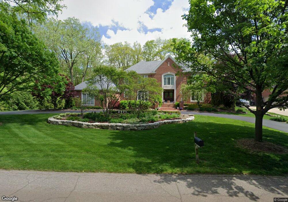
117 Devon Rd Bloomfield Hills, MI 48302
Estimated Value: $825,250 - $1,060,000
4
Beds
5
Baths
3,740
Sq Ft
$253/Sq Ft
Est. Value
About This Home
This home is located at 117 Devon Rd, Bloomfield Hills, MI 48302 and is currently estimated at $945,563, approximately $252 per square foot. 117 Devon Rd is a home located in Oakland County with nearby schools including Way Elementary School, South Hills Middle School, and Bloomfield Hills High School.
Ownership History
Date
Name
Owned For
Owner Type
Purchase Details
Closed on
Oct 25, 2000
Sold by
Steinman Russell T
Bought by
Hart J
Current Estimated Value
Home Financials for this Owner
Home Financials are based on the most recent Mortgage that was taken out on this home.
Original Mortgage
$600,000
Outstanding Balance
$212,175
Interest Rate
7.87%
Estimated Equity
$733,388
Purchase Details
Closed on
May 20, 1999
Sold by
Robert R Jones Associate
Bought by
Steinman Russell T
Create a Home Valuation Report for This Property
The Home Valuation Report is an in-depth analysis detailing your home's value as well as a comparison with similar homes in the area
Home Values in the Area
Average Home Value in this Area
Purchase History
| Date | Buyer | Sale Price | Title Company |
|---|---|---|---|
| Hart J | -- | -- | |
| Steinman Russell T | -- | -- |
Source: Public Records
Mortgage History
| Date | Status | Borrower | Loan Amount |
|---|---|---|---|
| Open | Hart J | $600,000 |
Source: Public Records
Tax History
| Year | Tax Paid | Tax Assessment Tax Assessment Total Assessment is a certain percentage of the fair market value that is determined by local assessors to be the total taxable value of land and additions on the property. | Land | Improvement |
|---|---|---|---|---|
| 2025 | $12,088 | $392,410 | $86,830 | $305,580 |
| 2024 | $6,090 | $392,410 | $0 | $0 |
| 2023 | $5,893 | $367,200 | $0 | $0 |
| 2022 | $11,075 | $342,190 | $0 | $0 |
| 2021 | $10,996 | $359,050 | $0 | $0 |
| 2020 | $5,390 | $368,780 | $0 | $0 |
| 2019 | $10,347 | $374,660 | $0 | $0 |
| 2018 | $10,361 | $345,990 | $0 | $0 |
| 2017 | $10,287 | $346,830 | $0 | $0 |
| 2016 | $10,307 | $353,120 | $0 | $0 |
| 2015 | -- | $304,570 | $0 | $0 |
| 2014 | -- | $262,830 | $0 | $0 |
| 2011 | -- | $281,070 | $0 | $0 |
Source: Public Records
Map
Nearby Homes
- 0000 Devon Rd
- 164 Timber Trace Ln
- 240 Applewood Ln
- 2864 Colonial Trail
- 62 Barrington Rd
- 00 S Berkshire
- 2863 Meadowood Ln
- 2871 Meadowood Ln
- 95 Hillsdale Rd
- 1661 Winthrop Rd
- 2738 Berry Dr
- 237 Marlborough Dr
- 42160 Woodward Ave Unit 8
- 42160 Woodward Ave Unit 86
- 2570 Aspen Ln
- 3080 Chickering Ct
- 2449 Mulberry Square Unit 28
- 3260 Chickering Ln
- 112 E Hickory Grove Rd Unit 26
- 152 E Hickory Grove Rd
- 175 Devon Rd
- 120 Devon Rd Unit Bldg-Unit
- 120 Devon Rd
- 111 Devon Rd
- 2631 Wendover Rd
- 210 Devon Rd
- 2610 Lahser Rd
- 85 Devon Rd
- 188 Timber Trace Ln Unit 15
- 2630 Lahser Rd
- 2650 Lahser Rd
- 190 Timber Trace Ln Unit 14
- 90 Devon Rd
- 2600 Lahser Rd
- 230 Devon Rd
- 2601 Wendover Rd
- 2560 Coldspring Dr
- 192 Timber Trace Ln Unit 13
- 2580 Lahser Rd
- 11 Devon Rd
Your Personal Tour Guide
Ask me questions while you tour the home.