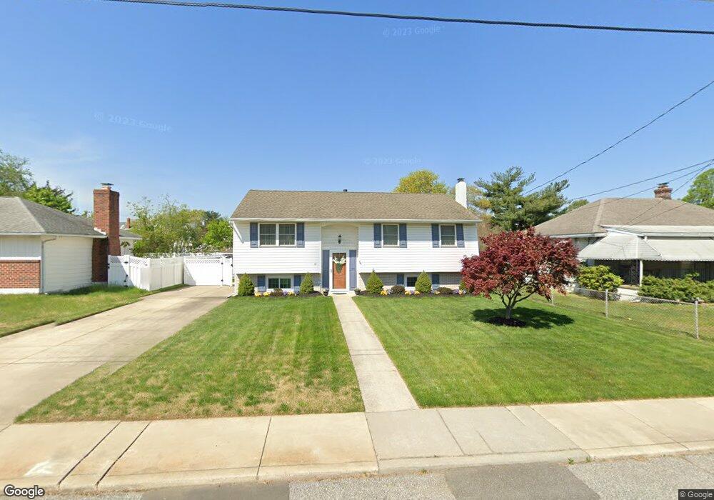
117 Dupont Ave Gibbstown, NJ 08027
Greenwich Township NeighborhoodEstimated Value: $284,845 - $360,000
--
Bed
--
Bath
2,068
Sq Ft
$158/Sq Ft
Est. Value
About This Home
This home is located at 117 Dupont Ave, Gibbstown, NJ 08027 and is currently estimated at $327,711, approximately $158 per square foot. 117 Dupont Ave is a home located in Gloucester County with nearby schools including Nehaunsey Middle School and Guardian Angels Regional School.
Create a Home Valuation Report for This Property
The Home Valuation Report is an in-depth analysis detailing your home's value as well as a comparison with similar homes in the area
Home Values in the Area
Average Home Value in this Area
Tax History Compared to Growth
Tax History
| Year | Tax Paid | Tax Assessment Tax Assessment Total Assessment is a certain percentage of the fair market value that is determined by local assessors to be the total taxable value of land and additions on the property. | Land | Improvement |
|---|---|---|---|---|
| 2025 | $6,049 | $175,700 | $28,800 | $146,900 |
| 2024 | $5,731 | $175,700 | $28,800 | $146,900 |
| 2023 | $5,731 | $175,700 | $28,800 | $146,900 |
| 2022 | $5,735 | $175,700 | $28,800 | $146,900 |
| 2021 | $5,675 | $175,700 | $28,800 | $146,900 |
| 2020 | $5,754 | $175,700 | $28,800 | $146,900 |
| 2019 | $5,758 | $175,700 | $28,800 | $146,900 |
| 2018 | $5,594 | $175,700 | $28,800 | $146,900 |
| 2017 | $5,459 | $175,700 | $28,800 | $146,900 |
| 2016 | $5,402 | $175,800 | $28,800 | $147,000 |
| 2015 | $5,228 | $175,800 | $28,800 | $147,000 |
| 2014 | $5,003 | $175,800 | $28,800 | $147,000 |
Source: Public Records
Map
Nearby Homes
- 431 Washington St
- 433 Jefferson St
- 132 Tomlin Station Rd
- 157 S Poplar St
- 752 Duncan Ave
- 268 Memorial Ave
- W Broad St
- 456 Freund Ave
- 0 S Democrat Rd Unit NJGL2065008
- 126 Repaupo Station Rd
- 43 45 Repaupo Station Rd
- 0 Swedesboro Ave Unit NJGL2061592
- 792 Paulsboro Rd
- 788 Paulsboro Rd
- 330 Croce Ave
- 219 Vanneman Blvd
- 0 Rd Unit NJGL2061600
- 344 W Washington St
- 335 W Buck St
- 120 Bartram Ave
- 113 Dupont Ave
- 127 Dupont Ave
- 133 Dupont Ave
- 107 Dupont Ave
- 126 N Repauno Ave
- 122 N Repauno Ave
- 126 Dupont Ave
- 124 Dupont Ave
- 139 Dupont Ave
- 134 N Repauno Ave
- 128 Dupont Ave
- 116 Dupont Ave
- 110 N Repauno Ave
- 142 N Repauno Ave
- 491 Hill St
- 147 Dupont Ave
- 146 N Repauno Ave
- 102 N Repauno Ave Unit 7
- 102 N Repauno Ave Unit 6
- 102 N Repauno Ave Unit 5