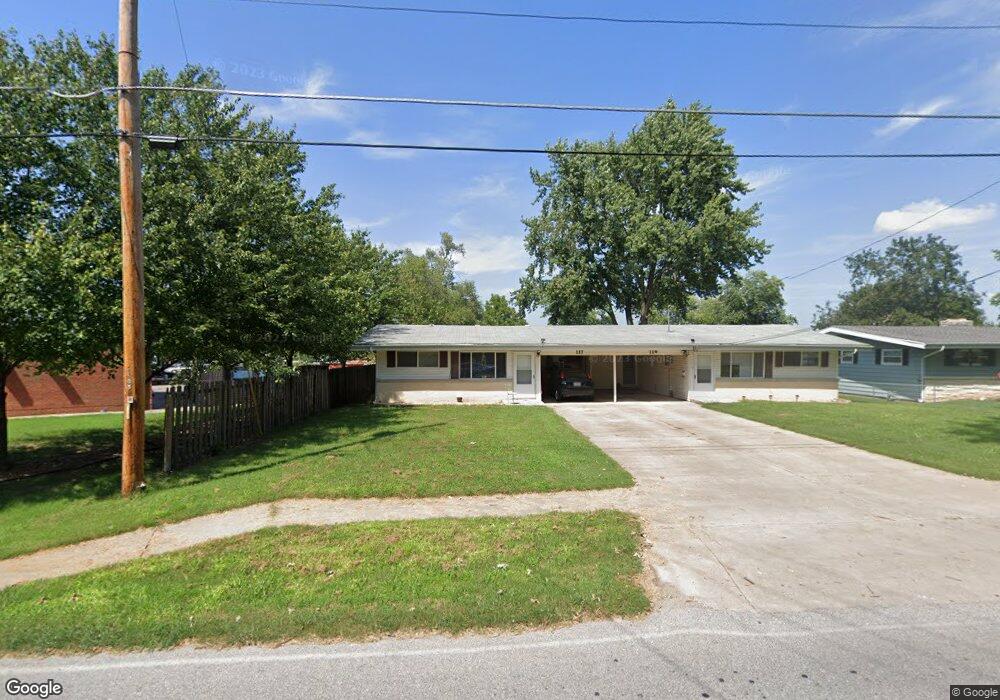
117 E Hines St Republic, MO 65738
Estimated Value: $185,263 - $242,000
4
Beds
2
Baths
1,648
Sq Ft
$132/Sq Ft
Est. Value
About This Home
This home is located at 117 E Hines St, Republic, MO 65738 and is currently estimated at $216,816, approximately $131 per square foot. 117 E Hines St is a home located in Greene County with nearby schools including Schofield Elementary School, Republic Middle School, and Republic High School.
Ownership History
Date
Name
Owned For
Owner Type
Purchase Details
Closed on
Dec 6, 2016
Sold by
Aldrich Dennis E and Aldrich Debra K
Bought by
Bfam4 Llc
Current Estimated Value
Home Financials for this Owner
Home Financials are based on the most recent Mortgage that was taken out on this home.
Original Mortgage
$79,200
Outstanding Balance
$63,854
Interest Rate
3.47%
Mortgage Type
Commercial
Estimated Equity
$152,962
Purchase Details
Closed on
Jun 9, 2008
Sold by
Ellison Casey P and Ellison Lindsey
Bought by
Aldrich Dennis Edward and Aldrich Debra K
Create a Home Valuation Report for This Property
The Home Valuation Report is an in-depth analysis detailing your home's value as well as a comparison with similar homes in the area
Home Values in the Area
Average Home Value in this Area
Purchase History
| Date | Buyer | Sale Price | Title Company |
|---|---|---|---|
| Bfam4 Llc | -- | None Available | |
| Aldrich Dennis Edward | -- | None Available |
Source: Public Records
Mortgage History
| Date | Status | Borrower | Loan Amount |
|---|---|---|---|
| Open | Bfam4 Llc | $79,200 |
Source: Public Records
Tax History
| Year | Tax Paid | Tax Assessment Tax Assessment Total Assessment is a certain percentage of the fair market value that is determined by local assessors to be the total taxable value of land and additions on the property. | Land | Improvement |
|---|---|---|---|---|
| 2025 | $955 | $17,990 | $4,750 | $13,240 |
| 2024 | $908 | $16,250 | $4,750 | $11,500 |
| 2023 | $890 | $16,250 | $4,750 | $11,500 |
| 2022 | $832 | $15,110 | $4,750 | $10,360 |
| 2021 | $827 | $15,110 | $4,750 | $10,360 |
| 2020 | $875 | $15,730 | $4,750 | $10,980 |
| 2019 | $871 | $15,730 | $4,750 | $10,980 |
| 2018 | $843 | $14,710 | $3,800 | $10,910 |
| 2017 | $836 | $13,850 | $3,800 | $10,050 |
| 2016 | $796 | $13,850 | $3,800 | $10,050 |
| 2015 | $794 | $13,850 | $3,800 | $10,050 |
| 2014 | $798 | $13,810 | $3,800 | $10,010 |
Source: Public Records
Map
Nearby Homes
- 1213 N London Place
- 319 W Hines St
- 636 N Dana Ave
- 647 N Dana Ave
- 513 W Logan St
- 425 E Harrison St
- 526 W Logan St
- 922 N Ridgemont Rd
- 00 N Boston Ln
- 421 W Elm St
- 630 E Kay St
- 263 E Garnet Dr
- 114 S Eagan St
- 393 N Ladera Dr
- 183 E Cowling St
- 219 E Kelce Ln
- 1015 N Lindsey Ave Unit Lot 13
- 960 N Lindsey Ave Unit Lot 16
- 990 N Lindsey Ave Unit Lot 17
- 1030 N Lindsey Ave Unit Lot 12
- 125 E Hines St
- 603 N Pine Ave
- 565 N Pine Ave
- 110 E Hines St
- 607 N Pine Ave
- 570 N Main Ave
- 559 N Pine Ave
- 562 N Main Ave
- 608 N Pine Ave
- 205 E Hines St
- 608 N Pine Ave
- 551 N Pine Ave
- 206 E Hines St
- 108 W State Highway 174
- 569 N Main Ave
- 552 N Main Ave
- 552 N Main St
- 558 N Pine Ave
- 561 N Main Ave
- 219 E Hines St
Your Personal Tour Guide
Ask me questions while you tour the home.