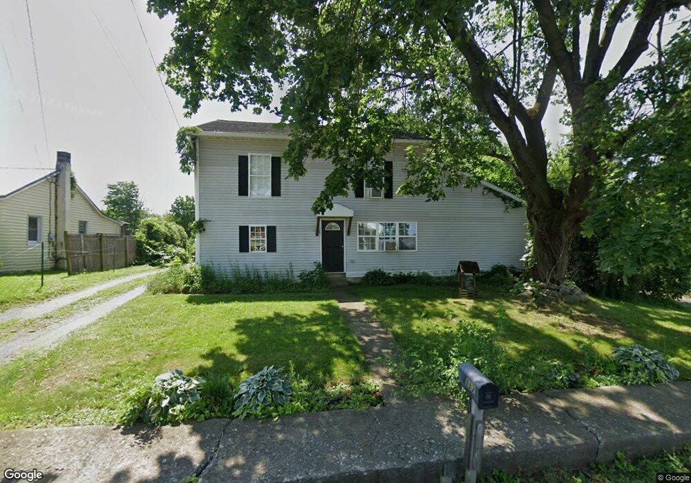
117 E Main St Walnut Bottom, PA 17266
Estimated Value: $243,000 - $253,000
4
Beds
2
Baths
2,512
Sq Ft
$99/Sq Ft
Est. Value
About This Home
This home is located at 117 E Main St, Walnut Bottom, PA 17266 and is currently estimated at $248,762, approximately $99 per square foot. 117 E Main St is a home located in Cumberland County with nearby schools including Oak Flat El School, Big Spring Middle School, and Big Spring High School.
Ownership History
Date
Name
Owned For
Owner Type
Purchase Details
Closed on
Apr 15, 2020
Sold by
Swartz Steve D
Bought by
Swartz Patrick R and Brandt Chelsea L
Current Estimated Value
Home Financials for this Owner
Home Financials are based on the most recent Mortgage that was taken out on this home.
Original Mortgage
$165,000
Outstanding Balance
$146,717
Interest Rate
3.6%
Mortgage Type
New Conventional
Estimated Equity
$102,045
Purchase Details
Closed on
Feb 15, 2017
Sold by
Swartz Steve D and Swartz Natasha J
Bought by
Swartz Steve D
Purchase Details
Closed on
Feb 23, 2007
Sold by
Reed Anthony J
Bought by
Swartz Steve D
Home Financials for this Owner
Home Financials are based on the most recent Mortgage that was taken out on this home.
Original Mortgage
$138,900
Interest Rate
6.23%
Mortgage Type
New Conventional
Create a Home Valuation Report for This Property
The Home Valuation Report is an in-depth analysis detailing your home's value as well as a comparison with similar homes in the area
Purchase History
| Date | Buyer | Sale Price | Title Company |
|---|---|---|---|
| Swartz Patrick R | $185,000 | None Available | |
| Swartz Steve D | -- | None Available | |
| Swartz Steve D | $138,900 | -- |
Source: Public Records
Mortgage History
| Date | Status | Borrower | Loan Amount |
|---|---|---|---|
| Open | Swartz Patrick R | $165,000 | |
| Previous Owner | Swartz Steve D | $138,900 |
Source: Public Records
Tax History
| Year | Tax Paid | Tax Assessment Tax Assessment Total Assessment is a certain percentage of the fair market value that is determined by local assessors to be the total taxable value of land and additions on the property. | Land | Improvement |
|---|---|---|---|---|
| 2025 | $3,024 | $157,100 | $32,000 | $125,100 |
| 2024 | $2,973 | $157,100 | $32,000 | $125,100 |
| 2023 | $2,884 | $157,100 | $32,000 | $125,100 |
| 2022 | $2,823 | $157,100 | $32,000 | $125,100 |
| 2021 | $2,747 | $157,100 | $32,000 | $125,100 |
| 2020 | $2,689 | $157,100 | $32,000 | $125,100 |
| 2019 | $2,636 | $157,100 | $32,000 | $125,100 |
| 2018 | $2,592 | $157,100 | $32,000 | $125,100 |
| 2017 | $2,538 | $157,100 | $32,000 | $125,100 |
| 2016 | -- | $157,100 | $32,000 | $125,100 |
| 2015 | -- | $157,100 | $32,000 | $125,100 |
| 2014 | -- | $157,100 | $32,000 | $125,100 |
Source: Public Records
Map
Nearby Homes
- 401-403 W Main St
- 1984 Ritner Hwy
- 222 Smith Rd
- 1824 Ritner Hwy
- 664 Walnut Bottom Rd
- 5 Apache Dr
- 310 Walnut Dale Rd
- 0 Southside Dr
- 1836 Pine Rd
- 60 Southside Dr
- 113 Big Spring Terrace
- 137 Oak Flat Rd
- 187 Big Spring Terrace
- 178 Big Spring Terrace
- 143 Oak Flat Rd
- 63 Big Spring Terrace
- 1172 Centerville Rd
- 1228 Centerville Rd
- 21 Beecher Dr
- 803 Greenwich Ln
Your Personal Tour Guide
Ask me questions while you tour the home.