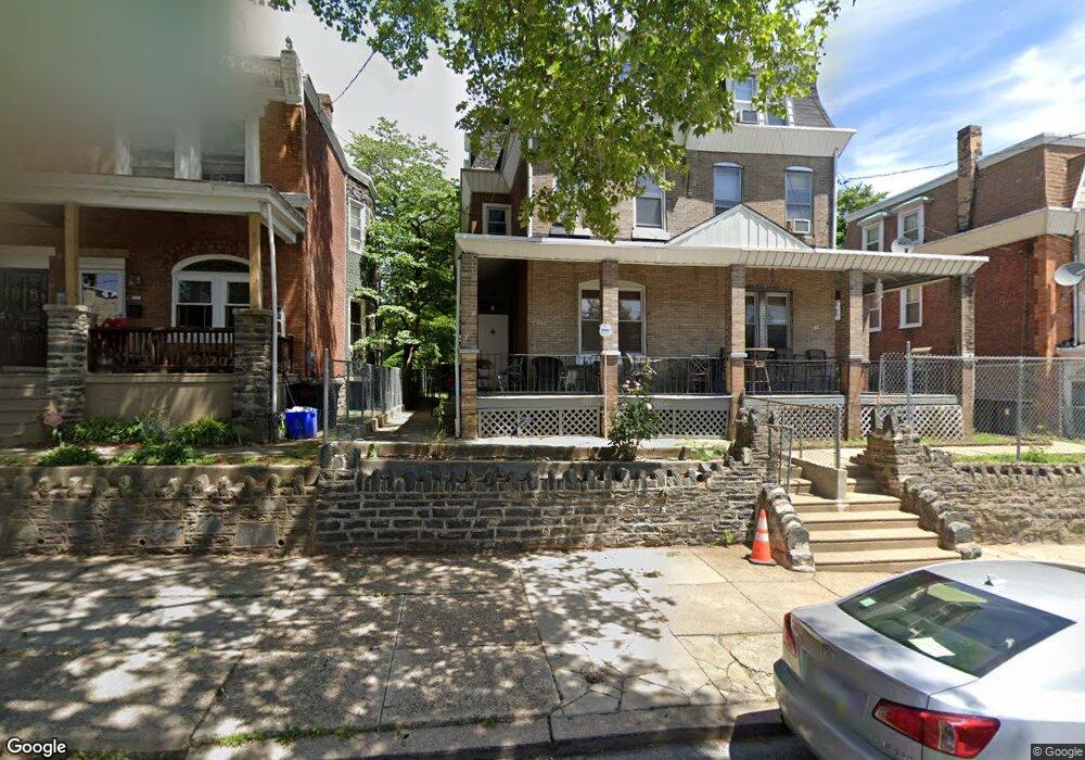
117 E Wellens Ave Philadelphia, PA 19120
Olney NeighborhoodEstimated Value: $214,000 - $258,000
--
Bed
--
Bath
2,266
Sq Ft
$104/Sq Ft
Est. Value
About This Home
This home is located at 117 E Wellens Ave, Philadelphia, PA 19120 and is currently estimated at $235,639, approximately $103 per square foot. 117 E Wellens Ave is a home located in Philadelphia County with nearby schools including Olney Elementary School, Olney Charter High School, and Olney Christian School.
Ownership History
Date
Name
Owned For
Owner Type
Purchase Details
Closed on
Sep 3, 2002
Sold by
Colon Miguel and Colon Gloria
Bought by
Garvin Tonya M
Current Estimated Value
Home Financials for this Owner
Home Financials are based on the most recent Mortgage that was taken out on this home.
Original Mortgage
$91,200
Outstanding Balance
$38,431
Interest Rate
6.36%
Mortgage Type
FHA
Estimated Equity
$197,208
Create a Home Valuation Report for This Property
The Home Valuation Report is an in-depth analysis detailing your home's value as well as a comparison with similar homes in the area
Home Values in the Area
Average Home Value in this Area
Purchase History
| Date | Buyer | Sale Price | Title Company |
|---|---|---|---|
| Garvin Tonya M | $92,700 | -- |
Source: Public Records
Mortgage History
| Date | Status | Borrower | Loan Amount |
|---|---|---|---|
| Open | Garvin Tonya M | $91,200 |
Source: Public Records
Tax History Compared to Growth
Tax History
| Year | Tax Paid | Tax Assessment Tax Assessment Total Assessment is a certain percentage of the fair market value that is determined by local assessors to be the total taxable value of land and additions on the property. | Land | Improvement |
|---|---|---|---|---|
| 2025 | $2,499 | $265,600 | $53,120 | $212,480 |
| 2024 | $2,499 | $265,600 | $53,120 | $212,480 |
| 2023 | $2,499 | $178,500 | $35,700 | $142,800 |
| 2022 | $1,117 | $133,500 | $35,700 | $97,800 |
| 2021 | $1,747 | $0 | $0 | $0 |
| 2020 | $1,747 | $0 | $0 | $0 |
| 2019 | $1,739 | $0 | $0 | $0 |
| 2018 | $1,218 | $0 | $0 | $0 |
| 2017 | $1,638 | $0 | $0 | $0 |
| 2016 | $1,218 | $0 | $0 | $0 |
| 2015 | $1,166 | $0 | $0 | $0 |
| 2014 | -- | $117,000 | $16,912 | $100,088 |
| 2012 | -- | $15,840 | $2,853 | $12,987 |
Source: Public Records
Map
Nearby Homes
- 127 E Wellens Ave
- 5230 N Front St
- 150 W Fisher Ave
- 220 E Tabor Rd
- 124 E Ruscomb St
- 4941 N Front St
- 5413 N Front St
- 252 E Albanus St
- 342 E Sheldon St
- 5157 C St
- 5228 N 2nd St
- 5230 N 2nd St
- 5150 N 2nd St
- 156 W Albanus St
- 218 E Roosevelt Blvd
- 224 W Duncannon Ave
- 216 E Roosevelt Blvd
- 239 Rubicam St
- 149 W Roosevelt Blvd
- 5227 31 N American St
- 115 E Wellens Ave
- 119 E Wellens Ave
- 113 E Wellens Ave
- 121 E Wellens Ave
- 111 E Wellens Ave
- 123 E Wellens Ave
- 109 E Wellens Ave
- 125 E Wellens Ave
- 116 E Fisher Ave
- 114 E Fisher Ave
- 112 E Fisher Ave
- 120 E Fisher Ave
- 129 E Wellens Ave
- 129 E Wellens St
- 122 E Fisher Ave
- 110 E Fisher Ave
- 124 E Fisher Ave
- 5231 N Front St
- 131 E Wellens Ave
- 116 E Wellens Ave