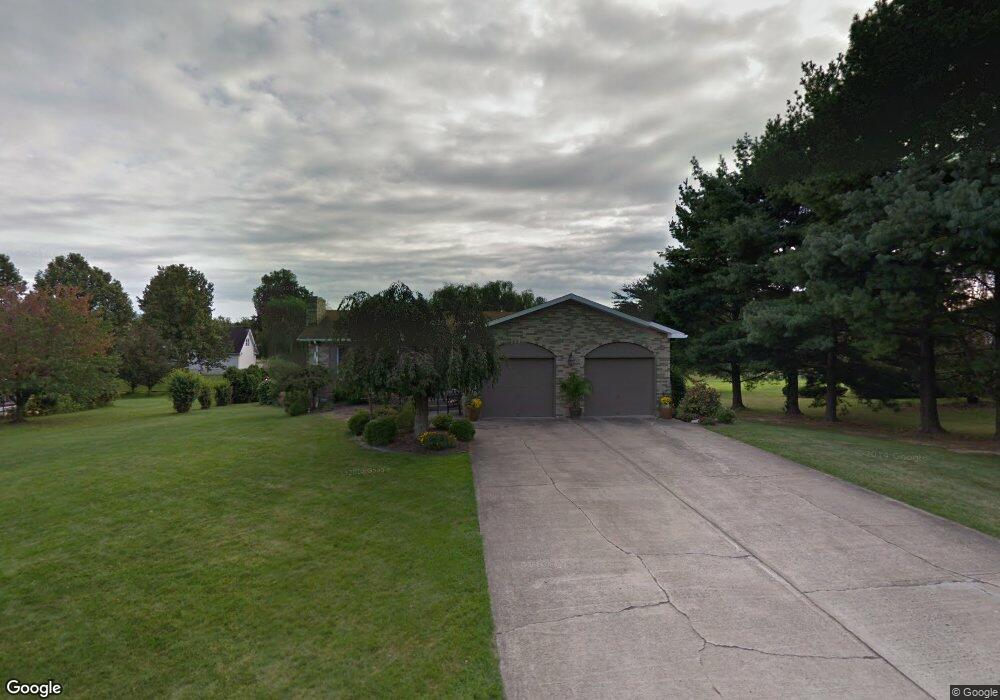
117 Eastgate Rd Uniontown, PA 15401
Estimated Value: $372,886 - $459,000
5
Beds
3
Baths
2,625
Sq Ft
$164/Sq Ft
Est. Value
About This Home
This home is located at 117 Eastgate Rd, Uniontown, PA 15401 and is currently estimated at $431,222, approximately $164 per square foot. 117 Eastgate Rd is a home located in Fayette County with nearby schools including Laurel Highlands Senior High School, St. John the Evangelist School, and Chestnut Ridge Christian Academy.
Ownership History
Date
Name
Owned For
Owner Type
Purchase Details
Closed on
Mar 13, 2009
Sold by
Malinzak Dale L
Bought by
Hensh Amy
Current Estimated Value
Home Financials for this Owner
Home Financials are based on the most recent Mortgage that was taken out on this home.
Original Mortgage
$188,000
Outstanding Balance
$118,844
Interest Rate
5.02%
Mortgage Type
New Conventional
Estimated Equity
$312,378
Create a Home Valuation Report for This Property
The Home Valuation Report is an in-depth analysis detailing your home's value as well as a comparison with similar homes in the area
Home Values in the Area
Average Home Value in this Area
Purchase History
| Date | Buyer | Sale Price | Title Company |
|---|---|---|---|
| Hensh Amy | $235,000 | None Available |
Source: Public Records
Mortgage History
| Date | Status | Borrower | Loan Amount |
|---|---|---|---|
| Open | Hensh Amy | $188,000 |
Source: Public Records
Tax History Compared to Growth
Tax History
| Year | Tax Paid | Tax Assessment Tax Assessment Total Assessment is a certain percentage of the fair market value that is determined by local assessors to be the total taxable value of land and additions on the property. | Land | Improvement |
|---|---|---|---|---|
| 2025 | $2,296 | $80,445 | $22,255 | $58,190 |
| 2024 | $2,231 | $80,445 | $22,255 | $58,190 |
| 2023 | $4,291 | $80,445 | $22,255 | $58,190 |
| 2022 | $4,250 | $80,445 | $22,255 | $58,190 |
| 2021 | $4,132 | $80,445 | $22,255 | $58,190 |
| 2020 | $4,132 | $80,445 | $22,255 | $58,190 |
| 2019 | $3,794 | $80,445 | $22,255 | $58,190 |
| 2018 | $3,680 | $80,445 | $22,255 | $58,190 |
| 2017 | $3,680 | $80,445 | $22,255 | $58,190 |
| 2016 | -- | $80,445 | $22,255 | $58,190 |
| 2015 | -- | $80,445 | $22,255 | $58,190 |
| 2014 | -- | $160,890 | $44,510 | $116,380 |
Source: Public Records
Map
Nearby Homes
- 103 Concord Place
- 70 Heritage Hills Rd
- 60 Heritage Hills Rd
- 42 Oconnell Ave
- 337 Saratoga Dr
- 160 Brownfield Ln
- 388 Derrick Ave
- 87 Farmview Dr
- 14 Amy Way
- 10 Wellington Dr
- 5 Albert St
- 0 Brownfield Rd Unit 10160173
- 0 Brownfield Rd Unit 1707349
- 615 Morgantown Rd
- 596 Morgantown Rd
- 302 Derrick Ave
- 1019 Kimberly Dr
- Lot 15 Baron Ct
- Lot 3 Baron Ct
- Lot 4 Baron Ct
- 115 Eastgate Rd
- 119 Eastgate Rd
- 115 Tyler Ct
- 118 Tyler Ct
- 113 Eastgate Rd
- 122 Heritage Hills Rd
- 118 Eastgate Rd
- 116 Eastgate Rd
- 120 Eastgate Rd
- 114 Eastgate Rd
- 116 Tyler Ct
- 111 Tyler Ct
- 111 Eastgate Rd
- 124 Heritage Hills Rd
- 112 Eastgate Rd
- 110 Heritage Hills Rd
- 114 Tyler Ct
- 113 Heritage Hills Rd
- 3 Brownfield Ln
- 123 Heritage Hills Rd