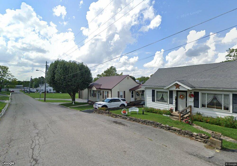
117 Ewing Ave Harrodsburg, KY 40330
Estimated Value: $131,862 - $178,000
2
Beds
1
Bath
1,042
Sq Ft
$144/Sq Ft
Est. Value
About This Home
This home is located at 117 Ewing Ave, Harrodsburg, KY 40330 and is currently estimated at $149,716, approximately $143 per square foot. 117 Ewing Ave is a home located in Mercer County with nearby schools including Mercer County Elementary School, Mercer County Intermediate School, and King Middle School.
Ownership History
Date
Name
Owned For
Owner Type
Purchase Details
Closed on
Oct 17, 2022
Sold by
Conrad Sheila and Conrad Richard
Bought by
Conrad Richard and Conrad Sheila
Current Estimated Value
Home Financials for this Owner
Home Financials are based on the most recent Mortgage that was taken out on this home.
Original Mortgage
$109,600
Outstanding Balance
$94,406
Interest Rate
5.21%
Mortgage Type
Balloon
Estimated Equity
$55,310
Purchase Details
Closed on
Oct 31, 2011
Sold by
Virgil Virgil and Peyton Opal
Bought by
Orrand Sheila
Create a Home Valuation Report for This Property
The Home Valuation Report is an in-depth analysis detailing your home's value as well as a comparison with similar homes in the area
Home Values in the Area
Average Home Value in this Area
Purchase History
| Date | Buyer | Sale Price | Title Company |
|---|---|---|---|
| Conrad Richard | -- | Indecomm Global Services | |
| Orrand Sheila | $60,000 | -- |
Source: Public Records
Mortgage History
| Date | Status | Borrower | Loan Amount |
|---|---|---|---|
| Open | Conrad Richard | $109,600 |
Source: Public Records
Tax History Compared to Growth
Tax History
| Year | Tax Paid | Tax Assessment Tax Assessment Total Assessment is a certain percentage of the fair market value that is determined by local assessors to be the total taxable value of land and additions on the property. | Land | Improvement |
|---|---|---|---|---|
| 2024 | $880 | $78,936 | $10,000 | $68,936 |
| 2023 | $710 | $63,051 | $0 | $0 |
| 2022 | $701 | $63,051 | $0 | $0 |
| 2021 | $709 | $63,051 | $0 | $0 |
| 2020 | $709 | $59,939 | $10,000 | $49,939 |
| 2019 | $685 | $59,939 | $10,000 | $49,939 |
| 2018 | $668 | $59,939 | $0 | $0 |
| 2017 | $644 | $59,939 | $0 | $0 |
| 2016 | $632 | $59,939 | $0 | $0 |
| 2015 | $613 | $59,939 | $10,000 | $49,939 |
| 2014 | $613 | $59,939 | $0 | $0 |
| 2010 | -- | $59,939 | $10,000 | $49,939 |
Source: Public Records
Map
Nearby Homes
- 302 Pheasant Dr
- 349 N Greenville St
- 913 Milward Dr
- 561 Harvest Ln
- 214 E Factory St
- 130 N Main St Unit 130/132/134
- 400 Bellaire Dr
- 342 N Magnolia St
- 324 Woodsland Dr
- 120 S Main St
- 202 S College St
- 108 Hensley Heights
- 000 Harrodsburg Bypass
- 111 Castle Heights Dr
- 365 Mooreland Ave
- 435 Linden Ave
- 419 Chippewa Dr
- 135 Parkview Ave
- 340 Dixie Manor
- 743 Greenbriar Dr
- 113 Ewing Ave
- 102 Ewing Ave
- 126 Eminence Ave
- 116 Eminence Ave
- 112 Eminence Ave
- 610 N Main St
- 606 N Main St
- 602 N Main St
- 139 Eminence Ave
- 534 N Main St
- 106 Eminence Ave
- 42 Ewing Ave
- 43 Ewing Ave
- 616 N Main St
- 42 A Ewing Ave
- 43 A Ewing Ave
- 0 Ewing Ave
- 620 N Main St
- 601 N Main St
- 140 Eminence Ave Unit 142