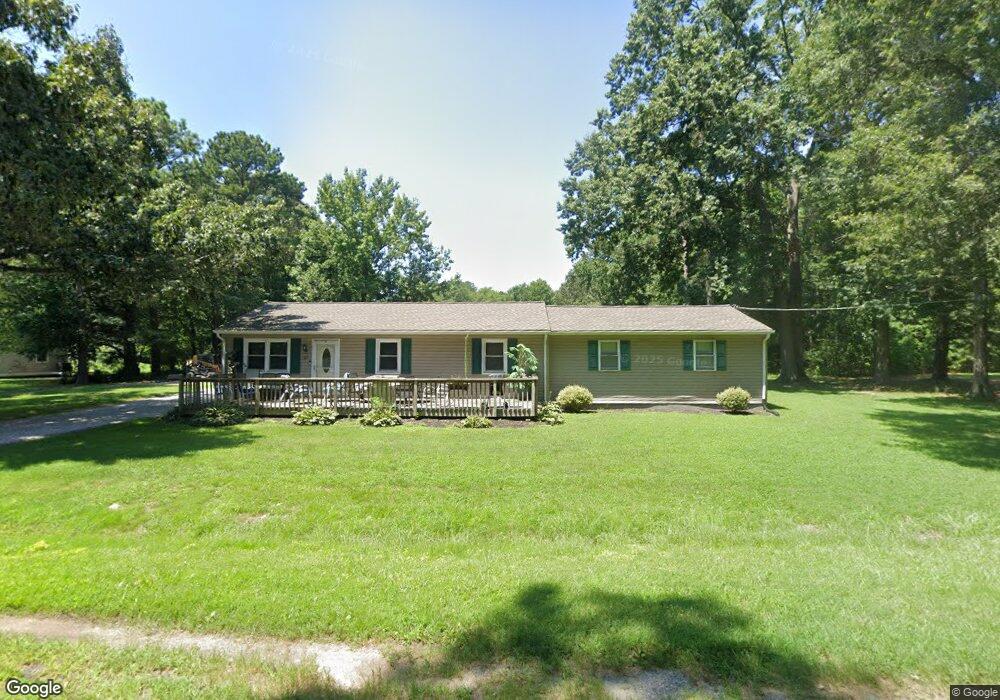
117 Forest Rd Grasonville, MD 21638
Estimated Value: $271,000 - $338,000
--
Bed
2
Baths
1,584
Sq Ft
$197/Sq Ft
Est. Value
About This Home
This home is located at 117 Forest Rd, Grasonville, MD 21638 and is currently estimated at $312,228, approximately $197 per square foot. 117 Forest Rd is a home located in Queen Anne's County with nearby schools including Grasonville Elementary School, Stevensville Middle School, and Kent Island High School.
Ownership History
Date
Name
Owned For
Owner Type
Purchase Details
Closed on
Jul 16, 1998
Sold by
Mcknight Roger K
Bought by
Fisher James E and Adkins Christine
Current Estimated Value
Purchase Details
Closed on
Dec 10, 1996
Sold by
Freeman William E and Freeman Everett J
Bought by
Mcknight Roger K
Purchase Details
Closed on
Mar 10, 1989
Sold by
Kerr Gregory P
Bought by
Freeman William E and Freeman Everett J
Home Financials for this Owner
Home Financials are based on the most recent Mortgage that was taken out on this home.
Original Mortgage
$64,000
Interest Rate
10.86%
Create a Home Valuation Report for This Property
The Home Valuation Report is an in-depth analysis detailing your home's value as well as a comparison with similar homes in the area
Home Values in the Area
Average Home Value in this Area
Purchase History
| Date | Buyer | Sale Price | Title Company |
|---|---|---|---|
| Fisher James E | $69,000 | -- | |
| Mcknight Roger K | $26,000 | -- | |
| Freeman William E | $64,000 | -- |
Source: Public Records
Mortgage History
| Date | Status | Borrower | Loan Amount |
|---|---|---|---|
| Previous Owner | Freeman William E | $64,000 | |
| Closed | Mcknight Roger K | -- |
Source: Public Records
Tax History Compared to Growth
Tax History
| Year | Tax Paid | Tax Assessment Tax Assessment Total Assessment is a certain percentage of the fair market value that is determined by local assessors to be the total taxable value of land and additions on the property. | Land | Improvement |
|---|---|---|---|---|
| 2025 | $2,083 | $254,133 | $0 | $0 |
| 2024 | $1,975 | $234,200 | $124,300 | $109,900 |
| 2023 | $1,886 | $228,200 | $0 | $0 |
| 2022 | $1,802 | $222,200 | $0 | $0 |
| 2021 | $1,669 | $216,200 | $99,300 | $116,900 |
| 2020 | $1,669 | $206,533 | $0 | $0 |
| 2019 | $1,590 | $196,867 | $0 | $0 |
| 2018 | $1,514 | $187,200 | $89,300 | $97,900 |
| 2017 | $1,436 | $173,233 | $0 | $0 |
| 2016 | -- | $159,267 | $0 | $0 |
| 2015 | $549 | $145,300 | $0 | $0 |
| 2014 | $549 | $145,300 | $0 | $0 |
Source: Public Records
Map
Nearby Homes
- 0 Grasonville Cemetery Rd
- 149 Sawmill Ln
- 155 Sawmill Ln
- 149,141,155 Sawmill Ln
- 201 Sawmill Ln
- 149 Unit 141155 SAWMILL Lane
- 141 Sawmill Ln
- 113 Aslan Ct
- The Chester Plan at Whitetail Crossing
- The Cordova Plan at Whitetail Crossing
- The Miles Plan at Whitetail Crossing
- The Caroline Plan at Whitetail Crossing
- 213 Slippery Hill Ln
- 317 Caspian Dr
- 5128 Main St
- 0 Hess Frontage Rd
- 144 River Run
- 116 Pine Dr
- 4926 Main St
- 915 Sportsman Neck Rd
- 113 Forest Rd
- 116 Forest Rd
- 141 Watkins Rd
- 120 Forest Rd
- 109 Forest Rd
- 108 Forest Rd
- 127 Forest Rd
- 124 Forest Rd
- 116 Watkins Rd
- 110 Watkins Rd
- 105 Forest Rd
- 104 Forest Rd
- 129 Forest Rd
- 119 Watkins Rd
- 127 Watkins Rd
- 135 Watkins Rd
- 100 Forest Rd
- 113 LOT 1 Watkins Rd
- 113 Watkins Rd
- 1015 Grasonville Cemetery Rd