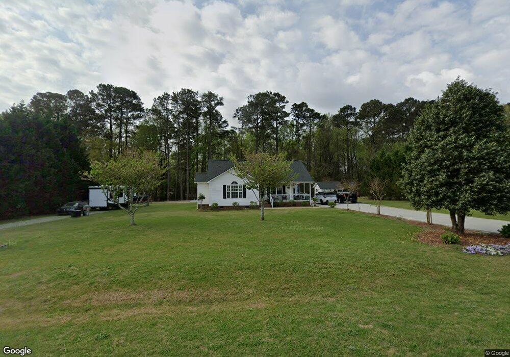
117 Forest Ridge Dr Willow Spring, NC 27592
Pleasant Grove NeighborhoodEstimated Value: $273,000 - $289,000
3
Beds
2
Baths
1,270
Sq Ft
$219/Sq Ft
Est. Value
About This Home
This home is located at 117 Forest Ridge Dr, Willow Spring, NC 27592 and is currently estimated at $277,808, approximately $218 per square foot. 117 Forest Ridge Dr is a home located in Johnston County with nearby schools including Dixon Road Elementary School, McGee's Crossroads Middle School, and West Johnston High School.
Ownership History
Date
Name
Owned For
Owner Type
Purchase Details
Closed on
Jan 27, 2020
Sold by
Lyle Blayne Ashlee
Bought by
Brown Frank William and Brown Jane Frances
Current Estimated Value
Home Financials for this Owner
Home Financials are based on the most recent Mortgage that was taken out on this home.
Original Mortgage
$184,500
Outstanding Balance
$163,764
Interest Rate
3.73%
Mortgage Type
VA
Estimated Equity
$114,044
Purchase Details
Closed on
Dec 28, 2018
Sold by
Mcbeath Kimberly L
Bought by
Lyle Blayne Ashlee
Home Financials for this Owner
Home Financials are based on the most recent Mortgage that was taken out on this home.
Original Mortgage
$149,246
Interest Rate
5.12%
Mortgage Type
FHA
Purchase Details
Closed on
Apr 30, 2004
Sold by
Mcbeath Kimberly L
Bought by
Phan Thang D
Create a Home Valuation Report for This Property
The Home Valuation Report is an in-depth analysis detailing your home's value as well as a comparison with similar homes in the area
Home Values in the Area
Average Home Value in this Area
Purchase History
We collect this data history from publicly available records. To have your information removed, we recommend requesting removal directly through your county’s website.
| Date | Buyer | Sale Price | Title Company |
|---|---|---|---|
| Brown Frank William | $185,000 | None Available | |
| Lyle Blayne Ashlee | $174,000 | None Available | |
| Phan Thang D | $108,000 | -- |
Source: Public Records
Mortgage History
We collect this data history from publicly available records. To have your information removed, we recommend requesting removal directly through your county’s website.
| Date | Status | Borrower | Loan Amount |
|---|---|---|---|
| Open | Brown Frank William | $184,500 | |
| Previous Owner | Lyle Blayne Ashlee | $149,246 |
Source: Public Records
Tax History
| Year | Tax Paid | Tax Assessment Tax Assessment Total Assessment is a certain percentage of the fair market value that is determined by local assessors to be the total taxable value of land and additions on the property. | Land | Improvement |
|---|---|---|---|---|
| 2025 | $1,394 | $263,820 | $75,000 | $188,820 |
| 2024 | $1,233 | $152,190 | $44,000 | $108,190 |
| 2023 | $1,195 | $152,190 | $44,000 | $108,190 |
| 2022 | $1,233 | $152,190 | $44,000 | $108,190 |
| 2021 | $1,189 | $146,810 | $44,000 | $102,810 |
| 2020 | $1,233 | $146,810 | $44,000 | $102,810 |
| 2019 | $1,204 | $146,810 | $44,000 | $102,810 |
| 2018 | $994 | $118,380 | $32,500 | $85,880 |
| 2017 | $994 | $118,380 | $32,500 | $85,880 |
| 2016 | $994 | $118,380 | $32,500 | $85,880 |
| 2015 | $994 | $118,380 | $32,500 | $85,880 |
| 2014 | $994 | $118,380 | $32,500 | $85,880 |
Source: Public Records
Map
Nearby Homes
- 100 Disc Dr
- 64 Marie Ct
- 47 Kiowa Ct
- 30 Gloria Grande Ct
- 200 Amber Ln
- 92 Balsawood Ct
- 127 Riders Ridge Ln
- 30 Basswood Cir
- 167 Windy Dr
- 150 Brett Cir
- 18 N Bream Ct
- 139 Edmondson Dr
- 105 S Bream Ct
- 115 S Bream Ct Unit Lot 6
- 114 S Bream Ct
- 119 S Bream Ct
- 10 Roping Horn Way
- 64 Abilene Ct
- 92 Poston Ct
- 68 Jetherage Dr
- 115 Forest Ridge Dr
- 123 Forest Ridge Dr
- 111 Forest Ridge Dr
- 0 Forest Ridge Dr Unit 1822131
- 116 Forest Ridge Dr
- 127 Forest Ridge Dr
- 120 Forest Ridge Dr
- 112 Forest Ridge Dr
- 124 Forest Ridge Dr
- 108 Forest Ridge Dr
- 131 Forest Ridge Dr
- 105 Forest Ridge Dr
- 128 Forest Ridge Dr
- 136 Forest Ridge Dr
- 132 Forest Ridge Dr
- 104 Forest Ridge Dr
- 110 Saleen Dr
- 115 Saleen Dr
- 28 Forest Ridge Dr
- 100 Forest Ridge Dr
Your Personal Tour Guide
Ask me questions while you tour the home.