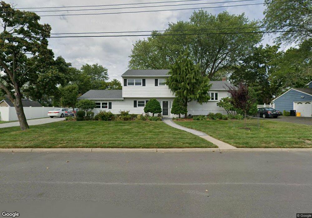
117 Forest St West Long Branch, NJ 07764
Estimated Value: $808,000 - $871,000
4
Beds
2
Baths
2,028
Sq Ft
$416/Sq Ft
Est. Value
About This Home
This home is located at 117 Forest St, West Long Branch, NJ 07764 and is currently estimated at $843,746, approximately $416 per square foot. 117 Forest St is a home located in Monmouth County with nearby schools including Betty McElmon Elementary School, Frank Antonides School, and Shore Regional High School.
Ownership History
Date
Name
Owned For
Owner Type
Purchase Details
Closed on
Mar 14, 2001
Sold by
Brodie Donald
Bought by
Jemas James and Jemas Sharon
Current Estimated Value
Home Financials for this Owner
Home Financials are based on the most recent Mortgage that was taken out on this home.
Original Mortgage
$134,000
Outstanding Balance
$48,465
Interest Rate
6.93%
Estimated Equity
$795,281
Create a Home Valuation Report for This Property
The Home Valuation Report is an in-depth analysis detailing your home's value as well as a comparison with similar homes in the area
Home Values in the Area
Average Home Value in this Area
Purchase History
| Date | Buyer | Sale Price | Title Company |
|---|---|---|---|
| Jemas James | $265,000 | -- |
Source: Public Records
Mortgage History
| Date | Status | Borrower | Loan Amount |
|---|---|---|---|
| Open | Jemas James | $134,000 |
Source: Public Records
Tax History
| Year | Tax Paid | Tax Assessment Tax Assessment Total Assessment is a certain percentage of the fair market value that is determined by local assessors to be the total taxable value of land and additions on the property. | Land | Improvement |
|---|---|---|---|---|
| 2025 | $9,886 | $835,400 | $530,200 | $305,200 |
| 2024 | $9,670 | $758,700 | $460,600 | $298,100 |
| 2023 | $9,670 | $692,200 | $451,000 | $241,200 |
| 2022 | $7,753 | $530,700 | $301,000 | $229,700 |
| 2021 | $7,753 | $401,100 | $215,800 | $185,300 |
| 2020 | $7,737 | $376,500 | $195,400 | $181,100 |
| 2019 | $7,675 | $375,500 | $195,400 | $180,100 |
| 2018 | $8,200 | $387,500 | $215,800 | $171,700 |
| 2017 | $8,246 | $372,100 | $205,700 | $166,400 |
| 2016 | $7,874 | $362,500 | $226,000 | $136,500 |
| 2015 | $8,104 | $372,600 | $226,000 | $146,600 |
| 2014 | $7,478 | $320,800 | $181,000 | $139,800 |
Source: Public Records
Map
Nearby Homes
- 112 Linden Ave
- 38 Delaware Ave
- 11 Fairway Ave
- 106 Wall St
- 182 Wall St
- 21 Dennis St Unit TBB
- 21 Dennis St
- 308 Monmouth Rd
- 583 Cedar Ave
- 126 Beechwood Ave
- 300 Monmouth Rd
- 521 Cedar Ave
- 558 Cedar Ave
- 940 Broadway
- 657 Campbell Ave
- 489 Cedar Ave
- 638 Overton Place
- 390 Monmouth Rd
- 681 Morford Ave
- 24 Mount Dr
- 115 Forest St
- 121 Forest St
- 116 Linden Ave
- 45 Community Dr
- 111 Forest St
- 41 Community Dr
- 110 Linden Ave
- 44 Community Dr
- 107 Forest St
- 30 Community Dr
- 38 Richard Ln
- 117 Linden Ave
- 33 Community Dr
- 115 Linden Ave
- 34 Richard Ln
- 36 Community Dr
- 113 Linden Ave
- 26 Community Dr
- 29 Community Dr
- 30 Richard Ln
Your Personal Tour Guide
Ask me questions while you tour the home.