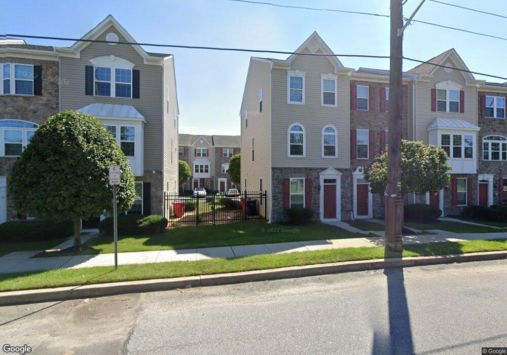
117 Franklin Cir Somerdale, NJ 08083
Estimated Value: $284,000 - $336,000
2
Beds
3
Baths
1,394
Sq Ft
$220/Sq Ft
Est. Value
About This Home
This home is located at 117 Franklin Cir, Somerdale, NJ 08083 and is currently estimated at $307,312, approximately $220 per square foot. 117 Franklin Cir is a home located in Camden County with nearby schools including Somerdale Park School and Sterling High School.
Ownership History
Date
Name
Owned For
Owner Type
Purchase Details
Closed on
Apr 23, 2014
Sold by
Nvr Inc
Bought by
Wabby Justin E and Wabby Vickie L
Current Estimated Value
Home Financials for this Owner
Home Financials are based on the most recent Mortgage that was taken out on this home.
Original Mortgage
$205,691
Outstanding Balance
$155,328
Interest Rate
4.32%
Mortgage Type
VA
Estimated Equity
$151,984
Purchase Details
Closed on
Jan 9, 2014
Sold by
Gvd Somerdale I Llc
Bought by
Nvr Inc and Ryan Homes
Create a Home Valuation Report for This Property
The Home Valuation Report is an in-depth analysis detailing your home's value as well as a comparison with similar homes in the area
Home Values in the Area
Average Home Value in this Area
Purchase History
| Date | Buyer | Sale Price | Title Company |
|---|---|---|---|
| Wabby Justin E | $201,362 | Legacy Title Agency Llc | |
| Nvr Inc | $265,000 | Title American Agency Corp |
Source: Public Records
Mortgage History
| Date | Status | Borrower | Loan Amount |
|---|---|---|---|
| Open | Wabby Justin E | $205,691 |
Source: Public Records
Tax History Compared to Growth
Tax History
| Year | Tax Paid | Tax Assessment Tax Assessment Total Assessment is a certain percentage of the fair market value that is determined by local assessors to be the total taxable value of land and additions on the property. | Land | Improvement |
|---|---|---|---|---|
| 2025 | $8,017 | $172,000 | $21,200 | $150,800 |
| 2024 | $7,673 | $172,000 | $21,200 | $150,800 |
| 2023 | $7,673 | $172,000 | $21,200 | $150,800 |
| 2022 | $7,346 | $172,000 | $21,200 | $150,800 |
| 2021 | $7,549 | $172,000 | $21,200 | $150,800 |
| 2020 | $7,362 | $172,000 | $21,200 | $150,800 |
| 2019 | $7,227 | $172,000 | $21,200 | $150,800 |
| 2018 | $6,104 | $141,800 | $21,200 | $120,600 |
| 2017 | $4,757 | $111,700 | $21,200 | $90,500 |
| 2016 | $3,375 | $81,500 | $21,200 | $60,300 |
| 2015 | $2,098 | $51,400 | $21,200 | $30,200 |
| 2014 | $829 | $21,200 | $21,200 | $0 |
Source: Public Records
Map
Nearby Homes
- 69 Franklin Cir
- 412 S Charleston Ave
- 348 Silk St
- 265 S Charleston Ave
- 5 Perot Ave
- 511 Ellis Ave
- 326 E Washington Ave
- 313 E Washington Ave
- 101 Railroad Blvd
- 178 E Charleston Ave
- 172 E Charleston Ave
- 0 Orchard Ave
- 412 N White Horse Pike
- 12 Country Ln
- 217 Ashland Ave
- 431 N White Horse Pike
- 130 E Evesham Ave
- 128 E Oak Ave
- 208 Ashley Run
- 211 Park Ave
- 119 Franklin Cir
- 121 Franklin Cir
- 115 Franklin Cir
- 123 Franklin Cir
- 113 Franklin Cir
- 125 Franklin Cir
- 111 Franklin Cir
- 127 Franklin Cir
- 109 Franklin Cir
- 129 Franklin Cir
- 107 Franklin Cir
- 131 Franklin Cir
- 10 Tylers Ct
- 10 Tylers Ct
- 14 Tylers Ct
- 105 Franklin Cir
- 12 Tylers Ct
- 14 Tylers Ct
- 133 Franklin Cir
- 0 Evesham Ave