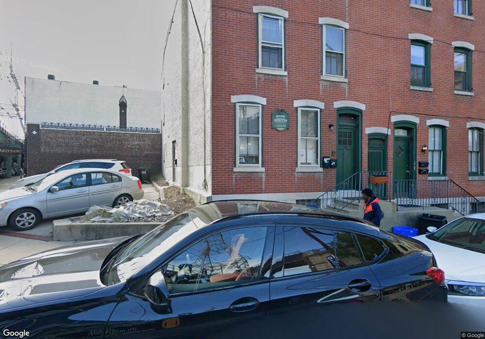
117 Green Ln Philadelphia, PA 19127
Manayunk NeighborhoodEstimated Value: $458,114 - $607,000
3
Beds
3
Baths
2,400
Sq Ft
$214/Sq Ft
Est. Value
About This Home
This home is located at 117 Green Ln, Philadelphia, PA 19127 and is currently estimated at $513,038, approximately $213 per square foot. 117 Green Ln is a home located in Philadelphia County with nearby schools including White Oaks Elementary School, James Dobson Elementary School, and Roxborough High School.
Ownership History
Date
Name
Owned For
Owner Type
Purchase Details
Closed on
Apr 2, 2021
Sold by
Green Lane Associates Llc
Bought by
Ridge Green Llc
Current Estimated Value
Purchase Details
Closed on
Jun 17, 2002
Sold by
Giovannone Francis and Giovannone Anthony
Bought by
Green Lane Associates Llc
Purchase Details
Closed on
May 10, 1999
Sold by
Giovannone Francis and Giovannone Anthony
Bought by
Giovannone Francis and Giovannone Anthony
Create a Home Valuation Report for This Property
The Home Valuation Report is an in-depth analysis detailing your home's value as well as a comparison with similar homes in the area
Home Values in the Area
Average Home Value in this Area
Purchase History
| Date | Buyer | Sale Price | Title Company |
|---|---|---|---|
| Ridge Green Llc | $403,500 | The Abstract Company | |
| Green Lane Associates Llc | $84,968 | -- | |
| Giovannone Francis | -- | -- |
Source: Public Records
Tax History Compared to Growth
Tax History
| Year | Tax Paid | Tax Assessment Tax Assessment Total Assessment is a certain percentage of the fair market value that is determined by local assessors to be the total taxable value of land and additions on the property. | Land | Improvement |
|---|---|---|---|---|
| 2026 | $4,470 | $595,400 | $119,080 | $476,320 |
| 2025 | $4,470 | $595,400 | $119,080 | $476,320 |
| 2024 | $4,470 | $595,400 | $119,080 | $476,320 |
| 2023 | $4,470 | $319,300 | $63,800 | $255,500 |
| 2022 | $4,339 | $319,300 | $63,800 | $255,500 |
| 2021 | $4,339 | $0 | $0 | $0 |
| 2020 | $4,339 | $0 | $0 | $0 |
| 2019 | $3,838 | $0 | $0 | $0 |
| 2018 | $0 | $0 | $0 | $0 |
| 2017 | $3,695 | $0 | $0 | $0 |
| 2016 | $3,695 | $0 | $0 | $0 |
| 2015 | $3,538 | $0 | $0 | $0 |
| 2014 | -- | $264,000 | $38,469 | $225,531 |
| 2012 | -- | $35,200 | $2,995 | $32,205 |
Source: Public Records
Map
Nearby Homes
- 131 Carson St
- 4419 Baker St
- 142 Carson St
- 4523 Riverside Way
- 4413 Baker St
- 152 Carson St
- 4506 Ritchie St
- 144 Levering St
- 4521 Wilde St
- 168 Gay St
- 175 Krams Ave
- 191 Maiden St
- 109 Cotton St
- 164 Grape St
- 0 Penn Ave
- 4584 Riverside Way
- 4586 Riverside Way
- 223 Dupont St
- 4630 Umbria St
- 182 00 Gay St Unit 103
- 117 Green Ln Unit C
- 117 Green Ln Unit B
- 117 Green Ln Unit 2
- 117 Green Ln Unit A
- 115 Green Ln
- 115 Green Ln Unit 1
- 115 Green Ln Unit 2
- 4444 Cresson St Unit G
- 4444 Cresson St Unit E
- 4444 Cresson St
- 4444 Cresson St Unit F
- 4442 Cresson St Unit B
- 4442 Cresson St Unit D
- 4442 Cresson St Unit A
- 4442 Cresson St Unit B
- 4442 Cresson St Unit C
- 4442 Cresson St
- 4457 Main St
- 123 Green Ln
- 125 Green Ln