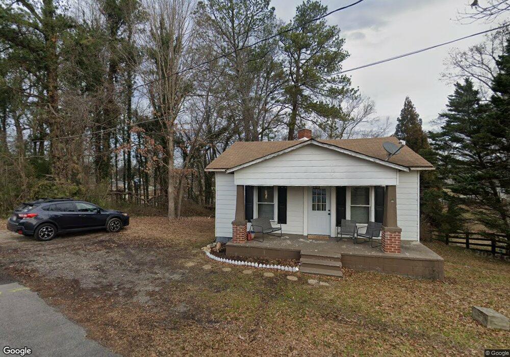
117 Grove Park Ave Dallas, GA 30132
Estimated Value: $186,000 - $194,000
2
Beds
1
Bath
988
Sq Ft
$192/Sq Ft
Est. Value
About This Home
This home is located at 117 Grove Park Ave, Dallas, GA 30132 and is currently estimated at $190,000, approximately $192 per square foot. 117 Grove Park Ave is a home located in Paulding County with nearby schools including Northside Elementary School, Herschel Jones Middle School, and Paulding County High School.
Ownership History
Date
Name
Owned For
Owner Type
Purchase Details
Closed on
Jul 24, 2023
Sold by
Diee Bob
Bought by
Diee Robert W
Current Estimated Value
Home Financials for this Owner
Home Financials are based on the most recent Mortgage that was taken out on this home.
Original Mortgage
$187,500
Outstanding Balance
$182,927
Interest Rate
6.67%
Mortgage Type
New Conventional
Estimated Equity
$7,073
Purchase Details
Closed on
Aug 21, 2019
Sold by
Brown David J Estate
Bought by
Diee Bob
Purchase Details
Closed on
Sep 6, 1990
Sold by
City Of Dallas Georgia
Bought by
Camp Major R
Create a Home Valuation Report for This Property
The Home Valuation Report is an in-depth analysis detailing your home's value as well as a comparison with similar homes in the area
Home Values in the Area
Average Home Value in this Area
Purchase History
| Date | Buyer | Sale Price | Title Company |
|---|---|---|---|
| Diee Robert W | -- | -- | |
| Diee Bob | $55,000 | -- | |
| Camp Major R | -- | -- |
Source: Public Records
Mortgage History
| Date | Status | Borrower | Loan Amount |
|---|---|---|---|
| Open | Diee Robert W | $187,500 |
Source: Public Records
Tax History Compared to Growth
Tax History
| Year | Tax Paid | Tax Assessment Tax Assessment Total Assessment is a certain percentage of the fair market value that is determined by local assessors to be the total taxable value of land and additions on the property. | Land | Improvement |
|---|---|---|---|---|
| 2024 | $1,916 | $61,400 | $4,880 | $56,520 |
| 2023 | $1,513 | $50,040 | $4,720 | $45,320 |
| 2022 | $1,094 | $41,960 | $4,320 | $37,640 |
| 2021 | $926 | $31,880 | $3,520 | $28,360 |
| 2020 | $745 | $28,480 | $3,640 | $24,840 |
| 2019 | $963 | $28,080 | $6,880 | $21,200 |
| 2018 | $578 | $19,200 | $5,880 | $13,320 |
| 2017 | $622 | $17,920 | $5,880 | $12,040 |
| 2016 | $540 | $15,680 | $5,880 | $9,800 |
| 2015 | $483 | $15,680 | $5,880 | $9,800 |
| 2014 | $495 | $15,680 | $5,880 | $9,800 |
| 2013 | -- | $13,080 | $5,760 | $7,320 |
Source: Public Records
Map
Nearby Homes
- 217 Victory Dr
- 353 Spring Ridge Path
- 208 Park St Unit 114
- 216 Hardee St
- 199 Highland Ave
- 119 Mcbee St
- 210 N Johnston St
- 207 Confederate Ave
- 220 Confederate Ave
- 0 Merchants Dr Unit 7658248
- 0 Merchants Dr Unit 10615716
- 234 E Memorial Dr
- 0 Jimmy Campbell Pkwy Unit 10556704
- 0 Jimmy Campbell Pkwy Unit 7607737
- 200 Polk Ave
- 205 Hart Cir
- 1119 W Memorial Dr
- 250 E Memorial Dr
- 118 Grove Park Ave
- 0 Grove Park Ave Unit 8193983
- 0 Grove Park Ave Unit 8193979
- 0 Grove Park Ave Unit 8192480
- 0 Grove Park Ave Unit 8143265
- 0 Grove Park Ave Unit 7314032
- 0 Grove Park Ave Unit 8226822
- 0 Grove Park Ave
- 121 Grove Park Ave
- 409 S Johnston St
- 122 Grove Park Ave
- 124 W Cooper Ave
- 214 W Cooper Ave
- 123 Grove Park Ave
- S S Johnston St
- 125 Grove Park Ave
- 403 S Johnston St
- 401 S Johnston St
- 218 Hood St
- 436 S Johnston St