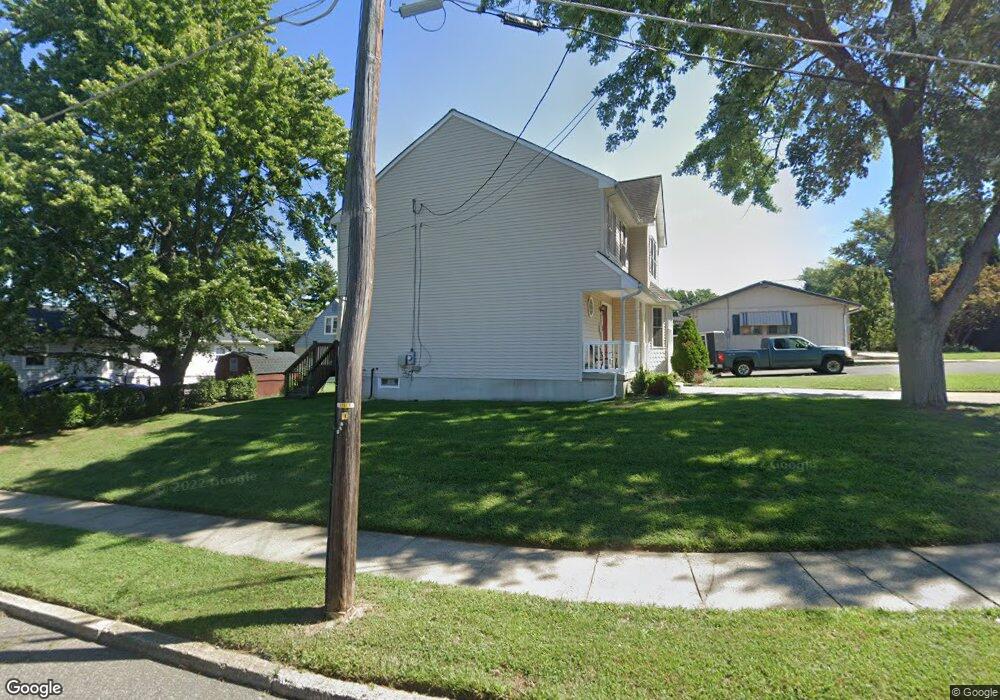
117 Harbor Rd Bellmawr, NJ 08031
Estimated Value: $344,219 - $400,000
--
Bed
--
Bath
1,686
Sq Ft
$223/Sq Ft
Est. Value
About This Home
This home is located at 117 Harbor Rd, Bellmawr, NJ 08031 and is currently estimated at $376,305, approximately $223 per square foot. 117 Harbor Rd is a home located in Camden County with nearby schools including Triton High School and Saint Rose of Lima Catholic School.
Ownership History
Date
Name
Owned For
Owner Type
Purchase Details
Closed on
Sep 12, 2005
Sold by
Dan B Enterprises Llc
Bought by
Green Kevin Michael and Green Beth Anne
Current Estimated Value
Home Financials for this Owner
Home Financials are based on the most recent Mortgage that was taken out on this home.
Original Mortgage
$192,000
Outstanding Balance
$103,172
Interest Rate
5.92%
Estimated Equity
$273,133
Purchase Details
Closed on
Sep 6, 2005
Sold by
Machenry Paul
Bought by
Dan B Enterprises Llc
Home Financials for this Owner
Home Financials are based on the most recent Mortgage that was taken out on this home.
Original Mortgage
$192,000
Outstanding Balance
$103,172
Interest Rate
5.92%
Estimated Equity
$273,133
Purchase Details
Closed on
Mar 29, 2004
Sold by
Lutricuso Joseph
Bought by
Machenry Paul and Machenry Nancy
Create a Home Valuation Report for This Property
The Home Valuation Report is an in-depth analysis detailing your home's value as well as a comparison with similar homes in the area
Home Values in the Area
Average Home Value in this Area
Purchase History
| Date | Buyer | Sale Price | Title Company |
|---|---|---|---|
| Green Kevin Michael | $240,000 | -- | |
| Dan B Enterprises Llc | $45,000 | -- | |
| Machenry Paul | $45,000 | -- |
Source: Public Records
Mortgage History
| Date | Status | Borrower | Loan Amount |
|---|---|---|---|
| Open | Green Kevin Michael | $192,000 |
Source: Public Records
Tax History Compared to Growth
Tax History
| Year | Tax Paid | Tax Assessment Tax Assessment Total Assessment is a certain percentage of the fair market value that is determined by local assessors to be the total taxable value of land and additions on the property. | Land | Improvement |
|---|---|---|---|---|
| 2025 | $8,547 | $226,000 | $52,000 | $174,000 |
| 2024 | $8,534 | $226,000 | $52,000 | $174,000 |
| 2023 | $8,534 | $226,000 | $52,000 | $174,000 |
| 2022 | $8,642 | $226,000 | $52,000 | $174,000 |
| 2021 | $8,812 | $226,000 | $52,000 | $174,000 |
| 2020 | $8,687 | $226,000 | $52,000 | $174,000 |
| 2019 | $8,599 | $226,000 | $52,000 | $174,000 |
| 2018 | $8,464 | $226,000 | $52,000 | $174,000 |
| 2017 | $8,364 | $226,000 | $52,000 | $174,000 |
| 2016 | $8,202 | $226,000 | $52,000 | $174,000 |
| 2015 | $8,043 | $226,000 | $52,000 | $174,000 |
| 2014 | $7,808 | $226,000 | $52,000 | $174,000 |
Source: Public Records
Map
Nearby Homes
- 3 Thomas Ave
- 126 Oak Ave
- 384 Windsor Dr
- 312 Creek Rd
- 222 Lowell Ave
- 420 Winthrop Ave
- 143 Baird Ave
- 214 James St
- 435 Flanders Rd
- 26 Wilson Ave
- 53 Apple Ave
- 2008 Sycamore St
- 105 Lincoln Ave
- 102 Lincoln Ave
- 144 Dobbs Ave
- 2004 S Park Ave
- 18 Chadwick Ave
- 309 S Lowell Ave
- 28 Jefferson Ave
- 308 Saunders Ave
- 107 Harbor Rd
- 188 Anderson Ave
- 184 Anderson Ave
- 184 Anderson Ave Unit B
- 184 Anderson Ave Unit A
- 108 Harbor Rd
- 178 Anderson Ave
- 109 Harbor Rd
- 104 Harbor Rd
- 174 Anderson Ave
- 193 Cardinal Dr
- 168 Anderson Ave
- 100 Harbor Rd
- 187 Cardinal Dr
- 164 Anderson Ave
- 205 Cardinal Dr
- 183 Cardinal Dr
- 160 Anderson Ave
- 204 Cardinal Dr
- 179 Cardinal Dr