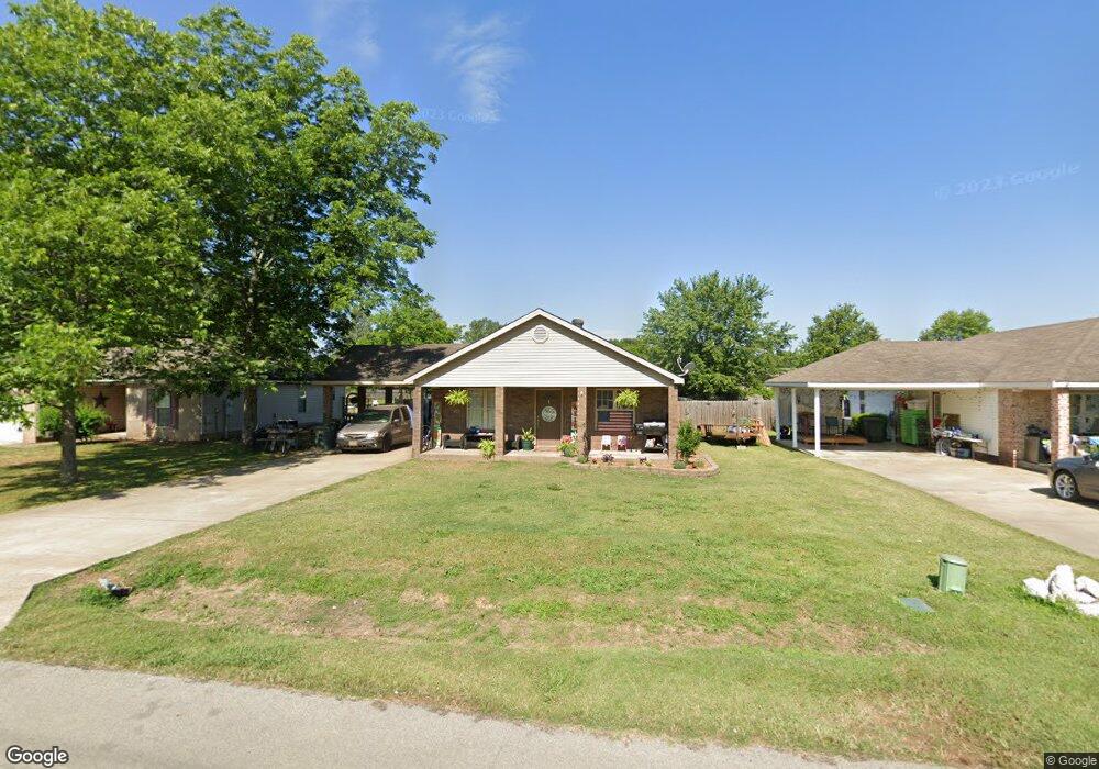
117 Hayes St Unit C Brookland, AR 72417
Estimated Value: $154,689 - $185,000
Studio
1
Bath
1,288
Sq Ft
$134/Sq Ft
Est. Value
About This Home
This home is located at 117 Hayes St Unit C, Brookland, AR 72417 and is currently estimated at $173,172, approximately $134 per square foot. 117 Hayes St Unit C is a home located in Craighead County with nearby schools including Brookland Elementary School, Brookland Middle School, and Brookland Junior High School.
Ownership History
Date
Name
Owned For
Owner Type
Purchase Details
Closed on
Aug 13, 2020
Sold by
Federal National Mortgage Association
Bought by
Lee Barbera and Lee Vincent
Current Estimated Value
Home Financials for this Owner
Home Financials are based on the most recent Mortgage that was taken out on this home.
Original Mortgage
$108,800
Outstanding Balance
$96,513
Interest Rate
3%
Mortgage Type
New Conventional
Estimated Equity
$76,659
Purchase Details
Closed on
May 1, 2019
Sold by
Us Bank Na
Bought by
Federal National Mortgage Association
Purchase Details
Closed on
Dec 3, 2007
Sold by
Holladay Jerome and Holladay Tracy
Bought by
Busby Donald D
Home Financials for this Owner
Home Financials are based on the most recent Mortgage that was taken out on this home.
Original Mortgage
$92,400
Interest Rate
6.43%
Mortgage Type
New Conventional
Purchase Details
Closed on
Apr 1, 2000
Bought by
Turman Trust
Purchase Details
Closed on
Dec 14, 1992
Bought by
Turman
Create a Home Valuation Report for This Property
The Home Valuation Report is an in-depth analysis detailing your home's value as well as a comparison with similar homes in the area
Home Values in the Area
Average Home Value in this Area
Purchase History
| Date | Buyer | Sale Price | Title Company |
|---|---|---|---|
| Lee Barbera | $136,000 | Prt | |
| Federal National Mortgage Association | -- | None Available | |
| Busby Donald D | $93,000 | None Available | |
| Turman Trust | -- | -- | |
| Turman | -- | -- |
Source: Public Records
Mortgage History
| Date | Status | Borrower | Loan Amount |
|---|---|---|---|
| Open | Lee Barbera | $108,800 | |
| Previous Owner | Busby Donald D | $92,400 |
Source: Public Records
Tax History
| Year | Tax Paid | Tax Assessment Tax Assessment Total Assessment is a certain percentage of the fair market value that is determined by local assessors to be the total taxable value of land and additions on the property. | Land | Improvement |
|---|---|---|---|---|
| 2025 | $1,217 | $24,796 | $2,300 | $22,496 |
| 2024 | $1,217 | $24,796 | $2,300 | $22,496 |
| 2023 | $1,131 | $24,796 | $2,300 | $22,496 |
| 2022 | $1,055 | $24,796 | $2,300 | $22,496 |
| 2021 | $990 | $21,020 | $2,300 | $18,720 |
| 2020 | $1,001 | $21,020 | $2,300 | $18,720 |
| 2019 | $626 | $21,020 | $2,300 | $18,720 |
| 2018 | $974 | $21,020 | $2,300 | $18,720 |
| 2017 | $580 | $21,020 | $2,300 | $18,720 |
| 2016 | $904 | $18,410 | $2,300 | $16,110 |
| 2015 | $904 | $18,410 | $2,300 | $16,110 |
| 2014 | $554 | $18,410 | $2,300 | $16,110 |
Source: Public Records
Map
Nearby Homes
- 111 Cameron Ave
- 103 A Hayes
- 626 N Holman St
- 587 E Matthews
- 126 Ellis Dr
- 107 Ellis Dr
- 104 E Matthews St
- 114 Oak Meadow Cir
- 107 E Hinkley St Unit A
- 108 E Hinkley St
- 125 Logan St
- 207 S Holman St Unit 207 B
- 74 Clearwater Dr
- 142 Brookvale Cir
- 48 +/- Ac County Road 936
- 404 W Matthews St
- 404 W Matthews St
- 145 Brookvale Cir
- 95 Clearwater Dr
- 109 Cody Ln
Your Personal Tour Guide
Ask me questions while you tour the home.