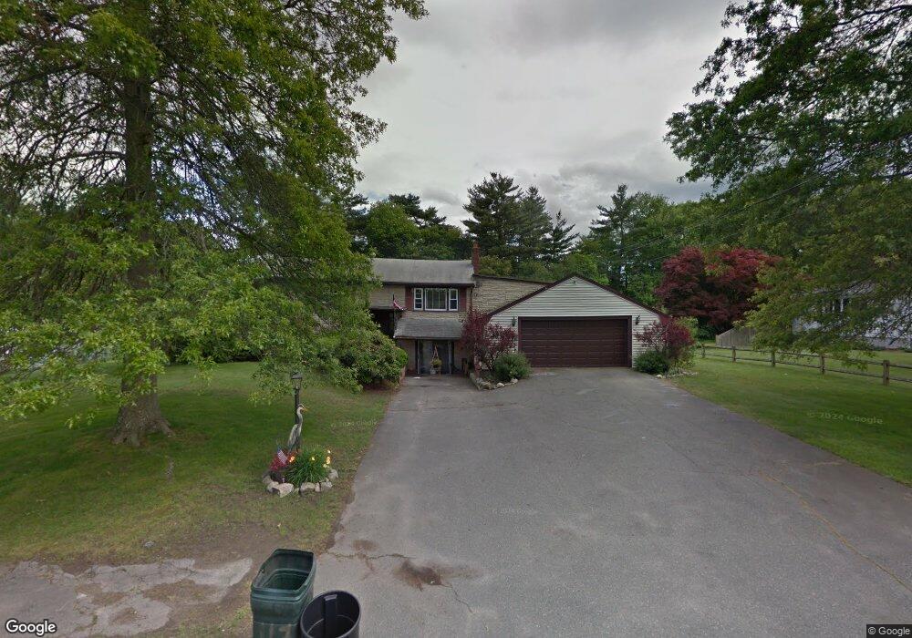
117 Hersey Ln Abington, MA 02351
Estimated Value: $744,000 - $826,000
4
Beds
3
Baths
2,486
Sq Ft
$314/Sq Ft
Est. Value
About This Home
This home is located at 117 Hersey Ln, Abington, MA 02351 and is currently estimated at $781,734, approximately $314 per square foot. 117 Hersey Ln is a home located in Plymouth County with nearby schools including Beaver Brook Elementary School, Abington Middle School, and Woodsdale School.
Ownership History
Date
Name
Owned For
Owner Type
Purchase Details
Closed on
Jan 26, 1998
Sold by
Trinh Tuoi D and Phan Mai Hoa
Bought by
Hamilton John A and Hamilton Judith T
Current Estimated Value
Purchase Details
Closed on
Jul 8, 1994
Sold by
Uvanitte Nancy J and Uvanitte Richard J
Bought by
Trinh Tuoi D and Phan Mai Hoa
Create a Home Valuation Report for This Property
The Home Valuation Report is an in-depth analysis detailing your home's value as well as a comparison with similar homes in the area
Home Values in the Area
Average Home Value in this Area
Purchase History
| Date | Buyer | Sale Price | Title Company |
|---|---|---|---|
| Hamilton John A | $200,000 | -- | |
| Trinh Tuoi D | $190,900 | -- |
Source: Public Records
Mortgage History
| Date | Status | Borrower | Loan Amount |
|---|---|---|---|
| Open | Trinh Tuoi D | $362,000 | |
| Closed | Trinh Tuoi D | $275,000 |
Source: Public Records
Tax History Compared to Growth
Tax History
| Year | Tax Paid | Tax Assessment Tax Assessment Total Assessment is a certain percentage of the fair market value that is determined by local assessors to be the total taxable value of land and additions on the property. | Land | Improvement |
|---|---|---|---|---|
| 2025 | $9,309 | $712,800 | $268,000 | $444,800 |
| 2024 | $8,927 | $667,200 | $244,100 | $423,100 |
| 2023 | $8,490 | $597,500 | $222,400 | $375,100 |
| 2022 | $8,056 | $529,300 | $186,100 | $343,200 |
| 2021 | $7,629 | $462,900 | $170,000 | $292,900 |
| 2020 | $7,789 | $458,200 | $171,200 | $287,000 |
| 2019 | $0 | $446,400 | $164,300 | $282,100 |
| 2018 | $3,850 | $413,300 | $164,300 | $249,000 |
| 2017 | $3,474 | $408,900 | $164,300 | $244,600 |
| 2016 | $6,595 | $367,800 | $150,100 | $217,700 |
| 2015 | $7,101 | $417,700 | $150,100 | $267,600 |
Source: Public Records
Map
Nearby Homes
- 137 Peregrine Rd
- 800 Plymouth St
- 679 Plymouth St
- 608 Plymouth St
- 158 Central St
- 14 Daniel Teague Dr
- 133 Spring St
- 64 Centre Ave Unit 1
- 17 Pat Rose Way
- 170 Pleasant St
- 20 Pat Rose Way
- 8 Pat Rose Way
- 6 Pat Rose Way
- 19 Pat Rose Way
- 810 Brookline Way
- 87 Summer St
- 40 Lazel St
- 149 Concord St
- 23 Reed Place
- 10 Bank St
- 105 Hersey Ln
- 129 Hersey Ln
- 95 Hersey Ln
- 56 Priscilla Alden Rd
- 120 Hersey Ln
- 139 Hersey Ln
- 68 Priscilla Alden Rd
- 106 Hersey Ln
- 46 Priscilla Alden Rd
- 134 Hersey Ln
- 78 Priscilla Alden Rd
- 85 Hersey Ln
- 34 Priscilla Alden Rd
- 151 Hersey Ln
- 88 Hersey Ln
- 148 Hersey Ln
- 65 Captain Standish Dr
- 77 Captain Standish Dr
- 90 Priscilla Alden Rd
- 53 Captain Standish Dr