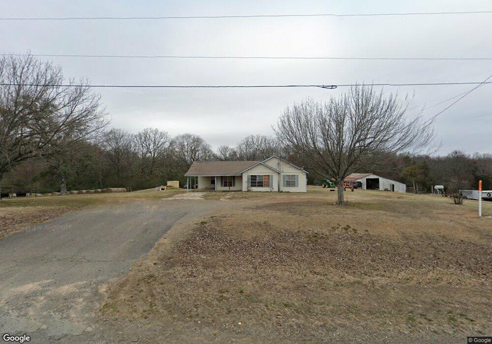
117 Highway 25 N Greenbrier, AR 72058
Estimated Value: $98,000 - $252,000
--
Bed
1
Bath
1,412
Sq Ft
$118/Sq Ft
Est. Value
About This Home
This home is located at 117 Highway 25 N, Greenbrier, AR 72058 and is currently estimated at $166,470, approximately $117 per square foot. 117 Highway 25 N is a home located in Faulkner County with nearby schools including Guy-Perkins Elementary School and Guy-Perkins High School.
Ownership History
Date
Name
Owned For
Owner Type
Purchase Details
Closed on
Dec 18, 2020
Sold by
Bivens Stevenson E and Bivens Kristi
Bought by
City Of Guy
Current Estimated Value
Purchase Details
Closed on
Nov 9, 2009
Bought by
Establish Boundary Lines For
Purchase Details
Closed on
Nov 28, 2005
Bought by
Stevenson and Stevenson
Purchase Details
Closed on
Oct 20, 2005
Bought by
Stevenson and Stevenson
Purchase Details
Closed on
Jul 2, 2002
Bought by
Water Pipeline Easement
Purchase Details
Closed on
May 13, 2002
Bought by
Entergy
Purchase Details
Closed on
Sep 8, 1994
Bought by
Comm Water System / Wtr Esmt
Create a Home Valuation Report for This Property
The Home Valuation Report is an in-depth analysis detailing your home's value as well as a comparison with similar homes in the area
Home Values in the Area
Average Home Value in this Area
Purchase History
| Date | Buyer | Sale Price | Title Company |
|---|---|---|---|
| City Of Guy | $7,500 | Faulkner County Title | |
| Establish Boundary Lines For | -- | -- | |
| Stevenson | -- | -- | |
| Stevenson | -- | -- | |
| Water Pipeline Easement | -- | -- | |
| Entergy | -- | -- | |
| Comm Water System / Wtr Esmt | -- | -- |
Source: Public Records
Tax History Compared to Growth
Tax History
| Year | Tax Paid | Tax Assessment Tax Assessment Total Assessment is a certain percentage of the fair market value that is determined by local assessors to be the total taxable value of land and additions on the property. | Land | Improvement |
|---|---|---|---|---|
| 2025 | $437 | $8,680 | $4,470 | $4,210 |
| 2024 | $437 | $8,680 | $4,470 | $4,210 |
| 2023 | $451 | $8,960 | $4,450 | $4,510 |
| 2022 | $456 | $8,960 | $4,450 | $4,510 |
| 2021 | $421 | $8,960 | $4,450 | $4,510 |
| 2020 | $386 | $6,980 | $3,230 | $3,750 |
| 2019 | $386 | $17,030 | $3,230 | $13,800 |
| 2018 | $57 | $17,030 | $3,230 | $13,800 |
| 2017 | $57 | $17,030 | $3,230 | $13,800 |
| 2016 | $57 | $6,360 | $3,230 | $3,130 |
| 2015 | $668 | $22,250 | $3,160 | $19,090 |
| 2014 | $420 | $22,250 | $3,160 | $19,090 |
Source: Public Records
Map
Nearby Homes
- 10 Sugar Maple Dr
- 6 Sugar Maple Dr
- 2 Silver Leaf Cove
- 6 Stockbridge Dr
- 27 Woodridge Dr
- 26 High Point Dr
- 32 High Point Dr
- 31 High Point Dr
- 37 High Point Dr
- 51 Summerlyn Place Dr
- 69 Summer Sky Dr
- 73 Summer Sky Dr
- 77 Summer Sky Dr
- 4 Woodridge Dr
- 5 Pine Shadow
- 0 Beene Rd
- 7 Pine Shadow Dr
- 43 Sky Eagle Dr
- 20 Sky Eagle Dr
- 51 Sky Eagle Dr
- 109 Highway 25 N
- 118 Highway 25 N
- 131 Highway 25 N
- 103 Highway 25 N
- 4 Chinquapin Rd
- 15 Blackjack Rd
- 97 Highway 25 N
- 80 E Republican Rd
- 139 Highway 25 N
- 2 Blackjack Rd
- 2 Blackjack Rd
- 4 Patricia Dr
- 6 Blackjack Rd
- 00 Blackjack Rd
- 26 Blackjack Rd
- 26 Blackjack Rd
- 26 Blackjack Rd Unit 26 A & B & C Blackja
- 86 Highway 25 N
- 199 Highway 25 N
- 90 E Republican Rd