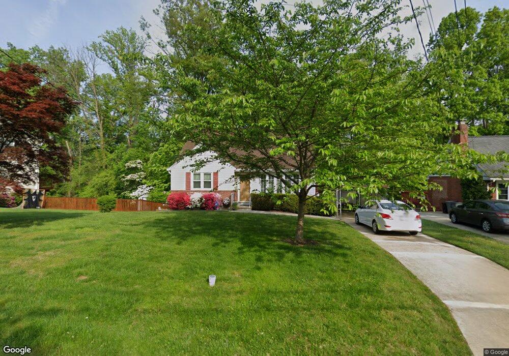
117 Hillside Rd Catonsville, MD 21228
Estimated Value: $319,558 - $458,000
--
Bed
1
Bath
1,180
Sq Ft
$336/Sq Ft
Est. Value
About This Home
This home is located at 117 Hillside Rd, Catonsville, MD 21228 and is currently estimated at $396,140, approximately $335 per square foot. 117 Hillside Rd is a home located in Baltimore County with nearby schools including Westchester Elementary School, Catonsville Middle School, and Catonsville High School.
Ownership History
Date
Name
Owned For
Owner Type
Purchase Details
Closed on
Oct 9, 2018
Sold by
Odonnell Mary Ellen
Bought by
Odonnell Raymond Hugh and Odonnell Mark Frncis
Current Estimated Value
Purchase Details
Closed on
Aug 2, 2002
Sold by
Odonnell James P
Bought by
Odonnell James P and Odonnell Mary Ellen
Purchase Details
Closed on
May 3, 1999
Sold by
Odonnell James P
Bought by
Odonnell James P and Odonnell Mary Ellen
Purchase Details
Closed on
Aug 24, 1970
Sold by
Mccann Paul J
Bought by
Odonnell James P
Create a Home Valuation Report for This Property
The Home Valuation Report is an in-depth analysis detailing your home's value as well as a comparison with similar homes in the area
Home Values in the Area
Average Home Value in this Area
Purchase History
| Date | Buyer | Sale Price | Title Company |
|---|---|---|---|
| Odonnell Raymond Hugh | -- | None Available | |
| Odonnell James P | -- | -- | |
| Odonnell James P | -- | -- | |
| Odonnell James P | $19,000 | -- |
Source: Public Records
Tax History Compared to Growth
Tax History
| Year | Tax Paid | Tax Assessment Tax Assessment Total Assessment is a certain percentage of the fair market value that is determined by local assessors to be the total taxable value of land and additions on the property. | Land | Improvement |
|---|---|---|---|---|
| 2025 | $3,983 | $283,867 | -- | -- |
| 2024 | $3,983 | $278,200 | $131,500 | $146,700 |
| 2023 | $1,934 | $276,033 | $0 | $0 |
| 2022 | $3,697 | $273,867 | $0 | $0 |
| 2021 | $3,211 | $271,700 | $131,500 | $140,200 |
| 2020 | $3,123 | $257,667 | $0 | $0 |
| 2019 | $2,953 | $243,633 | $0 | $0 |
| 2018 | $3,135 | $229,600 | $116,600 | $113,000 |
| 2017 | $2,858 | $226,267 | $0 | $0 |
| 2016 | $2,434 | $222,933 | $0 | $0 |
| 2015 | $2,434 | $219,600 | $0 | $0 |
| 2014 | $2,434 | $219,600 | $0 | $0 |
Source: Public Records
Map
Nearby Homes
- 231 Gralan Rd
- 1900 Lismore Ln
- 11 Clay Lodge Ln Unit 204
- 2110 Edmondson Ave
- 19 Clay Lodge Ln Unit 104
- 105 Oella Ave
- 302 Wessling Cir
- 311 Radstock Rd
- 8 Seminole Ave
- 2310 Rockwell Ave
- 2305 Rockwell Ave
- 627 Meyers Dr
- 627 Meyers Dr Unit PARCEL 108
- 2208 W Geipe Rd
- 1300 Rice Ave
- 230 N Beaumont Ave
- 343 N Beaumont Ave
- 2621 Westchester Ave
- 353 N Beaumont Ave
- 2308 Quilting Bee Rd
- 115 Hillside Rd
- 121 Hillside Rd
- 113 Hillside Rd
- 118 Hillside Rd
- 116 Hillside Rd
- 114 Hillside Rd
- 120 Hillside Rd
- 125 Hillside Rd
- 111 Hillside Rd
- 2015 Devere Ln
- 112 Hillside Rd
- 112 Rollingbrook Way
- 110 Rollingbrook Way
- 2005 Devere Ln
- 108 Rollingbrook Way
- 114 Rollingbrook Way
- 151 Longview Dr
- 2031 Rollingwood Rd
- 2019 Devere Ln
- 106 Rollingbrook Way