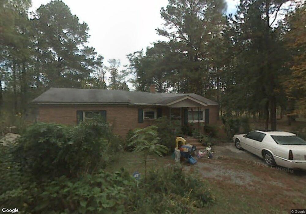
117 Hutcherson Cir Winnsboro, SC 29180
Estimated Value: $99,313 - $778,000
3
Beds
2
Baths
943
Sq Ft
$356/Sq Ft
Est. Value
About This Home
This home is located at 117 Hutcherson Cir, Winnsboro, SC 29180 and is currently estimated at $336,104, approximately $356 per square foot. 117 Hutcherson Cir is a home with nearby schools including Forest Heights Elementary School, Heyward Gibbes Middle School, and Eau Claire High School.
Ownership History
Date
Name
Owned For
Owner Type
Purchase Details
Closed on
Mar 16, 2018
Sold by
Hutherson Ledonia Trapp
Bought by
Hutcherson Erwin
Current Estimated Value
Purchase Details
Closed on
May 28, 2003
Sold by
Hutcherson Jessie James
Bought by
Hutcherson Ledonia
Home Financials for this Owner
Home Financials are based on the most recent Mortgage that was taken out on this home.
Original Mortgage
$62,100
Interest Rate
9.5%
Mortgage Type
Purchase Money Mortgage
Create a Home Valuation Report for This Property
The Home Valuation Report is an in-depth analysis detailing your home's value as well as a comparison with similar homes in the area
Home Values in the Area
Average Home Value in this Area
Purchase History
| Date | Buyer | Sale Price | Title Company |
|---|---|---|---|
| Hutcherson Erwin | -- | None Available | |
| Hutcherson Erwin | -- | None Available | |
| Hutcherson Ledonia | -- | -- |
Source: Public Records
Mortgage History
| Date | Status | Borrower | Loan Amount |
|---|---|---|---|
| Previous Owner | Hutcherson Ledonia | $62,100 |
Source: Public Records
Tax History Compared to Growth
Tax History
| Year | Tax Paid | Tax Assessment Tax Assessment Total Assessment is a certain percentage of the fair market value that is determined by local assessors to be the total taxable value of land and additions on the property. | Land | Improvement |
|---|---|---|---|---|
| 2024 | $442 | $9,000 | $0 | $0 |
| 2023 | $442 | $0 | $0 | $0 |
| 2022 | $604 | $38,400 | $7,800 | $30,600 |
| 2021 | $585 | $1,540 | $0 | $0 |
| 2020 | $590 | $1,540 | $0 | $0 |
| 2019 | $557 | $1,540 | $0 | $0 |
| 2018 | $490 | $1,340 | $0 | $0 |
| 2017 | $249 | $1,380 | $0 | $0 |
| 2016 | $249 | $1,380 | $0 | $0 |
| 2015 | $249 | $1,380 | $0 | $0 |
| 2014 | $249 | $46,800 | $0 | $0 |
| 2013 | -- | $1,380 | $0 | $0 |
Source: Public Records
Map
Nearby Homes
- 1315 Richtex Rd
- 1252 Richtex Rd
- 1300 Richtex Rd
- 129 Tiger Paw Ln
- 1130 Richtex Rd
- 109 Broad Bluff Point
- 230 Cedar Shoals Way
- 211 Bookman Mill Rd
- 0 State Road S-20-327
- 501 Crawfish Ln
- 0 TBD PARCEL B Eleazer Rd
- 424 Maypop Ln
- 428 Maypop Ln
- 411 Maypop Ln
- 279 Canterwood Rd
- 10 Saints Creek Place
- 288 Canterwood Rd
- 208 Livingston Woods Dr
- 206 Livingston Woods Dr
- 202 Livingston Woods Dr
- 11124 Monticello Rd
- 11200 Monticello Rd
- 108 Cliff Anderson Rd
- 107 Hutcherson Cir
- 11222 Monticello Rd
- 11114 Monticello Rd
- 11120 Monticello Rd
- 11221 Monticello Rd
- 110 Pilgrim Acres Rd
- 139 Pilgrim Acres Rd
- 116 Pilgrim Acres Rd
- 11100 Monticello Rd
- 119 My End Rd
- 11101 Monticello Rd
- 125 Pilgrim Acres Rd
- 131 Pilgrim Acres Rd
- 147 Pilgrim Acres Rd
- 146 Pilgrim Acres Rd
- 155 Pilgrim Acres Rd
- 11301 Monticello Rd