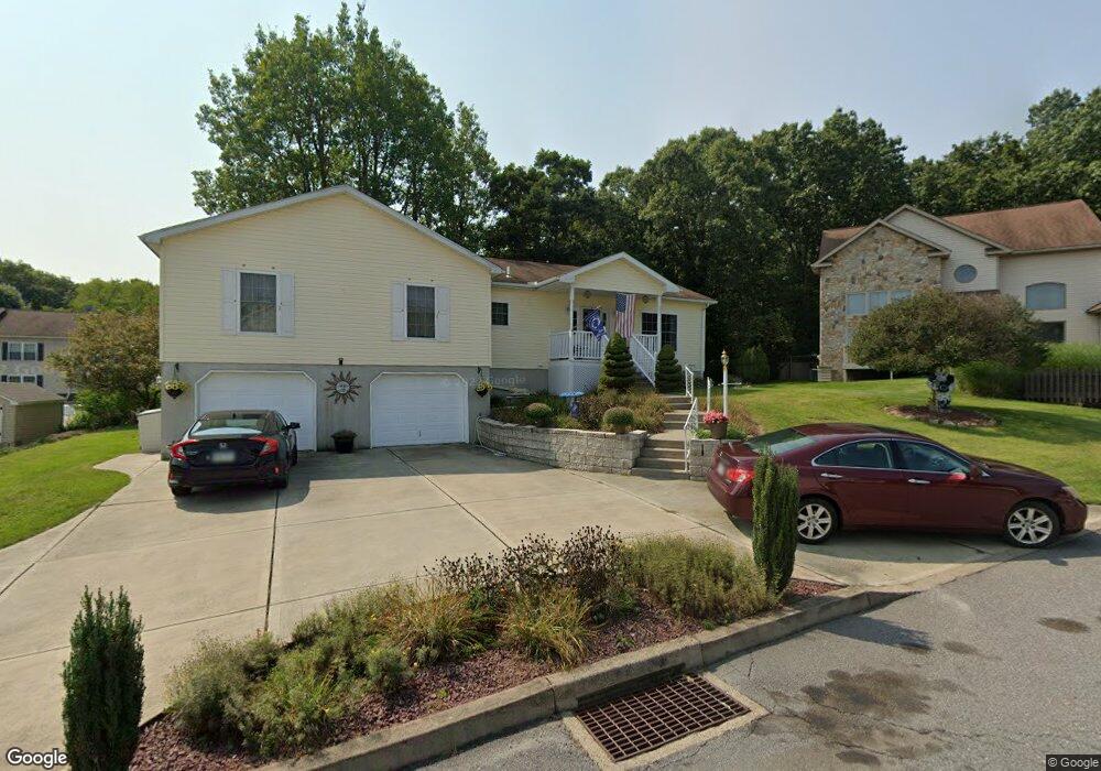
117 Jamestown Way Cir Scranton, PA 18504
West Mountain NeighborhoodEstimated Value: $264,346 - $466,000
5
Beds
4
Baths
3,282
Sq Ft
$108/Sq Ft
Est. Value
About This Home
This home is located at 117 Jamestown Way Cir, Scranton, PA 18504 and is currently estimated at $352,837, approximately $107 per square foot. 117 Jamestown Way Cir is a home located in Lackawanna County with nearby schools including Longan Elementary School, Adams Elementary School, and Isaac Tripp Elementary School.
Ownership History
Date
Name
Owned For
Owner Type
Purchase Details
Closed on
Feb 12, 2015
Sold by
Yarros Robert G and Yarros Mary J
Bought by
Yarros Robert G and Yarros Mary J
Current Estimated Value
Home Financials for this Owner
Home Financials are based on the most recent Mortgage that was taken out on this home.
Original Mortgage
$176,000
Interest Rate
3.64%
Mortgage Type
New Conventional
Create a Home Valuation Report for This Property
The Home Valuation Report is an in-depth analysis detailing your home's value as well as a comparison with similar homes in the area
Home Values in the Area
Average Home Value in this Area
Purchase History
| Date | Buyer | Sale Price | Title Company |
|---|---|---|---|
| Yarros Robert G | -- | Fidelity Natl Title Ins Co |
Source: Public Records
Mortgage History
| Date | Status | Borrower | Loan Amount |
|---|---|---|---|
| Closed | Yarros Robert G | $176,000 |
Source: Public Records
Tax History Compared to Growth
Tax History
| Year | Tax Paid | Tax Assessment Tax Assessment Total Assessment is a certain percentage of the fair market value that is determined by local assessors to be the total taxable value of land and additions on the property. | Land | Improvement |
|---|---|---|---|---|
| 2025 | $6,579 | $18,000 | $6,875 | $11,125 |
| 2024 | $6,065 | $18,000 | $6,875 | $11,125 |
| 2023 | $6,065 | $18,000 | $6,875 | $11,125 |
| 2022 | $5,934 | $18,000 | $6,875 | $11,125 |
| 2021 | $5,934 | $18,000 | $6,875 | $11,125 |
| 2020 | $5,837 | $18,000 | $6,875 | $11,125 |
| 2019 | $5,507 | $18,000 | $6,875 | $11,125 |
| 2018 | $5,507 | $18,000 | $6,875 | $11,125 |
| 2017 | $5,423 | $18,000 | $6,875 | $11,125 |
| 2016 | $2,161 | $18,000 | $6,875 | $11,125 |
| 2015 | $3,884 | $18,000 | $6,875 | $11,125 |
| 2014 | -- | $18,000 | $6,875 | $11,125 |
Source: Public Records
Map
Nearby Homes
- 0 Way
- 0 Roanoke Ln Unit GSBSC254856
- 813 S Keyser Ave
- 310 Dale Ave
- 0 Crisp Ave and Division St Unit 22-3646
- 138 S Keyser Ave
- 2613 Jackson St
- 2749 Jackson St
- 0 Marginal Rd Unit GSBSC253025
- 2923 Frink St
- 1819 Luzerne St
- 415 18th Ave
- 2133 35 Jackson St
- 405 17th Ave
- 142 S Van Buren Ave
- 706 Parrott Ave
- 133 S Van Buren Ave
- 138-140 S Everett Ave
- 149 S Everett Ave
- 1809 Washburn St
- 119 Jamestown Way Cir
- 115 Jamestown Way Cir Unit 4
- 216 Parkedge Ln Unit 216
- 216 Park Edge Ln
- 212 Parkedge Ln
- 212 Park Edge Ln
- 210 Parkedge Ln Unit E
- 10 Bald Mountain Rd
- 113 Jamestown Way Cir
- 210 Park Edge Ln
- 210 Park Edge Ln Unit Building E
- 120 Jamestown Way Cir
- 206 Parkedge Ln Unit D
- 308 Park Edge Ln
- 308 Parkedge Ln
- 204 Parkedge Ln Unit D
- 111 Jamestown Way Cir
- 202 Parkedge Ln Unit D
- 106 Jamestown Way Cir
- 200 Park Edge Ln