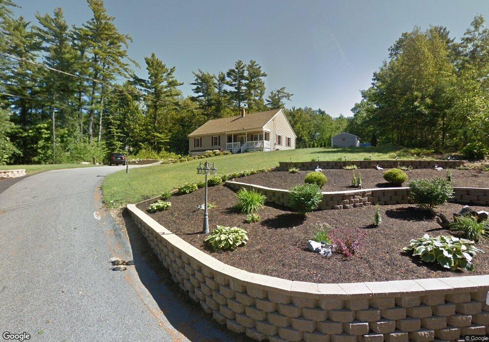
117 Javica Ln Sanford, ME 04073
South Sanford NeighborhoodEstimated Value: $471,000 - $498,890
3
Beds
2
Baths
1,536
Sq Ft
$318/Sq Ft
Est. Value
About This Home
This home is located at 117 Javica Ln, Sanford, ME 04073 and is currently estimated at $488,973, approximately $318 per square foot. 117 Javica Ln is a home located in York County.
Ownership History
Date
Name
Owned For
Owner Type
Purchase Details
Closed on
Aug 7, 2025
Sold by
Jones Florence S and Jones James L
Bought by
Brienza Guy A and Brienza Dolores S
Current Estimated Value
Purchase Details
Closed on
Mar 14, 2005
Sold by
Owen & Owen Invest Llc
Bought by
Brienza Dolores S and Brienza Guy A
Home Financials for this Owner
Home Financials are based on the most recent Mortgage that was taken out on this home.
Original Mortgage
$158,995
Interest Rate
5.64%
Mortgage Type
Purchase Money Mortgage
Create a Home Valuation Report for This Property
The Home Valuation Report is an in-depth analysis detailing your home's value as well as a comparison with similar homes in the area
Home Values in the Area
Average Home Value in this Area
Purchase History
| Date | Buyer | Sale Price | Title Company |
|---|---|---|---|
| Brienza Guy A | $200 | -- | |
| Brienza Guy A | $200 | -- | |
| Brienza Guy A | $200 | -- | |
| Brienza Dolores S | -- | -- | |
| Brienza Dolores S | -- | -- | |
| Brienza Dolores S | -- | -- |
Source: Public Records
Mortgage History
| Date | Status | Borrower | Loan Amount |
|---|---|---|---|
| Previous Owner | Brienza Dolores S | $129,644 | |
| Previous Owner | Brienza Dolores S | $50,000 | |
| Previous Owner | Brienza Dolores S | $158,995 | |
| Previous Owner | Brienza Dolores S | $100,000 |
Source: Public Records
Tax History Compared to Growth
Tax History
| Year | Tax Paid | Tax Assessment Tax Assessment Total Assessment is a certain percentage of the fair market value that is determined by local assessors to be the total taxable value of land and additions on the property. | Land | Improvement |
|---|---|---|---|---|
| 2025 | $5,246 | $306,800 | $42,600 | $264,200 |
| 2024 | $4,952 | $306,800 | $42,600 | $264,200 |
| 2023 | $4,607 | $304,300 | $42,600 | $261,700 |
| 2022 | $4,504 | $304,300 | $42,600 | $261,700 |
| 2021 | $4,410 | $242,600 | $42,600 | $200,000 |
| 2020 | $4,270 | $211,800 | $42,600 | $169,200 |
| 2019 | $4,082 | $197,200 | $42,600 | $154,600 |
| 2018 | $3,889 | $189,700 | $38,100 | $151,600 |
| 2017 | $3,727 | $179,700 | $38,100 | $141,600 |
| 2016 | $3,754 | $165,100 | $38,200 | $126,900 |
| 2015 | $3,451 | $166,600 | $40,000 | $126,600 |
| 2014 | $3,554 | $166,700 | $40,000 | $126,700 |
| 2013 | -- | $174,400 | $44,900 | $129,500 |
Source: Public Records
Map
Nearby Homes
- 99 Channel Ln
- 122 Country Club 3 Rd
- 41 Sunny Ln
- Lot 8E Country Club Rd
- 42 Bernice Ave
- 22 Lentago Ln
- Lot 55-A Ford Quint Rd
- Lot 4 Tbd Lentago Ln Unit Lot 4
- 247 Sam Allen Rd
- TBD Ridge Terrace Unit Lot 7
- TBD Ridge Terrace Unit Lot 6
- Lot 1 Ridge Terrace
- 45 Grace Ln
- 17 Airport Rd
- 0 Airport Rd Unit 1634997
- 0 Airport Rd Unit 1624305
- 12 Birch Ln
- Lot 3 Gatehouse Rd
- 469 High St
- Lot 1 Gatehouse Rd