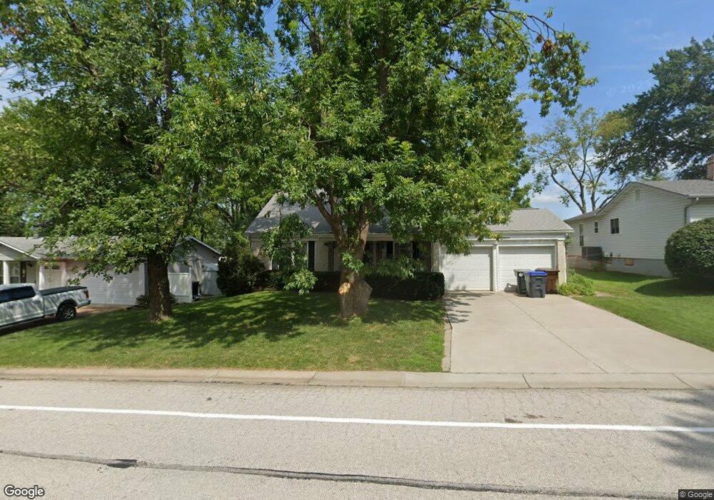
117 Kimberly Ln Saint Peters, MO 63376
Estimated Value: $301,000 - $344,000
4
Beds
3
Baths
1,618
Sq Ft
$197/Sq Ft
Est. Value
About This Home
This home is located at 117 Kimberly Ln, Saint Peters, MO 63376 and is currently estimated at $318,516, approximately $196 per square foot. 117 Kimberly Ln is a home located in St. Charles County with nearby schools including Lewis & Clark Elementary School, Dr. Bernard J. Dubray Middle School, and Fort Zumwalt East High School.
Ownership History
Date
Name
Owned For
Owner Type
Purchase Details
Closed on
Nov 7, 1997
Sold by
Mitchell Clinton Harley Wilma Louise
Bought by
Schrader Gordon L and Schrader Jacqueline D
Current Estimated Value
Home Financials for this Owner
Home Financials are based on the most recent Mortgage that was taken out on this home.
Original Mortgage
$105,500
Outstanding Balance
$16,697
Interest Rate
7.28%
Mortgage Type
VA
Estimated Equity
$301,819
Create a Home Valuation Report for This Property
The Home Valuation Report is an in-depth analysis detailing your home's value as well as a comparison with similar homes in the area
Home Values in the Area
Average Home Value in this Area
Purchase History
| Date | Buyer | Sale Price | Title Company |
|---|---|---|---|
| Schrader Gordon L | $105,500 | -- |
Source: Public Records
Mortgage History
| Date | Status | Borrower | Loan Amount |
|---|---|---|---|
| Open | Schrader Gordon L | $105,500 |
Source: Public Records
Tax History Compared to Growth
Tax History
| Year | Tax Paid | Tax Assessment Tax Assessment Total Assessment is a certain percentage of the fair market value that is determined by local assessors to be the total taxable value of land and additions on the property. | Land | Improvement |
|---|---|---|---|---|
| 2025 | $3,581 | $54,037 | -- | -- |
| 2024 | $3,581 | $51,238 | -- | -- |
| 2023 | $3,577 | $51,238 | $0 | $0 |
| 2022 | $2,810 | $37,479 | $0 | $0 |
| 2021 | $2,804 | $37,479 | $0 | $0 |
| 2020 | $2,656 | $34,660 | $0 | $0 |
| 2019 | $2,647 | $34,660 | $0 | $0 |
| 2018 | $2,445 | $30,680 | $0 | $0 |
| 2017 | $2,434 | $30,680 | $0 | $0 |
| 2016 | $2,245 | $28,338 | $0 | $0 |
| 2015 | $2,241 | $28,338 | $0 | $0 |
| 2014 | $2,175 | $26,733 | $0 | $0 |
Source: Public Records
Map
Nearby Homes
- 26 Jane Dr
- 5 Victoria Square
- 1196 Colby Ct
- 212 Agamemnon Ct
- 537 Ryehill Dr
- 533 Ryehill Dr
- 22 Shadow Creek Dr
- 38 Amberly Dr
- Winslow Plan at Ryehill Manor
- Carver Plan at Ryehill Manor
- Stratton Plan at Ryehill Manor
- Lansford Plan at Ryehill Manor
- Brookmont Plan at Ryehill Manor
- Parker Plan at Ryehill Manor
- Waverly Plan at Ryehill Manor
- Whitehall Plan at Ryehill Manor
- 213 Candice Way
- 116 Willott Square Dr
- 309 Willott Square Dr
- 17 Forrel Tree Ct