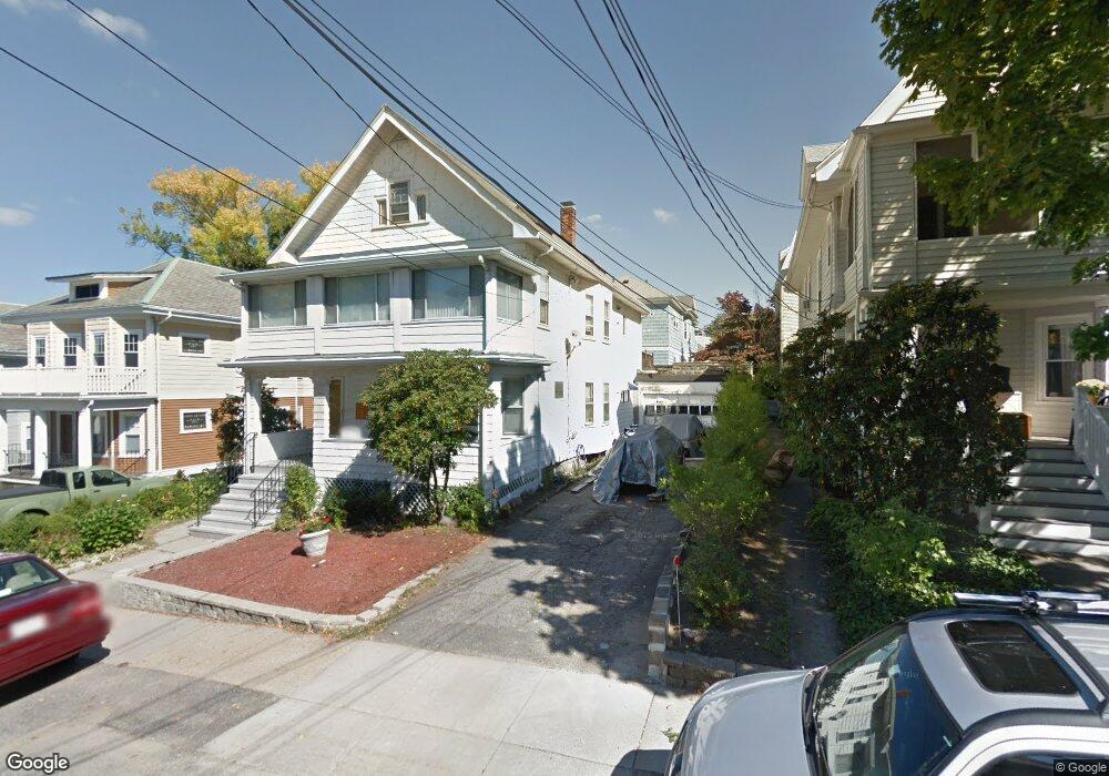
117 Langdon Ave Watertown, MA 02472
East Watertown NeighborhoodEstimated Value: $1,038,000 - $1,301,962
4
Beds
3
Baths
2,711
Sq Ft
$422/Sq Ft
Est. Value
About This Home
This home is located at 117 Langdon Ave, Watertown, MA 02472 and is currently estimated at $1,144,241, approximately $422 per square foot. 117 Langdon Ave is a home located in Middlesex County with nearby schools including St. Stephen's Armenian Elementary School, The Kendall School, and Atrium School.
Ownership History
Date
Name
Owned For
Owner Type
Purchase Details
Closed on
Oct 21, 2014
Sold by
Kotzampaltiris Vasilios and Kotzampaltiris Hariklia
Bought by
17 Langdon Drive T and Kotzampaltiris
Current Estimated Value
Purchase Details
Closed on
Mar 29, 1967
Bought by
Kotzampaltiris Vassilios and Kotzampaltiris Paul
Create a Home Valuation Report for This Property
The Home Valuation Report is an in-depth analysis detailing your home's value as well as a comparison with similar homes in the area
Home Values in the Area
Average Home Value in this Area
Purchase History
| Date | Buyer | Sale Price | Title Company |
|---|---|---|---|
| 17 Langdon Drive T | -- | -- | |
| 17 Langdon Drive T | -- | -- | |
| 17 Langdon Drive T | -- | -- | |
| Kotzampaltiris Vassilios | -- | -- |
Source: Public Records
Tax History Compared to Growth
Tax History
| Year | Tax Paid | Tax Assessment Tax Assessment Total Assessment is a certain percentage of the fair market value that is determined by local assessors to be the total taxable value of land and additions on the property. | Land | Improvement |
|---|---|---|---|---|
| 2025 | $11,937 | $1,022,000 | $507,500 | $514,500 |
| 2024 | $11,244 | $961,000 | $505,600 | $455,400 |
| 2023 | $12,481 | $919,100 | $476,700 | $442,400 |
| 2022 | $11,367 | $857,900 | $415,300 | $442,600 |
| 2021 | $10,016 | $817,600 | $390,000 | $427,600 |
| 2020 | $9,690 | $798,200 | $382,800 | $415,400 |
| 2019 | $9,200 | $714,300 | $368,400 | $345,900 |
| 2018 | $9,107 | $676,100 | $361,100 | $315,000 |
| 2017 | $8,991 | $647,300 | $332,300 | $315,000 |
| 2016 | $8,855 | $647,300 | $332,300 | $315,000 |
| 2015 | $8,035 | $534,600 | $296,100 | $238,500 |
| 2014 | $7,998 | $534,600 | $296,100 | $238,500 |
Source: Public Records
Map
Nearby Homes
- 133 Hillside Rd Unit 2
- 133 Hillside Rd Unit 1
- 81 Winsor Ave
- 147 Langdon Ave Unit 147
- 147 Langdon Ave Unit 149
- 56-58 Edgecliff Rd
- 354 School St Unit 354
- 15 Edgecliff Rd
- 276 Belmont St Unit 1
- 87 Templeton Pkwy Unit 3
- 172 Maplewood St
- 27 Appleton St
- 43 Irma Ave Unit 43
- 1 Clayton St
- 17 Templeton Pkwy Unit 1
- 5 Marlboro St
- 163 Belmont St
- 30 Unity Ave Unit 30
- 15-17 Porter St
- 73 Foster Rd Unit 2
- 125 Langdon Ave
- 113 Langdon Ave
- 113 Langdon Ave Unit 2
- 116 Hillside Rd
- 118 Hillside Rd
- 114 Hillside Rd
- 120 Hillside Rd Unit 122
- 129 Langdon Ave
- 109 Langdon Ave
- 124 Hillside Rd
- 124 Hillside Rd Unit 1
- 124 Hillside Rd
- 124 Hillside Rd Unit 2
- 116 Langdon Ave
- 110 Hillside Rd Unit 112
- 145 Langdon Ave
- 168 Langdon Ave Unit 168
- 112 Langdon Ave
- 120 Langdon Ave
- 120 Langdon Ave Unit 118