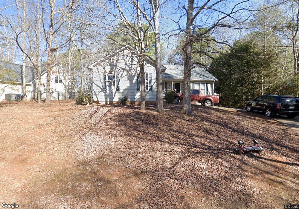
117 Laurel Springs Dr Athens, GA 30606
Estimated Value: $305,000 - $321,000
3
Beds
2
Baths
1,408
Sq Ft
$223/Sq Ft
Est. Value
About This Home
This home is located at 117 Laurel Springs Dr, Athens, GA 30606 and is currently estimated at $314,035, approximately $223 per square foot. 117 Laurel Springs Dr is a home located in Clarke County with nearby schools including Cleveland Road Elementary School, Burney-Harris-Lyons Middle School, and Clarke Central High School.
Ownership History
Date
Name
Owned For
Owner Type
Purchase Details
Closed on
Dec 22, 2009
Sold by
Trane Frederick C
Bought by
Trane Kathryn F
Current Estimated Value
Purchase Details
Closed on
Mar 27, 2006
Sold by
Not Provided
Bought by
Trane Kathryn F
Home Financials for this Owner
Home Financials are based on the most recent Mortgage that was taken out on this home.
Original Mortgage
$82,700
Interest Rate
6.88%
Mortgage Type
New Conventional
Purchase Details
Closed on
Mar 22, 2002
Sold by
Broun Family Partnership Llp
Bought by
Trane Frederick C
Purchase Details
Closed on
Jan 18, 2002
Sold by
Shorter William B and Shorter Barbara J
Bought by
Broun Family Partnership Llp
Purchase Details
Closed on
Dec 1, 2000
Sold by
Broun Family Partnership Llp
Bought by
Shorter William B and Short Barbara J
Purchase Details
Closed on
Jul 1, 1998
Sold by
Woodstone Park L L C
Bought by
Broun Family Partnership Llp
Purchase Details
Closed on
Aug 29, 1997
Sold by
A & J Properties Inc
Bought by
Woodstone Park L L C
Purchase Details
Closed on
Jul 25, 1995
Sold by
Dillard Howard L
Bought by
A & J Properties
Create a Home Valuation Report for This Property
The Home Valuation Report is an in-depth analysis detailing your home's value as well as a comparison with similar homes in the area
Home Values in the Area
Average Home Value in this Area
Purchase History
| Date | Buyer | Sale Price | Title Company |
|---|---|---|---|
| Trane Kathryn F | -- | -- | |
| Trane Kathryn F | -- | -- | |
| Trane Frederick C | $119,400 | -- | |
| Broun Family Partnership Llp | -- | -- | |
| Shorter William B | $124,700 | -- | |
| Broun Family Partnership Llp | -- | -- | |
| Woodstone Park L L C | $105,700 | -- | |
| A & J Properties | -- | -- |
Source: Public Records
Mortgage History
| Date | Status | Borrower | Loan Amount |
|---|---|---|---|
| Previous Owner | Trane Kathryn F | $82,700 |
Source: Public Records
Tax History Compared to Growth
Tax History
| Year | Tax Paid | Tax Assessment Tax Assessment Total Assessment is a certain percentage of the fair market value that is determined by local assessors to be the total taxable value of land and additions on the property. | Land | Improvement |
|---|---|---|---|---|
| 2025 | $1,567 | $101,548 | $12,000 | $89,548 |
| 2024 | $1,567 | $97,485 | $12,000 | $85,485 |
| 2023 | $347 | $96,157 | $12,000 | $84,157 |
| 2022 | $1,599 | $80,211 | $10,400 | $69,811 |
| 2021 | $1,503 | $66,976 | $10,400 | $56,576 |
| 2020 | $1,432 | $61,777 | $10,400 | $51,377 |
| 2019 | $1,337 | $54,085 | $10,400 | $43,685 |
| 2018 | $1,328 | $53,417 | $10,400 | $43,017 |
| 2017 | $1,294 | $50,953 | $10,400 | $40,553 |
| 2016 | $1,226 | $46,115 | $10,400 | $35,715 |
| 2015 | $1,217 | $45,792 | $10,400 | $35,392 |
| 2014 | $1,226 | $45,973 | $10,400 | $35,573 |
Source: Public Records
Map
Nearby Homes
- 637 Huntington Rd Unit B1
- 141 Huntington Shoals Dr
- 470 Huntington Rd Unit 5
- 532 Huntington Rd Unit 7
- 212 Huntington Shoals Dr
- 241 Meeler Cir
- 240 W Huntington Rd
- 212 Meeler Cir
- 190 W Huntington Rd
- 256 Cherokee Ridge
- 682 Chesterfield Rd
- 170 Huntington Ct
- 150 Callaway Dr
- 211 Littleton Way
- 450 River Bottom Rd
- 240 Cleveland Rd Unit 105
- 100 Hanover Dr
- 117 117laurel Springs Dr
- 115 Laurel Springs Dr
- 634 Huntington Rd
- 637 Huntington Rd Unit B5
- 637 Huntington Rd Unit B2
- 637 Huntington Rd Unit C4
- 637 Huntington Rd Unit D2
- 637 Huntington Rd Unit A1
- 637 Huntington Rd Unit 5E
- 637 Huntington Rd Unit B-4
- 637 Huntington Rd Unit C-5
- 637 Huntington Rd Unit 6
- 637 Huntington Rd Unit E4
- 637 Huntington Rd Unit 2
- 637 Huntington Rd
- 637 Huntington Rd
- 637 Huntington Rd
- 637 Huntington Rd
- 637 Huntington Rd
- 637 Huntington Rd