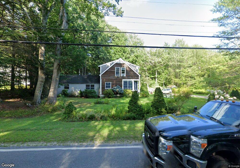
117 Log Cabin Rd Kennebunkport, ME 04046
Estimated Value: $637,181 - $767,000
3
Beds
2
Baths
2,242
Sq Ft
$316/Sq Ft
Est. Value
About This Home
This home is located at 117 Log Cabin Rd, Kennebunkport, ME 04046 and is currently estimated at $708,545, approximately $316 per square foot. 117 Log Cabin Rd is a home with nearby schools including Kennebunk High School and School Around Us.
Create a Home Valuation Report for This Property
The Home Valuation Report is an in-depth analysis detailing your home's value as well as a comparison with similar homes in the area
Home Values in the Area
Average Home Value in this Area
Tax History Compared to Growth
Tax History
| Year | Tax Paid | Tax Assessment Tax Assessment Total Assessment is a certain percentage of the fair market value that is determined by local assessors to be the total taxable value of land and additions on the property. | Land | Improvement |
|---|---|---|---|---|
| 2025 | $3,057 | $444,300 | $125,400 | $318,900 |
| 2024 | $2,888 | $444,300 | $125,400 | $318,900 |
| 2023 | $2,777 | $444,300 | $125,400 | $318,900 |
| 2022 | $2,657 | $442,800 | $125,400 | $317,400 |
| 2021 | $2,366 | $246,500 | $63,800 | $182,700 |
| 2020 | $2,329 | $246,500 | $63,800 | $182,700 |
| 2019 | $2,329 | $246,500 | $63,800 | $182,700 |
| 2018 | $2,159 | $246,500 | $63,800 | $182,700 |
| 2017 | $2,145 | $246,500 | $63,800 | $182,700 |
| 2016 | $2,041 | $246,500 | $63,800 | $182,700 |
| 2015 | $1,821 | $246,500 | $63,800 | $182,700 |
| 2014 | $1,881 | $246,500 | $63,800 | $182,700 |
Source: Public Records
Map
Nearby Homes
- 83 Log Cabin Rd
- 115 Log Cabin Rd
- 8 Ladysliper Ln
- 112 Log Cabin Rd
- 123 Log Cabin Rd
- 16 Ladysliper Ln
- 106 Log Cabin Rd
- 127 Log Cabin Rd
- 97 Log Cabin Rd
- 104 Log Cabin Rd
- 24 Lady Slipper Ln
- 100 Log Cabin Rd
- 128 Log Cabin Rd
- 129 Log Cabin Rd
- 98 Log Cabin Rd
- 95 Log Cabin Rd
- 20 Fairfield Hill Rd
- 32 Fairfield Hill Rd
- 90 Log Cabin Rd
- 27 Pitchforth Dr