Estimated Value: $497,788 - $724,000
Studio
--
Bath
1,268
Sq Ft
$507/Sq Ft
Est. Value
About This Home
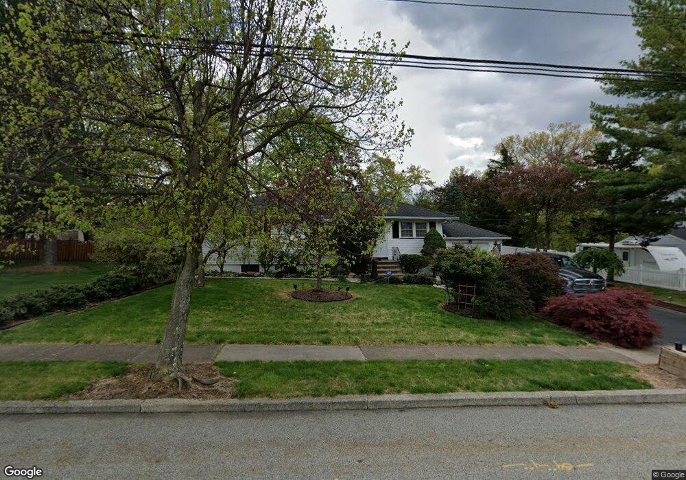
This home is located at 117 Longport Rd, Wayne, NJ 07470 and is currently estimated at $643,197, approximately $507 per square foot. 117 Longport Rd is a home located in Passaic County with nearby schools including Theunis Dey Elementary School, Schuyler-Colfax Middle School, and Wayne Hills High School.
Ownership History
Date
Name
Owned For
Owner Type
Purchase Details
Closed on
Sep 13, 2016
Sold by
Sabatino Richard and Sabatino Gloria
Bought by
Sabatjno Richard and Sabatjno Gloria
Current Estimated Value
Home Financials for this Owner
Home Financials are based on the most recent Mortgage that was taken out on this home.
Original Mortgage
$301,342
Outstanding Balance
$240,700
Interest Rate
3.43%
Mortgage Type
VA
Estimated Equity
$402,497
Purchase Details
Closed on
Jul 28, 2000
Sold by
Sabatino Steven and Sabatino Richard
Bought by
Sabatino Richard
Create a Home Valuation Report for This Property
The Home Valuation Report is an in-depth analysis detailing your home's value as well as a comparison with similar homes in the area
Home Values in the Area
Average Home Value in this Area
Purchase History
| Date | Buyer | Sale Price | Title Company |
|---|---|---|---|
| Sabatjno Richard | -- | None Available | |
| Sabatino Richard | -- | -- |
Source: Public Records
Mortgage History
| Date | Status | Borrower | Loan Amount |
|---|---|---|---|
| Open | Sabatjno Richard | $301,342 |
Source: Public Records
Tax History
| Year | Tax Paid | Tax Assessment Tax Assessment Total Assessment is a certain percentage of the fair market value that is determined by local assessors to be the total taxable value of land and additions on the property. | Land | Improvement |
|---|---|---|---|---|
| 2025 | $10,406 | $175,000 | $105,800 | $69,200 |
| 2024 | $10,007 | $175,000 | $105,800 | $69,200 |
| 2022 | $9,895 | $175,000 | $105,800 | $69,200 |
| 2021 | $9,884 | $175,000 | $105,800 | $69,200 |
| 2020 | $9,840 | $175,000 | $105,800 | $69,200 |
| 2019 | $9,650 | $175,000 | $105,800 | $69,200 |
| 2018 | $9,564 | $175,000 | $105,800 | $69,200 |
| 2017 | $9,476 | $175,000 | $105,800 | $69,200 |
| 2016 | $9,343 | $175,000 | $105,800 | $69,200 |
| 2015 | $9,231 | $175,000 | $105,800 | $69,200 |
| 2014 | $8,971 | $175,000 | $105,800 | $69,200 |
Source: Public Records
Map
Nearby Homes
- 28 Kingston Rd
- 25 Nathan Way
- 48 Deerfield Rd
- 22 Greendale Ave
- 648 Black Oak Ridge Rd
- 21 Romondt Rd
- 45 Kime Ave
- 78 Maple Ln
- 45 Village Rd
- 2 Marvin Rd
- 2 Michael Ct
- 520 Turnpike C112 Unit C112
- 520 Newark Pompton Turnpike Unit C222
- 43 Madison St
- 7 Shore Rd
- 520 Turnpike C222 Unit 222
- 36 Yellow Brick Rd
- 1690 Hamburg Turnpike
- 139 Webster Dr
- 32 Garden Place
- 113 Longport Rd
- 121 Longport Rd
- 110 Fieldstone Place
- 116 Fieldstone Place
- 89 Farmingdale Rd
- 109 Longport Rd
- 106 Fieldstone Place
- 114 Longport Rd
- 98 Farmingdale Rd
- 94 Farmingdale Rd
- 112 Longport Rd
- 83 Farmingdale Rd
- 105 Longport Rd
- 90 Farmingdale Rd
- 100 Fieldstone Place
- 109 Fieldstone Place
- 115 Fieldstone Place
- 108 Longport Rd
- 105 Fieldstone Place
- 51 Grantwood Rd
Your Personal Tour Guide
Ask me questions while you tour the home.