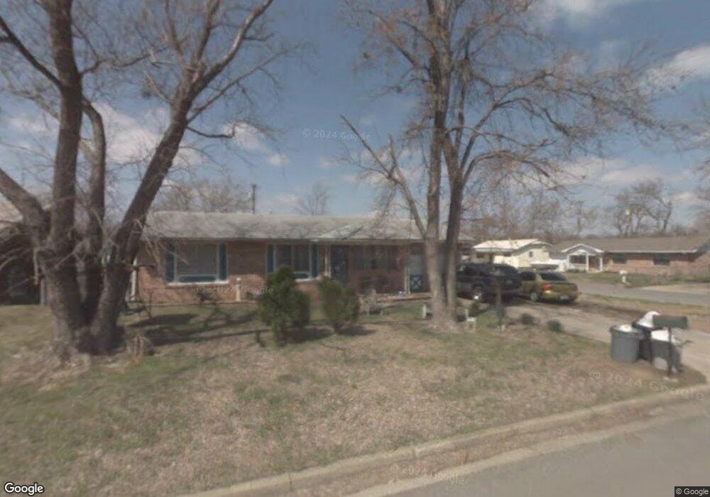
117 Maple Locust Grove, OK 74352
Estimated Value: $130,000 - $192,000
3
Beds
3
Baths
1,248
Sq Ft
$125/Sq Ft
Est. Value
About This Home
This home is located at 117 Maple, Locust Grove, OK 74352 and is currently estimated at $156,574, approximately $125 per square foot. 117 Maple is a home with nearby schools including Locust Grove Early Lrning Center, Locust Grove Upper Elementary School, and Locust Grove Middle School.
Ownership History
Date
Name
Owned For
Owner Type
Purchase Details
Closed on
Dec 7, 2018
Sold by
Covington Jesse and Covington Cassie L
Bought by
Covington Jesse A and May Cassie L
Current Estimated Value
Home Financials for this Owner
Home Financials are based on the most recent Mortgage that was taken out on this home.
Original Mortgage
$37,000
Outstanding Balance
$32,534
Interest Rate
4.8%
Mortgage Type
New Conventional
Estimated Equity
$124,040
Purchase Details
Closed on
Apr 6, 2004
Sold by
Caine Nila and Donald Crai
Bought by
Covington Jesse and Covington Cassie
Purchase Details
Closed on
Jan 22, 2002
Sold by
Randeau Glenda
Bought by
Caine Nila and Lori Mullin
Purchase Details
Closed on
Jun 29, 2000
Sold by
Caine Nila and Ori Mullins
Bought by
Randeau Glenda
Purchase Details
Closed on
Nov 22, 1995
Sold by
Stafford Euretha Fay
Bought by
Caine Ronald C
Create a Home Valuation Report for This Property
The Home Valuation Report is an in-depth analysis detailing your home's value as well as a comparison with similar homes in the area
Purchase History
| Date | Buyer | Sale Price | Title Company |
|---|---|---|---|
| Covington Jesse A | -- | None Available | |
| Covington Jesse | $47,000 | -- | |
| Caine Nila | $52,000 | -- | |
| Randeau Glenda | $55,000 | -- | |
| Caine Ronald C | $37,500 | -- |
Source: Public Records
Mortgage History
| Date | Status | Borrower | Loan Amount |
|---|---|---|---|
| Open | Covington Jesse A | $37,000 |
Source: Public Records
Tax History
| Year | Tax Paid | Tax Assessment Tax Assessment Total Assessment is a certain percentage of the fair market value that is determined by local assessors to be the total taxable value of land and additions on the property. | Land | Improvement |
|---|---|---|---|---|
| 2025 | $661 | $8,119 | $1,324 | $6,795 |
| 2024 | $640 | $7,883 | $1,286 | $6,597 |
| 2023 | $640 | $7,654 | $1,261 | $6,393 |
| 2022 | $670 | $7,430 | $1,232 | $6,198 |
| 2021 | $652 | $7,077 | $1,211 | $5,866 |
| 2020 | $630 | $6,740 | $1,191 | $5,549 |
| 2019 | $601 | $6,419 | $1,163 | $5,256 |
| 2018 | $613 | $6,419 | $1,163 | $5,256 |
| 2017 | $613 | $6,419 | $1,163 | $5,256 |
| 2016 | $599 | $6,419 | $1,163 | $5,256 |
| 2015 | $618 | $6,418 | $1,163 | $5,255 |
| 2014 | $618 | $6,418 | $1,163 | $5,255 |
Source: Public Records
Map
Nearby Homes
Your Personal Tour Guide
Ask me questions while you tour the home.