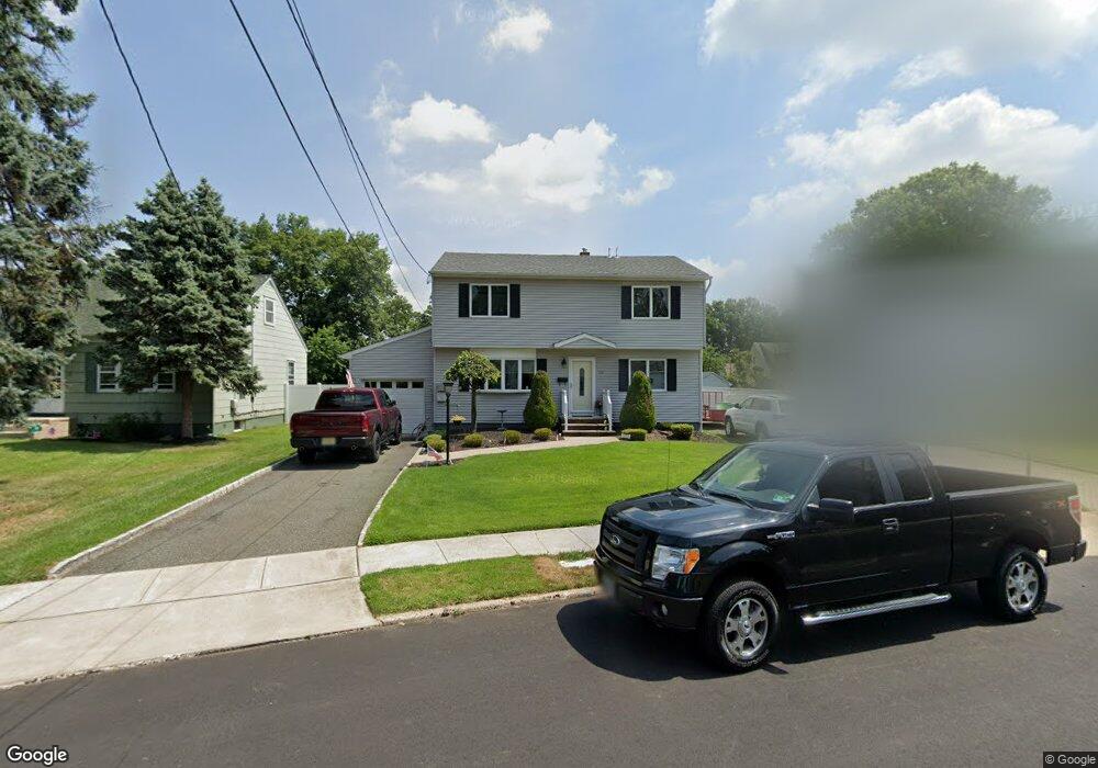
117 Michael St South Plainfield, NJ 07080
Estimated Value: $619,906 - $760,000
--
Bed
--
Bath
2,076
Sq Ft
$329/Sq Ft
Est. Value
About This Home
This home is located at 117 Michael St, South Plainfield, NJ 07080 and is currently estimated at $683,977, approximately $329 per square foot. 117 Michael St is a home located in Middlesex County with nearby schools including South Plainfield High School, Holy Savior Academy, and The Wardlaw-Hartridge School.
Ownership History
Date
Name
Owned For
Owner Type
Purchase Details
Closed on
Apr 23, 2002
Sold by
Castle Management
Bought by
Viola John and Viola Elaine
Current Estimated Value
Home Financials for this Owner
Home Financials are based on the most recent Mortgage that was taken out on this home.
Original Mortgage
$55,000
Outstanding Balance
$23,125
Interest Rate
7.01%
Estimated Equity
$660,852
Create a Home Valuation Report for This Property
The Home Valuation Report is an in-depth analysis detailing your home's value as well as a comparison with similar homes in the area
Home Values in the Area
Average Home Value in this Area
Purchase History
| Date | Buyer | Sale Price | Title Company |
|---|---|---|---|
| Viola John | $310,000 | -- |
Source: Public Records
Mortgage History
| Date | Status | Borrower | Loan Amount |
|---|---|---|---|
| Open | Viola John | $55,000 |
Source: Public Records
Tax History Compared to Growth
Tax History
| Year | Tax Paid | Tax Assessment Tax Assessment Total Assessment is a certain percentage of the fair market value that is determined by local assessors to be the total taxable value of land and additions on the property. | Land | Improvement |
|---|---|---|---|---|
| 2025 | $10,026 | $143,600 | $36,100 | $107,500 |
| 2024 | $9,590 | $143,600 | $36,100 | $107,500 |
| 2023 | $9,590 | $143,600 | $36,100 | $107,500 |
| 2022 | $9,470 | $143,600 | $36,100 | $107,500 |
| 2021 | $9,248 | $143,600 | $36,100 | $107,500 |
| 2020 | $9,113 | $143,600 | $36,100 | $107,500 |
| 2019 | $8,744 | $143,600 | $36,100 | $107,500 |
| 2018 | $8,518 | $143,600 | $36,100 | $107,500 |
| 2017 | $8,409 | $143,600 | $36,100 | $107,500 |
| 2016 | $8,324 | $143,600 | $36,100 | $107,500 |
| 2015 | $8,181 | $143,600 | $36,100 | $107,500 |
| 2014 | $7,945 | $143,600 | $36,100 | $107,500 |
Source: Public Records
Map
Nearby Homes
- 533 Edgar Ave
- 106 Devon Ln
- 260 Merchants Ave
- 102 Jerome Ave
- 222 Oak Tree Ave
- 241 Van Fleet Ave
- 184 W Nassau Ave
- 114 Whispering Hills Rd
- 6 Stacey Ct
- 128 Oak Tree Ave
- 458 Joan St
- 1726 Kenyon Ave
- 117 E Elmwood Dr
- 2415 Maple Ave
- 1712 Kenyon Ave
- 1905 Park Ave
- 605 Oak Tree Ave
- 3313 Banta Rd
- 2715 Maple Ave
- 418 Bergen St