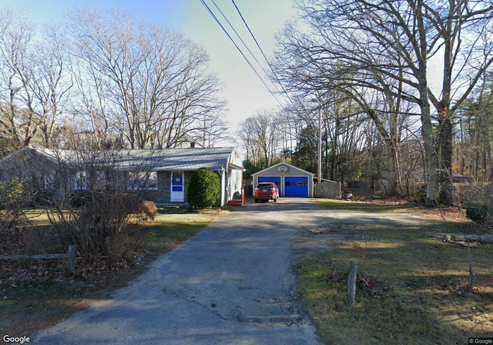
117 Middlesex Rd Topsham, ME 04086
Estimated Value: $344,451 - $367,000
3
Beds
1
Bath
1,586
Sq Ft
$223/Sq Ft
Est. Value
About This Home
This home is located at 117 Middlesex Rd, Topsham, ME 04086 and is currently estimated at $353,363, approximately $222 per square foot. 117 Middlesex Rd is a home located in Sagadahoc County with nearby schools including Mt Ararat High School, Harpswell Coastal Academy Divisions 2 and 3, and St John's Catholic School.
Ownership History
Date
Name
Owned For
Owner Type
Purchase Details
Closed on
Jun 11, 2015
Sold by
Russell Caroline K
Bought by
Labonte Myles G and Austin Patrick B
Current Estimated Value
Home Financials for this Owner
Home Financials are based on the most recent Mortgage that was taken out on this home.
Original Mortgage
$153,877
Outstanding Balance
$118,412
Interest Rate
3.65%
Mortgage Type
New Conventional
Estimated Equity
$234,951
Purchase Details
Closed on
Nov 26, 2014
Sold by
Department Of Housing & Urban Dev
Bought by
Russell Caroline K
Purchase Details
Closed on
Mar 20, 2009
Sold by
Fenimore 3Rd Edward G and Fenimore Susan F
Bought by
Brawn Christopher and Zwearcan Nicole
Home Financials for this Owner
Home Financials are based on the most recent Mortgage that was taken out on this home.
Original Mortgage
$162,011
Interest Rate
5.25%
Mortgage Type
FHA
Create a Home Valuation Report for This Property
The Home Valuation Report is an in-depth analysis detailing your home's value as well as a comparison with similar homes in the area
Home Values in the Area
Average Home Value in this Area
Purchase History
| Date | Buyer | Sale Price | Title Company |
|---|---|---|---|
| Labonte Myles G | -- | -- | |
| Russell Caroline K | -- | -- | |
| Brawn Christopher | -- | -- |
Source: Public Records
Mortgage History
| Date | Status | Borrower | Loan Amount |
|---|---|---|---|
| Open | Labonte Myles G | $153,877 | |
| Previous Owner | Brawn Christopher | $162,011 |
Source: Public Records
Tax History
| Year | Tax Paid | Tax Assessment Tax Assessment Total Assessment is a certain percentage of the fair market value that is determined by local assessors to be the total taxable value of land and additions on the property. | Land | Improvement |
|---|---|---|---|---|
| 2025 | $3,320 | $259,400 | $59,100 | $200,300 |
| 2024 | $3,191 | $255,300 | $55,000 | $200,300 |
| 2023 | $3,004 | $221,200 | $52,400 | $168,800 |
| 2022 | $3,337 | $231,400 | $50,500 | $180,900 |
| 2021 | $3,112 | $196,100 | $46,400 | $149,700 |
| 2020 | $3,168 | $177,400 | $46,400 | $131,000 |
| 2019 | $3,206 | $167,400 | $46,400 | $121,000 |
| 2018 | $2,858 | $152,600 | $41,600 | $111,000 |
| 2017 | $2,765 | $152,600 | $41,600 | $111,000 |
| 2016 | $2,724 | $151,400 | $41,600 | $109,800 |
| 2015 | $2,674 | $148,900 | $41,600 | $107,300 |
| 2014 | $2,558 | $147,600 | $41,600 | $106,000 |
| 2013 | $2,458 | $147,600 | $41,600 | $106,000 |
Source: Public Records
Map
Nearby Homes
- 8 Overbeck Dr
- 123 Middlesex Rd
- 111 Middlesex Rd
- 118 Middlesex Rd
- 9 Overbeck Dr
- 11 Overbeck Dr
- 126 Middlesex Rd
- TBD Middlesex
- 108 Middlesex Rd
- 99 Middlesex Rd
- 12 Somerset Place
- 8 Somerset Place
- 100 Middlesex Rd
- 6 Somerset Place
- 141 Middlesex Rd
- 136 Middlesex Rd
- 125 Middlesex Rd
- 4 Somerset Place
- 4 Arbor Ave
- 2 Somerset Place
Your Personal Tour Guide
Ask me questions while you tour the home.