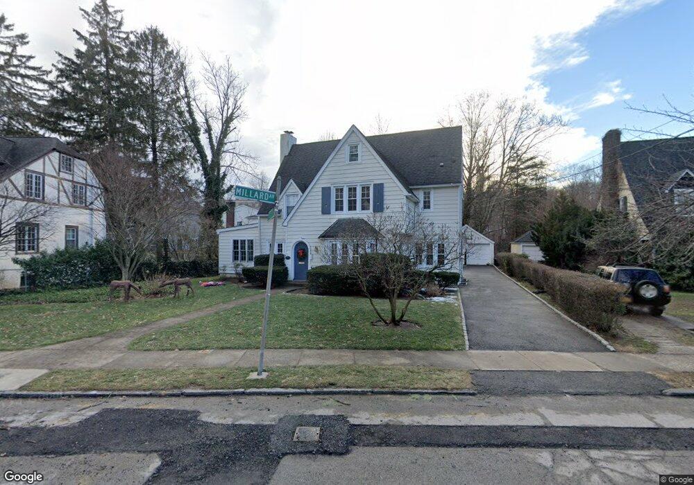
117 Millard Ave Bronxville, NY 10708
Cedar Knolls NeighborhoodEstimated Value: $1,106,000 - $1,334,000
3
Beds
3
Baths
1,844
Sq Ft
$651/Sq Ft
Est. Value
About This Home
This home is located at 117 Millard Ave, Bronxville, NY 10708 and is currently estimated at $1,200,827, approximately $651 per square foot. 117 Millard Ave is a home located in Westchester County with nearby schools including St. Eugene School and Saint Joseph School.
Ownership History
Date
Name
Owned For
Owner Type
Purchase Details
Closed on
Jan 29, 2008
Sold by
Melvin Robert and Melvin Lori
Bought by
Molloy Sean and Molloy Lisa
Current Estimated Value
Home Financials for this Owner
Home Financials are based on the most recent Mortgage that was taken out on this home.
Original Mortgage
$71,800
Outstanding Balance
$53,867
Interest Rate
6.5%
Mortgage Type
Credit Line Revolving
Estimated Equity
$1,146,960
Purchase Details
Closed on
May 3, 2002
Sold by
Corvini Eleanor
Bought by
Melvin Robert and Melvin Lori
Home Financials for this Owner
Home Financials are based on the most recent Mortgage that was taken out on this home.
Original Mortgage
$416,000
Interest Rate
6.73%
Mortgage Type
Purchase Money Mortgage
Create a Home Valuation Report for This Property
The Home Valuation Report is an in-depth analysis detailing your home's value as well as a comparison with similar homes in the area
Home Values in the Area
Average Home Value in this Area
Purchase History
| Date | Buyer | Sale Price | Title Company |
|---|---|---|---|
| Molloy Sean | $720,000 | Commonwealth Land Title | |
| Melvin Robert | $520,000 | Commonwealth Land Title Ins |
Source: Public Records
Mortgage History
| Date | Status | Borrower | Loan Amount |
|---|---|---|---|
| Open | Molloy Sean | $71,800 | |
| Previous Owner | Melvin Robert | $416,000 |
Source: Public Records
Tax History Compared to Growth
Tax History
| Year | Tax Paid | Tax Assessment Tax Assessment Total Assessment is a certain percentage of the fair market value that is determined by local assessors to be the total taxable value of land and additions on the property. | Land | Improvement |
|---|---|---|---|---|
| 2024 | $2,762 | $15,500 | $5,200 | $10,300 |
| 2023 | $2,747 | $15,500 | $5,200 | $10,300 |
| 2022 | $2,729 | $15,500 | $5,200 | $10,300 |
| 2021 | $12,352 | $15,500 | $5,200 | $10,300 |
| 2020 | $13,084 | $15,500 | $5,200 | $10,300 |
| 2019 | $14,575 | $15,500 | $5,200 | $10,300 |
| 2018 | $12,154 | $15,500 | $5,200 | $10,300 |
| 2017 | -- | $15,500 | $5,200 | $10,300 |
| 2016 | $12,862 | $15,500 | $5,200 | $10,300 |
| 2015 | -- | $15,500 | $5,200 | $10,300 |
| 2014 | -- | $15,500 | $5,200 | $10,300 |
| 2013 | -- | $15,500 | $5,200 | $10,300 |
Source: Public Records
Map
Nearby Homes
- 16 Bryn Mawr Pkwy
- 139 Ellison Ave
- 764 Palmer Rd Unit 1B
- 46 Dellwood Rd
- 49 Rockledge Rd Unit 12E
- 29 Chatfield Rd
- 15 Sunnybrook Rd Unit 2A
- 119 Pondfield Rd W
- 766 Palmer Rd Unit 2D
- 133 Pondfield Rd W Unit 2B
- 10 Rockledge Rd
- 824 Palmer Rd Unit 1D
- 65 Durham Rd Unit 2E
- 86 Pondfield Rd W
- 2 Rockledge Rd
- 209 Pondfield Rd W
- 609 Palmer Rd Unit 3M
- 609 Palmer Rd Unit 4C
- 609 Palmer Rd Unit 4J
- 632 Palmer Rd Unit 10B
- 123 Millard Ave
- 109 Millard Ave
- 115 Millard Ave
- 17 Meadow Ave W
- 11 Meadow Ave
- 11 Meadow Ave W
- 6 Millison Close
- 129 Millard Ave
- 118 Millard Ave
- 134 Millard Ave
- 5 Meadow Ave
- 5 Meadow Ave W Unit 7
- 5 Meadow Ave W
- 135 Millard Ave
- 138 Millard Ave
- 12 Meadow Ave Unit 1C
- 12 Meadow Ave Unit 3C
- 12 Meadow Ave Unit 5B
- 12 Meadow Ave Unit 2C
- 12 Meadow Ave Unit 6A