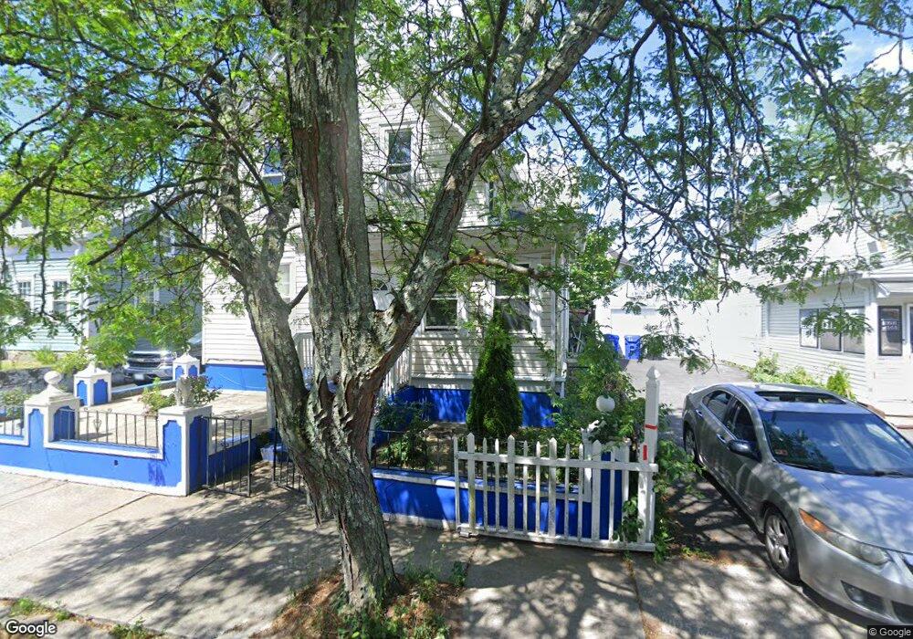
117 Mulberry St Pawtucket, RI 02860
Woodlawn NeighborhoodEstimated Value: $457,000 - $558,000
5
Beds
3
Baths
2,556
Sq Ft
$198/Sq Ft
Est. Value
About This Home
This home is located at 117 Mulberry St, Pawtucket, RI 02860 and is currently estimated at $505,792, approximately $197 per square foot. 117 Mulberry St is a home located in Providence County with nearby schools including International Charter School, Blackstone Academy Charter School, and Saint Raphael Academy.
Ownership History
Date
Name
Owned For
Owner Type
Purchase Details
Closed on
Jun 27, 2016
Sold by
Gomes Joao G
Bought by
Gomes Ida
Current Estimated Value
Home Financials for this Owner
Home Financials are based on the most recent Mortgage that was taken out on this home.
Original Mortgage
$134,055
Outstanding Balance
$109,214
Interest Rate
4.4%
Mortgage Type
FHA
Estimated Equity
$396,578
Purchase Details
Closed on
Apr 21, 2010
Sold by
Gomes Alda F
Bought by
Gomes Joan G
Purchase Details
Closed on
Aug 5, 1998
Sold by
Dagraca Daniel M and Dagraca Matilda
Bought by
Gomes Joao G and Gomes Jose G
Home Financials for this Owner
Home Financials are based on the most recent Mortgage that was taken out on this home.
Original Mortgage
$97,904
Interest Rate
6.92%
Create a Home Valuation Report for This Property
The Home Valuation Report is an in-depth analysis detailing your home's value as well as a comparison with similar homes in the area
Home Values in the Area
Average Home Value in this Area
Purchase History
| Date | Buyer | Sale Price | Title Company |
|---|---|---|---|
| Gomes Ida | $155,000 | -- | |
| Gomes Joan G | -- | -- | |
| Gomes Joao G | $98,000 | -- |
Source: Public Records
Mortgage History
| Date | Status | Borrower | Loan Amount |
|---|---|---|---|
| Open | Gomes Ida | $134,055 | |
| Previous Owner | Gomes Joao G | $97,904 |
Source: Public Records
Tax History Compared to Growth
Tax History
| Year | Tax Paid | Tax Assessment Tax Assessment Total Assessment is a certain percentage of the fair market value that is determined by local assessors to be the total taxable value of land and additions on the property. | Land | Improvement |
|---|---|---|---|---|
| 2025 | $5,160 | $392,400 | $120,000 | $272,400 |
| 2024 | $4,842 | $392,400 | $120,000 | $272,400 |
| 2023 | $4,696 | $277,200 | $54,000 | $223,200 |
| 2022 | $4,596 | $277,200 | $54,000 | $223,200 |
| 2021 | $4,596 | $277,200 | $54,000 | $223,200 |
| 2020 | $4,372 | $209,300 | $54,700 | $154,600 |
| 2019 | $4,372 | $209,300 | $54,700 | $154,600 |
| 2018 | $4,213 | $209,300 | $54,700 | $154,600 |
| 2017 | $3,871 | $170,400 | $41,800 | $128,600 |
| 2016 | $3,730 | $170,400 | $41,800 | $128,600 |
| 2015 | $3,730 | $170,400 | $41,800 | $128,600 |
| 2014 | $3,750 | $162,600 | $53,800 | $108,800 |
Source: Public Records
Map
Nearby Homes
- 55 Brown St
- 55 Brown St Unit 3
- 111 Mulberry St
- 123 Mulberry St
- 63 Brown St
- 107 Mulberry St
- 131 Mulberry St
- 45 Brown St
- 114 Mulberry St
- 4 Washington St
- 108 Mulberry St
- 101 Mulberry St
- 104 Mulberry St
- 9 Barney Ave
- 95 Mulberry St
- 41 Brown St
- 137 Mulberry St
- 8 Washington St
- 15 Barney Ave
- 130 Mulberry St