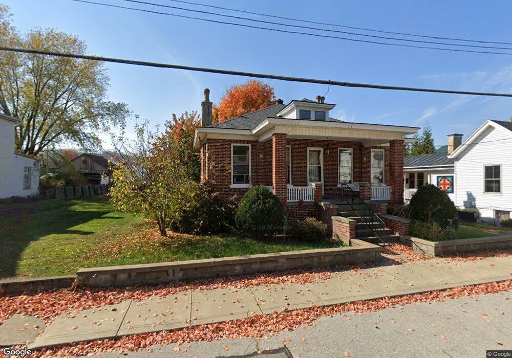
117 N 2nd St Ripley, OH 45167
Estimated Value: $156,981 - $223,000
3
Beds
2
Baths
2,212
Sq Ft
$83/Sq Ft
Est. Value
About This Home
This home is located at 117 N 2nd St, Ripley, OH 45167 and is currently estimated at $184,495, approximately $83 per square foot. 117 N 2nd St is a home located in Brown County with nearby schools including Ripley Union Lewis Huntington Elementary School, Ripley Union Lewis Huntington Middle School, and Ripley-Union-Lewis-Huntington High School.
Ownership History
Date
Name
Owned For
Owner Type
Purchase Details
Closed on
Mar 2, 2022
Sold by
Pollard Lawrence C
Bought by
Paracelsus Llc
Current Estimated Value
Purchase Details
Closed on
Jun 2, 1997
Sold by
Cooper John D
Bought by
Pollard Lawrence C
Create a Home Valuation Report for This Property
The Home Valuation Report is an in-depth analysis detailing your home's value as well as a comparison with similar homes in the area
Home Values in the Area
Average Home Value in this Area
Purchase History
| Date | Buyer | Sale Price | Title Company |
|---|---|---|---|
| Paracelsus Llc | -- | American Homeland Title | |
| Paracelsus Llc | -- | American Homeland Title | |
| Pollard Lawrence C | $63,000 | -- |
Source: Public Records
Mortgage History
| Date | Status | Borrower | Loan Amount |
|---|---|---|---|
| Closed | Pollard Lawrence C | -- |
Source: Public Records
Tax History Compared to Growth
Tax History
| Year | Tax Paid | Tax Assessment Tax Assessment Total Assessment is a certain percentage of the fair market value that is determined by local assessors to be the total taxable value of land and additions on the property. | Land | Improvement |
|---|---|---|---|---|
| 2024 | $1,578 | $48,060 | $5,370 | $42,690 |
| 2023 | $1,578 | $42,310 | $4,340 | $37,970 |
| 2022 | $1,207 | $42,310 | $4,340 | $37,970 |
| 2021 | $1,196 | $42,310 | $4,340 | $37,970 |
| 2020 | $1,047 | $36,800 | $3,780 | $33,020 |
| 2019 | $989 | $36,800 | $3,780 | $33,020 |
| 2018 | $1,031 | $36,800 | $3,780 | $33,020 |
| 2017 | $758 | $28,830 | $4,160 | $24,670 |
| 2016 | $757 | $28,830 | $4,160 | $24,670 |
| 2015 | $743 | $28,830 | $4,160 | $24,670 |
| 2014 | $743 | $28,450 | $3,780 | $24,670 |
| 2013 | $691 | $28,450 | $3,780 | $24,670 |
Source: Public Records
Map
Nearby Homes
- 45 Main St
- 220 Main St
- 610 N Second St
- 316 Circle Dr
- 402 Circle Dr
- 633 Robins Way
- 800 Catherine St
- 3635 Circle Dr
- 4381 E Us Highway 52
- 65 Governor St
- 1016 Elizabeth St
- 1205 Pearl St
- 5205 U S 52
- 3111 Lees Creek Rd
- 3179 Stephenson Rd
- 2028 Lucretia St
- 5796 Mary Ingles Hwy
- 2053 Johnson St
- 5050 U S 52
- 3150 Dover Minerva Rd