Estimated Value: $58,000 - $481,000
2
Beds
1
Bath
560
Sq Ft
$294/Sq Ft
Est. Value
About This Home
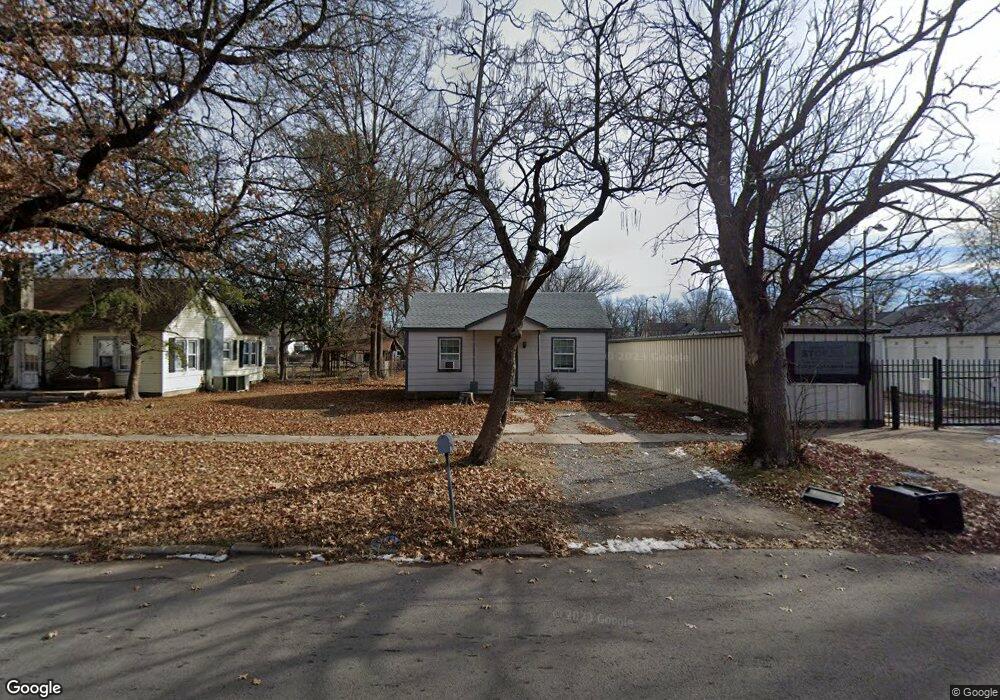
This home is located at 117 N Adair St, Pryor, OK 74361 and is currently estimated at $164,881, approximately $294 per square foot. 117 N Adair St is a home located in Mayes County with nearby schools including Pryor Middle School, Pryor High School, and William Bradford Christian School.
Ownership History
Date
Name
Owned For
Owner Type
Purchase Details
Closed on
Jul 14, 2020
Sold by
Lml Investments Llc
Bought by
Properties Llc
Current Estimated Value
Purchase Details
Closed on
Jan 19, 2010
Sold by
Deutsche Bank National Trust Co
Bought by
Lml Investments Llc
Purchase Details
Closed on
Jun 7, 2005
Sold by
Vigland Eric C and Vigland Terry D
Bought by
Anderson Rhonda D
Home Financials for this Owner
Home Financials are based on the most recent Mortgage that was taken out on this home.
Original Mortgage
$42,300
Interest Rate
5.83%
Mortgage Type
New Conventional
Purchase Details
Closed on
Oct 7, 1998
Sold by
Hagar Robert
Bought by
Ingram Cw
Purchase Details
Closed on
Feb 16, 1993
Sold by
Smith Lawrence
Bought by
Hagar Robert
Create a Home Valuation Report for This Property
The Home Valuation Report is an in-depth analysis detailing your home's value as well as a comparison with similar homes in the area
Home Values in the Area
Average Home Value in this Area
Purchase History
| Date | Buyer | Sale Price | Title Company |
|---|---|---|---|
| Properties Llc | $40,000 | Mayes County Abstract Co | |
| Lml Investments Llc | $18,000 | First Financial Title Agency | |
| Anderson Rhonda D | $47,000 | None Available | |
| Ingram Cw | $15,000 | -- | |
| Hagar Robert | $14,500 | -- |
Source: Public Records
Mortgage History
| Date | Status | Borrower | Loan Amount |
|---|---|---|---|
| Previous Owner | Anderson Rhonda D | $42,300 |
Source: Public Records
Tax History Compared to Growth
Tax History
| Year | Tax Paid | Tax Assessment Tax Assessment Total Assessment is a certain percentage of the fair market value that is determined by local assessors to be the total taxable value of land and additions on the property. | Land | Improvement |
|---|---|---|---|---|
| 2025 | $447 | $5,298 | $2,116 | $3,182 |
| 2023 | $426 | $5,027 | $2,184 | $2,843 |
| 2022 | $400 | $4,788 | $2,184 | $2,604 |
| 2021 | $385 | $4,560 | $2,184 | $2,376 |
| 2020 | $457 | $5,519 | $2,120 | $3,399 |
| 2019 | $449 | $5,256 | $1,953 | $3,303 |
| 2018 | $425 | $5,006 | $1,764 | $3,242 |
| 2017 | $407 | $5,162 | $1,764 | $3,398 |
| 2016 | $451 | $5,659 | $1,638 | $4,021 |
| 2015 | $459 | $5,659 | $1,638 | $4,021 |
| 2014 | $456 | $5,622 | $1,627 | $3,995 |
Source: Public Records
Map
Nearby Homes
- 218 N Vann St
- 310 N Rowe St
- 0 N 4318 Rd Unit 2522371
- 4748 N 4318 Rd
- 1545 S 4260 Rd
- 201 N Coo Y Yah St
- 304 N Hogan St
- 319 N Hogan St
- 305 NE 5th St
- 114 N Whitaker St
- 201 N Indianola St
- 115 N Indianola St
- 0 N Orphan St
- 15 S Mayes St
- 415 N Orphan St
- 107 S Coo Y Yah St
- 202 N Ora St
- 107 N Orphan St
- 20 S Elliott St
- 204 S Rowe St