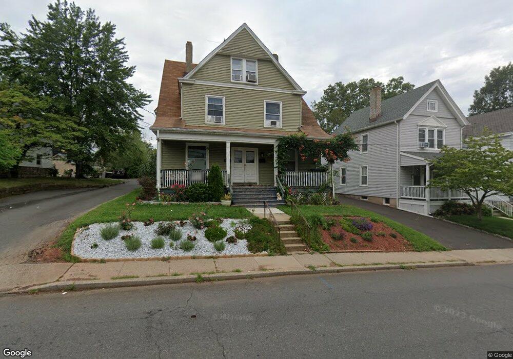
117 N Bridge St Unit 119 Somerville, NJ 08876
Estimated Value: $550,473 - $701,000
--
Bed
--
Bath
2,692
Sq Ft
$228/Sq Ft
Est. Value
About This Home
This home is located at 117 N Bridge St Unit 119, Somerville, NJ 08876 and is currently estimated at $613,618, approximately $227 per square foot. 117 N Bridge St Unit 119 is a home located in Somerset County with nearby schools including Van Derveer School, Somerville Middle School, and Somerville High School.
Ownership History
Date
Name
Owned For
Owner Type
Purchase Details
Closed on
May 1, 2003
Sold by
Lenches Richard
Bought by
Dowden Christopher
Current Estimated Value
Home Financials for this Owner
Home Financials are based on the most recent Mortgage that was taken out on this home.
Original Mortgage
$260,000
Outstanding Balance
$113,412
Interest Rate
5.84%
Estimated Equity
$500,206
Purchase Details
Closed on
Jul 21, 1988
Sold by
First National Bank/Central Jersey
Bought by
Lenches Richard F and Lenches Toni L
Create a Home Valuation Report for This Property
The Home Valuation Report is an in-depth analysis detailing your home's value as well as a comparison with similar homes in the area
Home Values in the Area
Average Home Value in this Area
Purchase History
| Date | Buyer | Sale Price | Title Company |
|---|---|---|---|
| Dowden Christopher | $325,000 | -- | |
| Lenches Richard F | -- | -- |
Source: Public Records
Mortgage History
| Date | Status | Borrower | Loan Amount |
|---|---|---|---|
| Open | Dowden Christopher | $260,000 |
Source: Public Records
Tax History Compared to Growth
Tax History
| Year | Tax Paid | Tax Assessment Tax Assessment Total Assessment is a certain percentage of the fair market value that is determined by local assessors to be the total taxable value of land and additions on the property. | Land | Improvement |
|---|---|---|---|---|
| 2025 | $11,740 | $297,000 | $107,200 | $189,800 |
| 2024 | $11,740 | $297,000 | $107,200 | $189,800 |
| 2023 | $11,470 | $297,000 | $107,200 | $189,800 |
| 2022 | $11,170 | $297,000 | $107,200 | $189,800 |
| 2021 | $10,796 | $297,000 | $107,200 | $189,800 |
| 2020 | $10,870 | $297,000 | $107,200 | $189,800 |
| 2019 | $10,796 | $297,000 | $107,200 | $189,800 |
| 2018 | $10,680 | $297,000 | $107,200 | $189,800 |
| 2017 | $10,460 | $297,000 | $107,200 | $189,800 |
| 2016 | $10,036 | $297,000 | $107,200 | $189,800 |
| 2015 | $9,902 | $282,400 | $107,200 | $175,200 |
| 2014 | $9,266 | $282,400 | $107,200 | $175,200 |
Source: Public Records
Map
Nearby Homes
- 21 W Cliff St
- 81 Grove St Unit 83
- 81-83 Grove St
- 23 W Spring St
- 84 Grove St
- 35 W High St
- 32 Maple St
- 361 William St
- 401 Highway22b40u6 Unit F
- 44 Mechanic St
- 36 S Bridge St
- 30 Demond Place
- 30 W End Ave
- 211 E High St
- 56-58 Hamilton St
- 3 Prospect St
- 27 2nd St
- 21 Second St
- 110 N Middaugh St
- 12 Schoolhouse Ln
- 121 N Bridge St
- 111 N Bridge St
- 123 N Bridge St
- 1 E Summit St
- 122 N Bridge St
- 120 N Bridge St
- 5 E Summit St
- 118 N Bridge St
- 116 N Bridge St
- 114 N Bridge St Unit 94H
- 9 E Summit St
- 112 N Bridge St
- 14 W Cliff St
- 14 W Cliff St Unit 14
- 6 W Cliff St
- 6 W Cliff St Unit 6
- 11 E Summit St
- 20 W Cliff St
- 100 N Bridge St Unit 94A
- 16 E Summit St