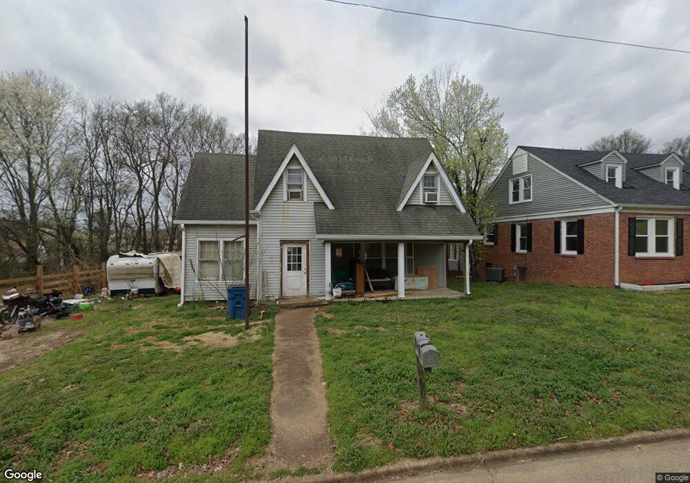
117 N Forrest Ave Camden, TN 38320
Estimated Value: $113,000 - $135,213
About This Home
This home is located at 117 N Forrest Ave, Camden, TN 38320 and is currently estimated at $121,071, approximately $54 per square foot. 117 N Forrest Ave is a home located in Benton County with nearby schools including Camden Elementary School, Briarwood School, and Camden Junior High School.
Ownership History
We collect this data history from publicly available records. To have your information removed, we recommend requesting removal directly through your county’s website.
Purchase Details
Purchase Details
Purchase Details
Home Values in the Area
Average Home Value in this Area
Purchase History
We collect this data history from publicly available records. To have your information removed, we recommend requesting removal directly through your county’s website.
| Date | Buyer | Sale Price | Title Company |
|---|---|---|---|
| $42,000 | -- | ||
| -- | -- | ||
| -- | -- |
Tax History
We collect this data history from publicly available records. To have your information removed, we recommend requesting removal directly through your county’s website.
| Year | Tax Paid | Tax Assessment Tax Assessment Total Assessment is a certain percentage of the fair market value that is determined by local assessors to be the total taxable value of land and additions on the property. | Land | Improvement |
|---|---|---|---|---|
| 2025 | $934 | $39,920 | $3,960 | $35,960 |
| 2024 | $880 | $24,000 | $3,600 | $20,400 |
| 2023 | $880 | $24,000 | $3,600 | $20,400 |
| 2022 | $880 | $24,000 | $3,600 | $20,400 |
| 2021 | $880 | $24,000 | $3,600 | $20,400 |
| 2020 | $880 | $24,000 | $3,600 | $20,400 |
| 2019 | $868 | $21,960 | $3,600 | $18,360 |
| 2018 | $868 | $21,960 | $3,600 | $18,360 |
| 2017 | $868 | $21,960 | $3,600 | $18,360 |
| 2016 | $1,109 | $28,080 | $3,600 | $24,480 |
| 2015 | $1,120 | $28,080 | $3,600 | $24,480 |
| 2014 | $996 | $28,080 | $3,600 | $24,480 |
| 2013 | $996 | $25,287 | $0 | $0 |
Map
- 1 Maple Ave
- 122 W Lake St
- 113 S Forrest Ave
- 130 Turnpike Ave
- 115 Cherry St
- 117 Turnpike Ave Unit 117
- 121 Turnpike Ave Unit 121
- 147 Berry St
- 153 Stigall St
- 172 W Main St
- 114 E Frazier St
- 000 Wyly St
- 181 Washington Ave
- 0 Stigall St
- 241 Stigall St
- 170 Westview St
- 190 Post Oak Ave
- 103 Highway 641 N
- 0 George St
- 146 Mimosa St
- 123 N Forrest Ave
- 114 N Forrest Ave
- 108 Vine St
- 110 N Forrest Ave
- 125 N Forrest Ave
- 114 Vine St
- 119 Maple Ave Unit 1
- 119 Maple Ave Unit 2
- 115 Vine St
- 6100 Old Highway 69s
- 0 Morningside Ave Unit RTC2891557
- 0 Morningside Ave Unit 134207
- 119 N Church Ave
- 113 N Church Ave
- 111 N Church Ave
- 0 Riverview Rd Unit RTC1387062
- 126 Post Oak
- 111 Church Ave
- 115 Maple Ave
- 115 N Church Ave
Ask me questions while you tour the home.