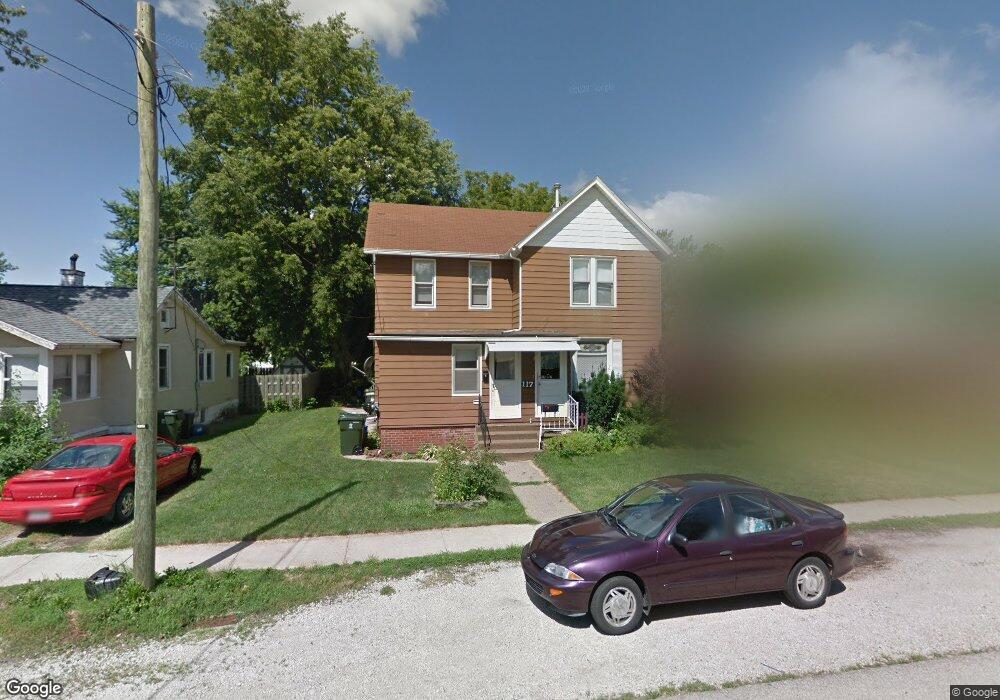
117 N Hill St Geneseo, IL 61254
Estimated Value: $117,000 - $193,000
4
Beds
2
Baths
2,057
Sq Ft
$70/Sq Ft
Est. Value
About This Home
This home is located at 117 N Hill St, Geneseo, IL 61254 and is currently estimated at $144,107, approximately $70 per square foot. 117 N Hill St is a home located in Henry County with nearby schools including Geneseo High School and St. Malachy School.
Ownership History
Date
Name
Owned For
Owner Type
Purchase Details
Closed on
Sep 30, 2020
Sold by
Ferry Robert W and Ferry Judith E
Bought by
Mackey Travis W and Mackey Kris E
Current Estimated Value
Purchase Details
Closed on
May 18, 2010
Sold by
Eickman Sharri L
Bought by
Mackey Travis W and Mackey Kristine E
Home Financials for this Owner
Home Financials are based on the most recent Mortgage that was taken out on this home.
Original Mortgage
$65,000
Interest Rate
5.3%
Mortgage Type
Future Advance Clause Open End Mortgage
Create a Home Valuation Report for This Property
The Home Valuation Report is an in-depth analysis detailing your home's value as well as a comparison with similar homes in the area
Home Values in the Area
Average Home Value in this Area
Purchase History
| Date | Buyer | Sale Price | Title Company |
|---|---|---|---|
| Mackey Travis W | -- | Attorney | |
| Mackey Travis W | $64,000 | None Available |
Source: Public Records
Mortgage History
| Date | Status | Borrower | Loan Amount |
|---|---|---|---|
| Previous Owner | Mackey Travis W | $65,000 |
Source: Public Records
Tax History Compared to Growth
Tax History
| Year | Tax Paid | Tax Assessment Tax Assessment Total Assessment is a certain percentage of the fair market value that is determined by local assessors to be the total taxable value of land and additions on the property. | Land | Improvement |
|---|---|---|---|---|
| 2024 | $3,311 | $40,732 | $3,696 | $37,036 |
| 2023 | $2,943 | $37,096 | $3,366 | $33,730 |
| 2022 | $2,802 | $34,476 | $3,128 | $31,348 |
| 2021 | $2,745 | $33,603 | $3,049 | $30,554 |
| 2020 | $2,565 | $31,841 | $3,078 | $28,763 |
| 2019 | $2,485 | $31,487 | $3,044 | $28,443 |
| 2018 | $2,357 | $29,761 | $2,877 | $26,884 |
| 2017 | $2,217 | $29,007 | $2,804 | $26,203 |
| 2016 | $2,313 | $28,272 | $2,733 | $25,539 |
| 2015 | $1,374 | $28,216 | $2,728 | $25,488 |
| 2013 | $1,374 | $27,688 | $2,677 | $25,011 |
Source: Public Records
Map
Nearby Homes
- 113 N Hill St
- 125 N Hill St
- 129 N Hill St
- 114 N Spring St
- 116 N Spring St
- 345 E Exchange St
- 106 N Spring St
- 339 E Exchange St
- 120 N Spring St
- 116 N Hill St
- 120 N Hill St
- 110 N Hill St
- 402 E Orange St
- 126 N Spring St
- 403 E Exchange St
- 102 N Spring St
- 406 E Orange St
- 407 E Exchange St
- 345 E Orange St
- 341 E Orange St