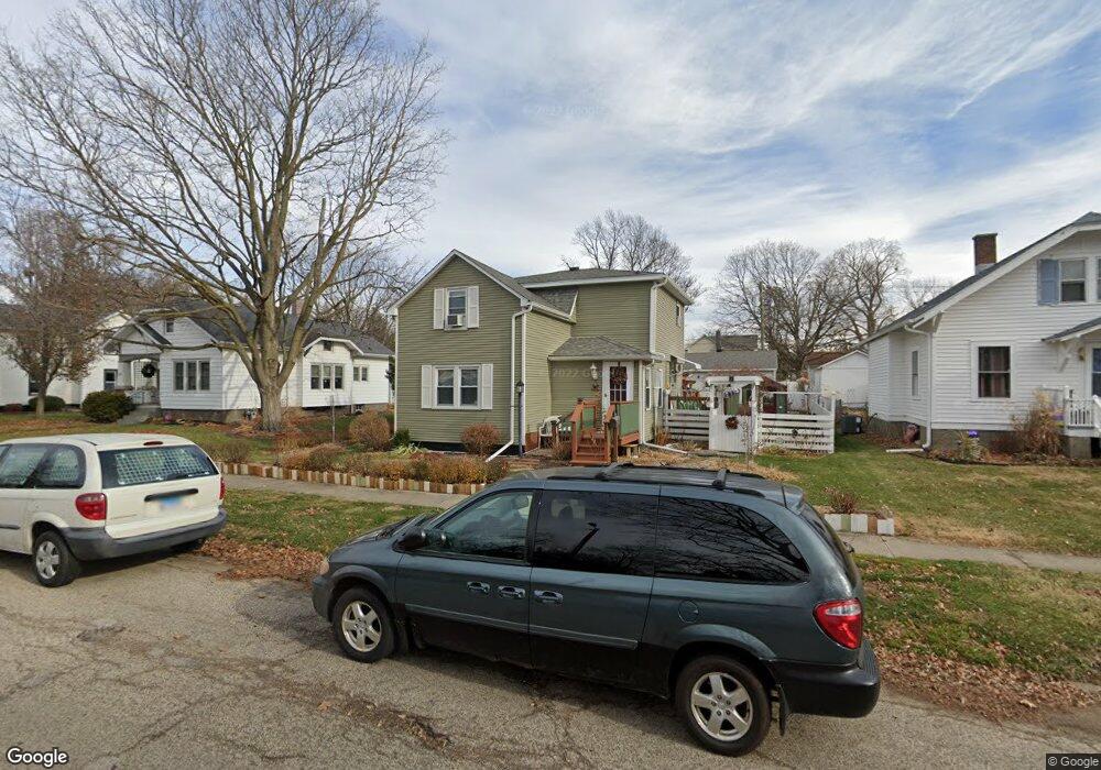
117 N Vernon St Princeton, IL 61356
Estimated Value: $90,034 - $135,000
3
Beds
2
Baths
1,302
Sq Ft
$81/Sq Ft
Est. Value
About This Home
This home is located at 117 N Vernon St, Princeton, IL 61356 and is currently estimated at $105,759, approximately $81 per square foot. 117 N Vernon St is a home located in Bureau County with nearby schools including Jefferson Elementary School, Lincoln Elementary School, and Logan Junior High School.
Ownership History
Date
Name
Owned For
Owner Type
Purchase Details
Closed on
May 15, 2006
Sold by
Fannie Mae
Bought by
Forman John J and Forman Debra
Current Estimated Value
Home Financials for this Owner
Home Financials are based on the most recent Mortgage that was taken out on this home.
Original Mortgage
$57,900
Outstanding Balance
$34,067
Interest Rate
6.68%
Mortgage Type
New Conventional
Estimated Equity
$71,692
Purchase Details
Closed on
Jan 10, 2006
Sold by
Whitefield Jeremy A and Whitefield Victoria L
Bought by
Federal National Mortgage Association
Create a Home Valuation Report for This Property
The Home Valuation Report is an in-depth analysis detailing your home's value as well as a comparison with similar homes in the area
Home Values in the Area
Average Home Value in this Area
Purchase History
| Date | Buyer | Sale Price | Title Company |
|---|---|---|---|
| Forman John J | -- | First American Title | |
| Federal National Mortgage Association | $85,000 | None Available |
Source: Public Records
Mortgage History
| Date | Status | Borrower | Loan Amount |
|---|---|---|---|
| Open | Forman John J | $57,900 |
Source: Public Records
Tax History Compared to Growth
Tax History
| Year | Tax Paid | Tax Assessment Tax Assessment Total Assessment is a certain percentage of the fair market value that is determined by local assessors to be the total taxable value of land and additions on the property. | Land | Improvement |
|---|---|---|---|---|
| 2024 | $973 | $29,502 | $4,647 | $24,855 |
| 2023 | $973 | $27,171 | $4,280 | $22,891 |
| 2022 | $956 | $25,475 | $4,013 | $21,462 |
| 2021 | $988 | $24,115 | $3,799 | $20,316 |
| 2020 | $1,009 | $23,232 | $3,660 | $19,572 |
| 2019 | $1,009 | $22,954 | $3,616 | $19,338 |
| 2018 | $1,008 | $22,311 | $3,554 | $18,757 |
| 2017 | $987 | $22,392 | $3,567 | $18,825 |
| 2016 | $936 | $21,808 | $3,474 | $18,334 |
| 2015 | -- | $18,013 | $0 | $18,013 |
| 2014 | -- | $21,427 | $3,414 | $18,013 |
| 2013 | -- | $20,897 | $3,433 | $17,464 |
Source: Public Records
Map
Nearby Homes
- 15 S Vernon St
- 405 N Church St
- 215 N Randolph St
- 225 N Randolph St
- 506 N Pleasant St
- 310 S Pleasant St
- 443 E Peru St
- 311 W Franklin St
- 432 S 1st St
- 120 W Marquette St
- 525 E Marion St
- 103 S Plum St
- 725 Independence Dr
- 804 S Euclid Ave
- 815 W Hudson St
- 1007 W Farnham St
- 625 S 5th Avenue Dr
- 810 W Railroad Ave
- 1118 S Euclid Ave
- 507 S 9th St
- 123 N Vernon St
- 118 N Church St
- 109 N Vernon St
- 130 N Church St
- 105 N Vernon St
- 124 N Church St
- 129 N Vernon St
- 112 N Church St
- 104 N Church St
- 118 N Vernon St
- 112 N Vernon St
- 124 N Vernon St
- 23 E Putnam St
- 205 N Vernon St
- 26 N Church St
- 130 N Vernon St
- 121 N Church St
- 111 N Church St
- 119 N Church St
- 204 N Church St