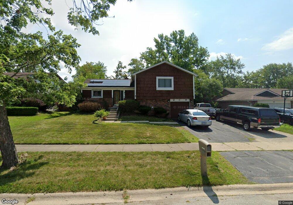
117 Pheasant Rd Matteson, IL 60443
West Matteson NeighborhoodEstimated Value: $226,679 - $238,000
3
Beds
2
Baths
1,295
Sq Ft
$179/Sq Ft
Est. Value
About This Home
This home is located at 117 Pheasant Rd, Matteson, IL 60443 and is currently estimated at $232,170, approximately $179 per square foot. 117 Pheasant Rd is a home located in Cook County with nearby schools including Colin Powell Middle School.
Ownership History
Date
Name
Owned For
Owner Type
Purchase Details
Closed on
Mar 19, 2024
Sold by
Northern James R
Bought by
True North Trust
Current Estimated Value
Purchase Details
Closed on
Aug 30, 1999
Sold by
Robinson Jesse and Robinson Lily M
Bought by
Northern James R
Home Financials for this Owner
Home Financials are based on the most recent Mortgage that was taken out on this home.
Original Mortgage
$90,105
Interest Rate
10.9%
Purchase Details
Closed on
Apr 22, 1997
Sold by
Carter Lemark A and Carter Lamark A
Bought by
Robinson Jesse and Robinson Lily M
Home Financials for this Owner
Home Financials are based on the most recent Mortgage that was taken out on this home.
Original Mortgage
$65,100
Interest Rate
12.37%
Purchase Details
Closed on
Jun 23, 1994
Sold by
Carter Lemark A
Bought by
Carter Lemark A and Nelson Carter Delores
Home Financials for this Owner
Home Financials are based on the most recent Mortgage that was taken out on this home.
Original Mortgage
$74,800
Interest Rate
7.87%
Create a Home Valuation Report for This Property
The Home Valuation Report is an in-depth analysis detailing your home's value as well as a comparison with similar homes in the area
Home Values in the Area
Average Home Value in this Area
Purchase History
| Date | Buyer | Sale Price | Title Company |
|---|---|---|---|
| True North Trust | -- | None Listed On Document | |
| Northern James R | $100,500 | -- | |
| Robinson Jesse | $93,000 | -- | |
| Carter Lemark A | -- | -- |
Source: Public Records
Mortgage History
| Date | Status | Borrower | Loan Amount |
|---|---|---|---|
| Previous Owner | Northern James R | $90,105 | |
| Previous Owner | Robinson Jesse | $65,100 | |
| Previous Owner | Carter Lemark A | $74,800 |
Source: Public Records
Tax History
| Year | Tax Paid | Tax Assessment Tax Assessment Total Assessment is a certain percentage of the fair market value that is determined by local assessors to be the total taxable value of land and additions on the property. | Land | Improvement |
|---|---|---|---|---|
| 2025 | $6,501 | $17,538 | $2,774 | $14,764 |
| 2024 | $6,501 | $17,538 | $2,774 | $14,764 |
| 2023 | $4,326 | $19,000 | $2,774 | $16,226 |
| 2022 | $4,326 | $11,502 | $2,427 | $9,075 |
| 2021 | $4,416 | $11,501 | $2,426 | $9,075 |
| 2020 | $4,386 | $11,501 | $2,426 | $9,075 |
| 2019 | $5,436 | $13,378 | $2,253 | $11,125 |
| 2018 | $5,353 | $13,378 | $2,253 | $11,125 |
| 2017 | $5,237 | $13,378 | $2,253 | $11,125 |
| 2016 | $5,178 | $12,502 | $2,080 | $10,422 |
| 2015 | $5,020 | $12,502 | $2,080 | $10,422 |
| 2014 | $4,911 | $12,502 | $2,080 | $10,422 |
| 2013 | $4,907 | $13,295 | $2,080 | $11,215 |
Source: Public Records
Map
Nearby Homes
- 124 Oriole Rd
- 123 Oriole Rd
- 115 Oriole Rd
- 141 Timberlane Rd
- 56 Timberlane Rd
- 152 Oakhurst Rd
- 42 Pheasant Rd
- 41 Willow Rd
- 25 Pheasant Rd
- 50 Willow Rd
- 6005 Woodgate Dr
- 40 Huntingwood Rd
- 72 White Oaks Rd
- 5943 Woodgate Dr
- 133 Deerpath Rd
- 13 Oakview Rd
- 156 Cloverleaf Rd
- 6128 Wedgewood Ct
- 34 Wedgewood Rd
- 10 Wedgewood Rd
- 109 Pheasant Rd
- 125 Pheasant Rd
- 125 Pheasant Rd
- 118 Pheasant Rd
- 110 Pheasant Rd
- 131 Pheasant Rd
- 126 Pheasant Rd
- 103 Pheasant Rd
- 116 Oriole Rd
- 130 Oriole Rd
- 132 Pheasant Rd
- 104 Pheasant Rd
- 139 Pheasant Rd
- 136 Oriole Rd
- 108 Oriole Rd
- 57 Pheasant Rd
- 58 Pheasant Rd
- 111 Timberlane Rd
- 105 Timberlane Rd
- 119 Timberlane Rd
Your Personal Tour Guide
Ask me questions while you tour the home.